Elevation gain: 2880 feet
Trails used: Long Trail, bushwhack to Sugarloaf Mountain.
Highlight(s): Long Trail, register on the summit of Sugarloaf Mountain.
After our overnight at Jay Pass Camp, where we were the only people staying, we packed up our gear and headed back to the cars to begin the drive over to the start of the Long Trail in Hazens Notch. First, we got our gear ready and had some quick breakfast which was tough since the wind was howling through Jay Pass and trying to get the camp stove to stay lit was a chore. We then left my car in Jay Pass, and drove around to Hazens Notch where we would do this traverse from south to north.
Sugarloaf Mountain, Buchanan Mountain and Domeys Dome are located in Westfield, Vermont. The wooded, view-less summit of Sugarloaf Mountain can be reached by a combination of trails and bushwhack. The Long Trail runs over the summit of wooded, view-less Buchanan Mountain, Domeys Dome and Gilpin Mountain (the northern bump is the higher summit, thus reached by bushwhack). There would be views all along the Long Trail but with todays weather, they were all but non-existent.
We started the day at the parking area in Jay Pass at 730 in the morning and right after a night of almost constant rain. We then drove Brian's car to Hazens Notch so we would do the Long Trail from south to north this time.

The start of the Long Trail off of Hazens Notch Road. There's a spot just down the road for two to three cars, and then walk to the start of the trail.

We climbed along the Long Trail on the west shoulder of Sugarloaf Mountain, at first not gaining much elevation but actually losing it. The Long Trail then decided it wanted to go up, which it did until we began the bushwhack to the summit of Sugarloaf Mountain.

Despite the overnight rain, the few stream crossings were still pretty low along this section of the Long Trail.

Wide open woods on the bushwhack up to the summit of Sugarloaf Mountain. We followed a flagged route that went directly to the summit area.

The jar register on the summit of Sugarloaf Mountain (elevation: 2421 feet).

Brian working his way back down to the Long Trail, where we continued our hike on the way to Bruce Peak and Buchanan Mountain.

The junction of the Long Trail and short spur path to Hazens Notch Camp. We liked the mileage marker that tells you how close to Canada you are, or how far away from Massachusetts you are.

The Long Trail was a mixture of ups and downs and slight straight sections of trail on our way over to Bruce Peak and Buchanan Mountain.

In between Hazens Camp and the hike up towards Buchanan Mountain, the rain and winds hit us and the low clouds moved in which made the last three miles dismal.

The summit area for Buchanan Mountain (elevation: 2940 feet), which is right along the Long Trail. There were no views today, even if we looked around the summit for them.

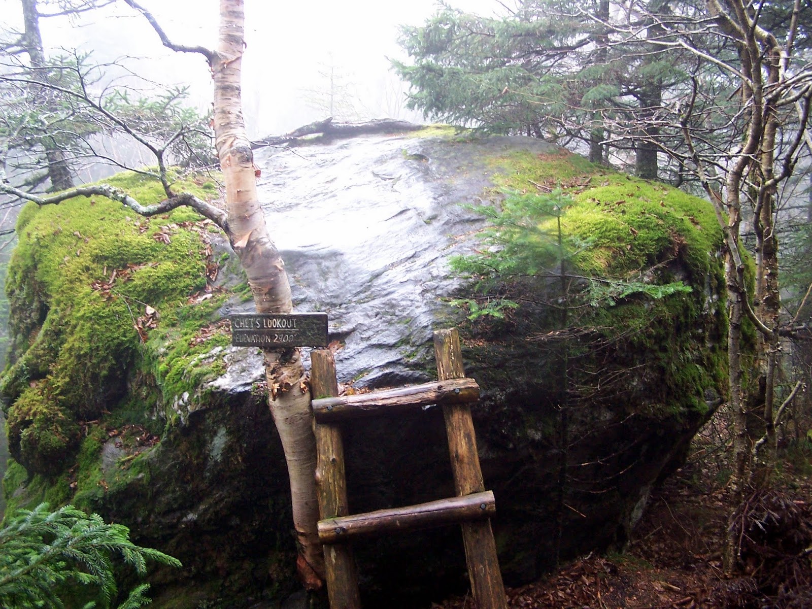
Chet's Lookout, which consisted of this ladder and boulder. Unfortunately, we would get no views from it today so we didn't bother climbing up.
The summit of Domeys Dome (elevation: 2880 feet). It was a bit confusing on this summit to figure out where the Long Trail continued north.

It was rainy and overcast, which is why this picture of the summit area of Domeys Dome managed to come out blurry.

Brian walking along the Long Trail as we near the southern spur for Gilpin Mountain. We were both pretty much soaked and muddy from the rain.

The summit area for Gilpin Mountain-South Peak (elevation: 2920 feet). It was less of a summit and more of a southern spur of the south peak of Gilpin Mountain.

Heading down off of Gilpin Mountain we came across our nemesis for the past two days. Brian is showing his appreciation for all the mud.

Finally we make it back to Jay Pass and the finish of our two day trek along these two sections of the Long Trail.


We were glad to be at the cars so we could get some dry clothes on and warm up after the last few miles walking in the rain. This was an okay section to hike but not as nice as the first days ramblings in the woods. The weather also did not play a good role but we were well aware of how the two days would turn out. Two sections are complete but this ends our Long Trail jaunts for 2015. We will continue where we left off in May of 2016.
No comments:
Post a Comment