Sunday, December 28, 2014

Whiteface Mountain (Belknaps): 12/28/2014

Mileage: 3.10
Elevation gain: 880'
Trails used: Piper-Whiteface Trail, Whiteface Trail.


At first, Sunday looked like a total washout due to the rain that moved in overnight on Saturday.  Desi and I had initially thought about doing a hike but it was pretty much ruled out when we woke up to cold, dreary conditions.  That decicion quickly was reversed at about 1030 am when the rain stopped and the clouds started to part.  We got dressed quickly and headed out to do a hike in the Belknaps.  This would be our time on this particular peak in the Belknaps, which has yet to disappoint.

Whiteface Mountain is located in the southwestern region of the Belknap Mountain range in Gilford, New Hampshire.  This is a trailed hike to a cleared summit with good views in all directions, especially from some ledges on the northern side of the summit.

Whiteface Mountain is on the Belknap Range Hiking List which consists of 12 peaks.


We parked at a pull-out just before the class VI road that heads into the woods and and turned onto the Piper-Whiteface Trail not too far from the parking area.


You pass this Lakes Region Conservation Trust (LRCT) kiosk at the start of the trail, complete with a Belknap Range map.


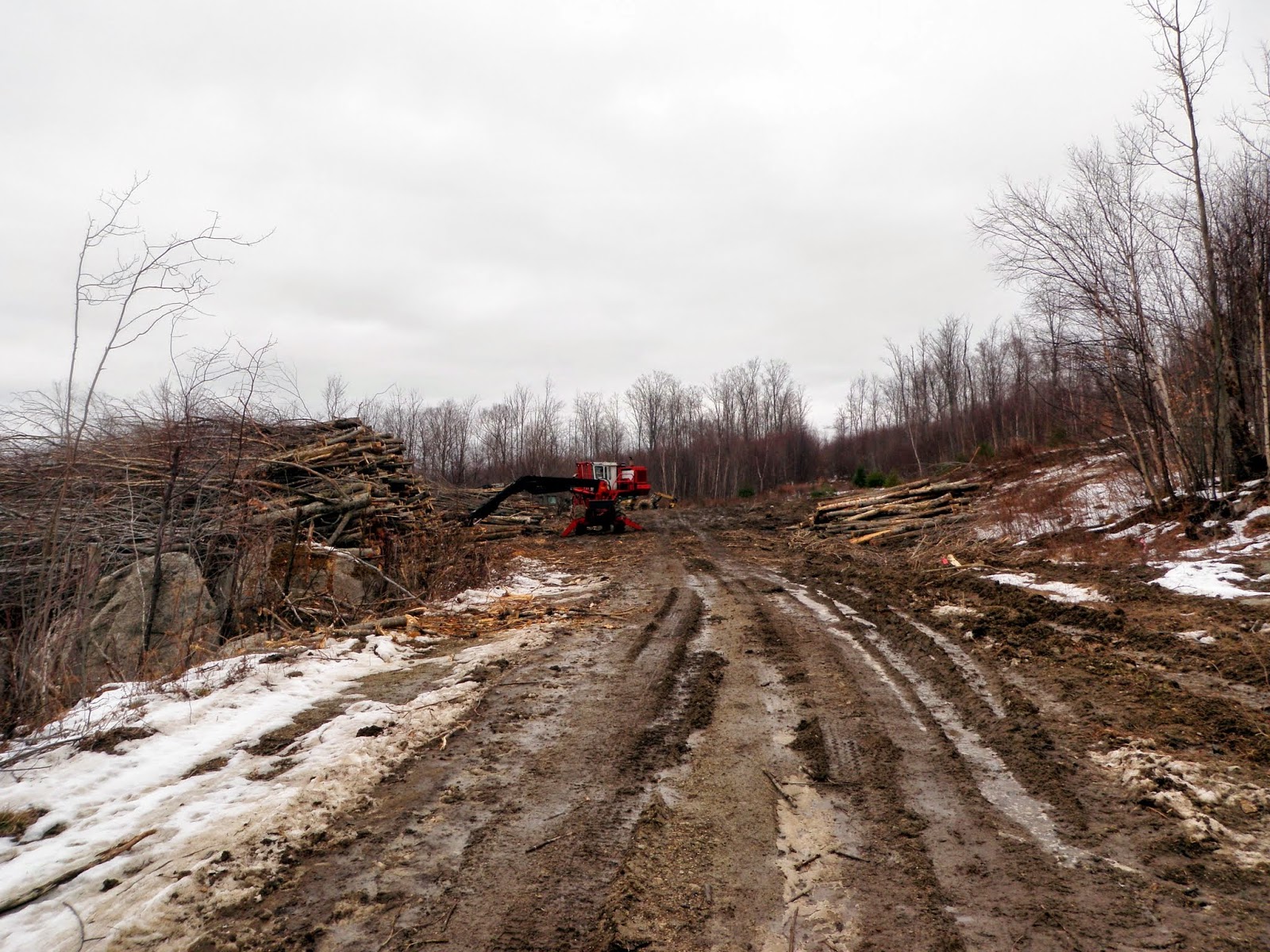
It was wet on the trail from the prior day's rain, plus warmer temperatures melting the snow a bit.  This section of trail is on an old eroded road.


The trail was moderate as far as steepness goes.  It never felt too strenous and was easy to follow.  The higher we went, it was a mix of bare ground, snow and ice.


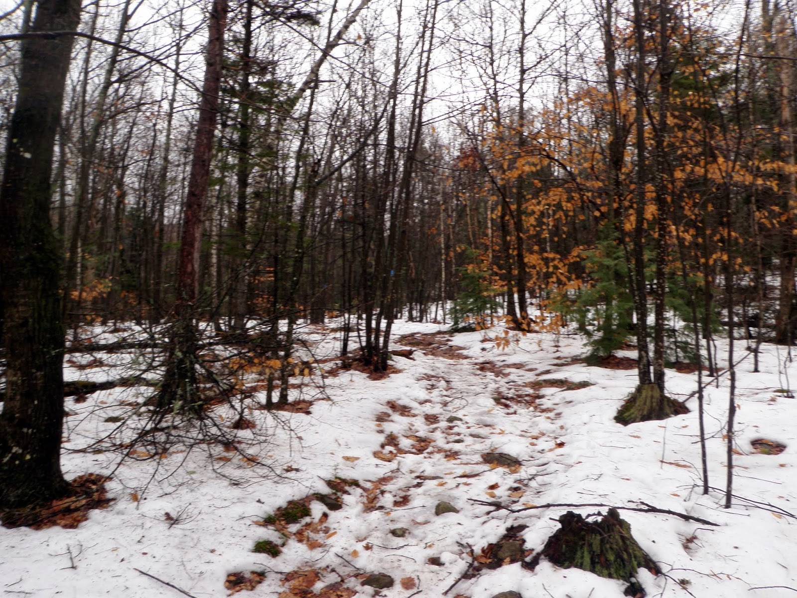
The Piper-Whiteface Trail is blazed in blue, and like I said, easy to follow.


Eventually you come to the junction of the Piper-Whiteface Trail, Whiteface Mountain Trail, and Whiteface-Piper Link Trail.  Going left at this junction takes your towards Piper Mountain.  We would go right, through a gap in this rock wall and head towards Whiteface Mountain on the Whiteface Mountain Trail.


Desi walking along the Whiteface Mountain Trail through this open meadow with Whiteface Mountain's summit visible on the left.


Right around an old jeep road that is currently used by ATV's.  This was probably the section of trail with the most snow and ice.


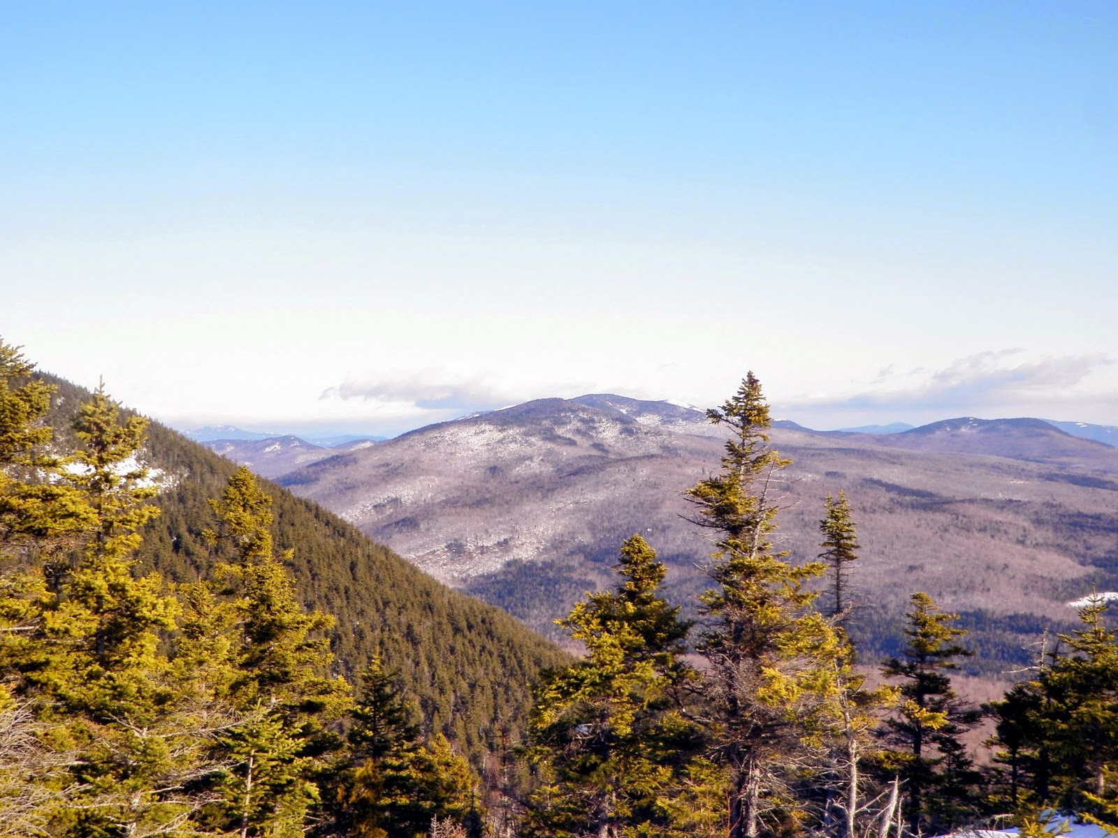
Looking over to Mount Kearsarge (in the clouds, left) and Ragged Mountain (right) from just below the summit of Whiteface Mountain.


Views south of Durrell Mountain, Grant Hill and Lamprey Hill from the summit of Whiteface Mountain (elevation 1670').


The clouds tried to part but they were having a tough time.  This is looking towards Piper Mountain, Mount Klem and Mount Mack from the summit of Whiteface Mountain.


Looking north towards the Ossipee Mountains, which are mainly in the clouds.  Red Hill is just visible to the right and to the left of a ridge of Gunstock Mountain.


Another view of Piper Mountain and its ledges on and around its summit area.


We reversed back the way we came up and made a quick return back to the car.  

Not too bad of a decision on our part to head out, although if we had waited a bit longer the sun may have come out a bit more.  All in all, a nice little family friendly hike as most of the Belknaps have been.  There is a bit of everything for everyone; easy trails, views, nice woods, etc.  

This hike also effectively ended our hiking for 2014.   What a year it has been with a few ups and downs (no pun intended), but we managed to make the most of it.  Thank you to everyone who has contributed to my other blog and the fundraising endeavor Brian and I embarked on to help find a cure for Multiple Sclerosis.  We managed to raise a little more than 2000 dollars for the year.

May 2015 be a wonderful year for everyone!!

Saturday, December 27, 2014

North/South Doublehead (Jackson) - Beech Hill (Twin Mountain): 12/27/2014

Joe would be joining Brian and I for this hike, as he really had zero idea what he wanted to do himself.  I had originally thought about doing one of the seven winter four thousand footers I have left for my winter list, but thought about doing something a bit mellow, and then possibly doing a second hike if time and energy warranted it.

North-South Doublehead

Mileage: 4.0
Elevation gain: 1860'
Trails used: Doublehead Ski Trail, Old Path, New Path.
Highlight(s):


Thus I decided on doing the Doublehead Mountains, which all three of us have done before (a few of us several times).

The Doubleheads are located in Jackson, New Hampshire.  These are not to be confused with Doublehead Mountain in the Squam Lakes area.   North Doublehead has a CCC ski trail that runs from its summit down to Dundee Road.  The hiking trail coincides with the Doublehead Ski Trail.  North Doublehead also has a cabin for rent ($20.00 a night) and information can be found here

North Doublehead and South Doublehead are on the New Hampshire 200 Hundred Highest List, and New Hampshire 52 With A View (52WAV). North Doublehead is on the New Hampshire 3k List.


Starting the hike on the Doublehead Ski Trail, which is close to the parking area off of Dundee Road in Jackson, New Hampshire.


The hike up was a mixture of bare ground, running water and rotten snow.  We started off on the Doublehead Ski Trail but not too soon after headed up the Old Path towards South Doublehead and its better views.


The steepest stretch of the trail up and the snow was getting a bit deeper but not by much.


Approaching the junction with the Old Path/New Path.  Turning to the right, you head off towards South Doublehead and turning left brings you to North Doublehead.


The Old Path/New Path Trail junction.  At this point, the snow was hard packed and icy.


Nearby North Doublehead, which we would head to once we were doing on South Doublehead.


The views from the lower ledges off of South Doublehead, looking towards the Presidential Range, the Wildcat Range, Carter Dome and the long Black Mountain ridge and ski area.


Views north looking at the Wildcat Range with Carter Notch, Carter Dome and the Carter Range with Black Mountains higher summit in the foreground.


A zoomed in view of the Black Mountain ski area.


The views of the Jackson area and the mountains to the south and west.


The summit of North Doublehead from the ledges just below the summit of South Doublehead.


A cool cloud formation over Mount Madison.


Chandler Mountain and Sable Mountain (left) and Eastman Mountain.


The nice woods in between North and South Doublehead.


The views from outside of the cabin on North Doublehead of the Presidential Range.


The Doublehead Cabin on the summit of North Doublehead (elevation 3053'). It is kept locked but you can make reservations to stay the night through the Saco Ranger District office.


Views looking into Maine.


Views through the trees as we are heading back to the car.


Beech Hill

Mileage: 5.3
Elevation gain: 1130'
Trails used: None. Logging roads, bushwhack.


Joe went off to do Kearsarge North while Brian and I headed out to do something else.  Intially I mentioned we should do the Sugarloaf's in the Twin Mountain area to stick with the 52WAV theme but earlier I had mentioned to Brian that Beech Hill had recent traffic so we decided to check it out.

Beech Hill is located in Twin Mountain and Bethlehem, New Hampshire.  There are no official trails that run to its wooded summit, so it requires a combination of bushwhacks and  hiking on logging roads to reach its summit. 


We would take this old logging road off of Beech Hill Road in Bethlehem.  Most of the property around here is No Trespassing, but the land owner allows hiking/hunting through here.


What started off as a nice old logging road, quickly turned into a wet soggy hike through almost bog like areas since a lot of the snow had melted.


Eventually we would make it to some logging roads that have some recent use.


Along with some very active logging landings.  These kind of areas are always fun with its wet out; we were sinking up to our ankles in spots so into the woods we would need to go.


Views from the logging road looking towards Mount Agassiz (right) and Mount Cleveland (left).  You can barely see Cannon Mountain's ski area to the far left.


The wooded summit of Beech Hill (elevation 2267' ).  There were several "bumps" in the area but this seemed to be the highest point.


We followed our footprints for a bit but decided to use various old logging roads to get us back down to the active logging roads.


Following another old logging road down.  At this time of year, these roads are very wet with lots of flowing water.


A nice first hike for our first winter hike of the 2014-2015 season, and we managed to get Joe out on a hike with us which is a bonus.  The second hike was so-so; we managed to hit a few wet areas on the way up and down but other than that, it wasn't too bad snow-wise.  

The Doubleheads have good views from the South summit, and the loop hike is nice.  Beech Hill is a peakbaggers delight so if you want to bushwhack something with a combination of active logging cuts and bushwhack, this one is for you.

Thursday, December 25, 2014

Osgood Hill (MA): 12/25/2014

Mileage: 1.65 miles
Elevation gain: 245 feet
Trails used: Osgood Hill Trail, Summit Trail.
Highlight(s): 


We were headed down to North Andover, Massachusetts for Christmas dinner with some of Desi's relatives so we figured we could get in a hike in the area before we went to eat.  There are numerous conservation areas and little hikes that dot this area so there is plenty to do.  This would be a nice hike on an almost 50+ degree day, which is a rarity at this time of year.

Osgood Hill is located in North Andover, Massachusetts.  This hike is also located on the Stevens Estate property which is on the National Register of Historic Places.   For other maps in this area, and a map of this hike, go here.


We parked at the trail head for the Osgood Hill Trail off of Osgood Street.  You can also drive up the Stevens Estate Driveway an start the hike from the nice parking area there.


The Osgood Trail kiosk, complete with map.


The trail was really muddy in spots (the few days of rain before will do that to these southern trails) but it was still easy to follow.


The trails are blazed and easy to follow.  There are signs at the junctions that point you in the right direction so make sure to download the map.


 Along the way, the various trees have signs that tell you what they are.  I photographed the ones we don't see often in New Hampshire. This is a Hornbeam.


This is a Shagbark Hickory.


This sign said this was a Mapleleaf Vibirnum but we think it is incorrectly placed as the Viburnum is a shrub.


This is an old tower of some sort, with a massive amount of old timber and cables strewn about. I could not find any information on-line on what it was though.


Panorama of Lake Cochichewick, and the southern trail head which sits at the bottom of Half Mile Hill.  There are a couple of chairs at this view point.  


The summit area of Osgood Hill (elevation 343').  Not much of a climb but a nice hike with multiple trails in the area.


Desi down by one of the buildings for the Stevens Estate.  Its also where you can park to go hiking on the property, which we did not know about at the time.


Desi hiking on the way out and back to the car on the boardwalk at the beginning.


A nice little hike in nice open woods if you want something light to do and you are in the area.  We saw lots of people out hiking, jogging and walking dogs on this Christmas day and who can blame them.  It's not often we get nice weather this far into December.  A quick few miles and then it was off for Christmas dinner.  Happy Holidays everyone.