The views from the Hugh Gallen Wayside/Lafayette Brook Scenic Area looking towards Mount Agassiz and Mount Cleveland.

The views of Mount Lafayette poking through the clouds at the Hugh Gallen Wayside/Lafayette Scenic Brook Area.

On 302, we stopped again but this time to get views of frost covered Mount Washington and Mount Monroe.


Sawyer Pond
Mileage: unknown. book is 3 miles RT, but we probably did close to 3.5
Elevation gain: unknown. approximately close to 400 feet
Trails used: Sawyer Pond Trail.
Highlight(s): Sawyer Pond.
One thought was to do Arethusa Falls as it has very little elevation, but the fact that all three of us had done it in the past didn't entice us enough to do it. We threw out a couple more suggestions before Joe suggested Sawyer Pond from the Sawyer Road side. Why not, we said. It was short, little elevation and just what Joe and I would need for the day.
Sawyer Pond is located in Livermore, New Hampshire. It is a popular destination for overnight camping (there are at least 6 tent platforms and 1 lean to shelter) and for fishing, and the approach to Sawyer Pond from the Sawyer River Road side is a pleasant, easy walk in the woods.
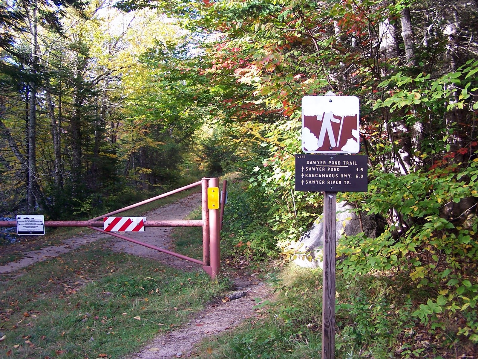
This is where parked to begin the hike on the Sawyer Pond Trail at the end of the gated section of Sawyer River Road.
Joe and Brian crossing the bridge over Sawyer River on the start of the Sawyer River Trail.

The color was starting to come out a bit along Sawyer River.

This short section of the Sawyer River Trail was easy to follow and had moderate grades all the way to Sawyer Pond.

We are at the Sawyer Pond Trail/Sawyer Pond camp site area. We took the shorter route to get here as the Kancamagus side is 4.6 miles one way.

We reached the shores of Sawyer Pond and got some really nice views of Mount Tremont and Owls Cliff.

Mount Tremont and its northwestern summit ridge from the shores of Sawyer Pond.

A reverse angle looking down the Sawyer River.

Walking around the gate on Sawyer River Road and heading back to the car.

Now what to do, that was the question. On the way to Sawyer River Road, we noticed they were doing free ski lift rides at Bretton Woods so we really couldn't miss this oppurtunity for a ride up (I am afraid of heights so things like this suck for me) and then an easy walk over to nice views. Did I mention the ski lifts were free?
Mount Oscar
Mileage: unknown.
Elevation gain: unknown.
Trails used: West Summit Trail.
Highlight(s): extensive views from the ski trails and summit area of Mount Oscar.
All three of us have been to Mount Oscar before; Desi, Joe and I hiked here when we did Mount Rosebrook several years ago and Brian did it solo a few years back. So, it was a no brainer to re-visit this nice peak via the free ski lift and a mellow hike along the ridge.
Mount Oscar is located in Bethlehem, New Hampshire and is part of the Rosebrook Mountain Range. There are mountain biking trails and mountain scooter trails, plus the hiking trails and numerous ATV/access roads that criss-cross the area. You can also hike up the mountain from the base station or take the lift up (free in summer/early fall) to just below the summit of Mount Rosebrook. There are 360 degree views from the summit area of Mount Oscar.
It was free to take the Bethlehem Express Quad ski lift up so we thought why not. It takes you up to the Latitude 44 degree restaurant and from there we would take the West Summit Trail to Mount Oscar.

From the ski lift, we headed towards Mount Oscar via the West Summit Trail which is a mixture of dirt service roads and ski trails.

Joe on the summit of Mount Oscar (elevation: 2746 feet) with Middle Sugarloaf and North Sugarloaf in the foreground. Mount Cleveland and Mount Agassiz are in the background. We could see all the way into Vermont today.

The views of Mount Hale from the summit of Mount Oscar.

The views from the summit of Mount Oscar looking towards Zeacliff, Mount Hancock, Whitewall Mountain, Mount Carrigain, and Mount Tom.

On the hike back to the ski lift, we got nice views of Mount Jefferson, Mount Clay, Mount Washington and Mount Monroe.

Another view of Mount Washington, Mount Monroe and Mount Eisenhower as we hike back to the ski lift for the ride back to the bottom.

The view from the top of the ski lift area of Mount Starr King and Mount Waumbek, in the background. Mount Deception is on the right and The Humps (Cherry Mountain) on the left.

Two things in this picture: the Conway Scenic Railroad (Crawford Notch Train) was arriving to Fabyans, and there are numerous people riding up on the ski lift in the bottom left corner.

Heading back down the ski lift with views towards the Deception Range.

The GPS went for a ride today on the first hike but only because it was dying and on its last leg. Hence the reason there are no mileage or elevation totals for either hike.
Both the hike to Sawyer Pond and to Mount Oscar (via the ski lift) were pleasant and with nice weather, although it was a bit cold riding the lift up to and down from the summit ski area. The views on Mount Oscar rivals most 52 With a View peaks so it is a must do for most people whether you take the ski lift up or hike up.
No comments:
Post a Comment