Sunday, September 28, 2014

Crow Hills (MA): 9/28/2014

Mileage: 2.05
Elevation gain: 650'
Trails used: Crow Hill Cliffs Trail, Midstate Trail.


We actually got to this one a little late mid morning on Sunday, after we woke up and had breakfast.  We decided to do a short hike on the way home so this one fit the bill perfectly.  The temperature was already starting to go up so it was going to be a hot but cloud free hike.

The Crow Hills are located in the Leominster State Forest and in Westminster, Massachusetts.  On its eastern side is a cliff that is popular for rock climbing, and a part of the Midstate Trail traverses over the hills.  The Crow Hills are a single monadnock and has two summits, but neither is reached by a trail.


Desi heading up at the start of the Crow Hill Ledges Trail, which is off of Route 31 South.  We parked at the parking area for Crow Hills Pond which has a recreation area with benches and fire pits for people to picnic and relax.


Rock steps are the norm for the first part of the hike up to the junction where you can go left to the base of the cliffs, or to the top of the ledges.


The trail is steep from the start of the hike until you reach the rock climbing area.


Ropes set up for rock climbers.  There were quite a few people out on various ledges but this seemed to be the main one right off the trail.  You can go to the top of this ledge to see where they roped off to some tree's.


Desi hiking along the Midstate Trail.


Looking down to part of Crow Hill Pond from some ledges along the Midstate Trail.


Views of Wachusett Mountain from a ledge.   Yes, it is a ski area.


Some of the tree's being used by the rock climbers as anchors for their belay's.


Eastern views into Massachusetts from some ledges on Crow Hill.


An interesting rock formation along the Midstate Trail, heading north.


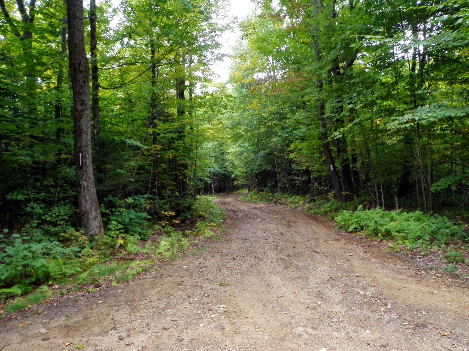
The trail was a bit grown-in in spots and sometimes confusing to follow, especially coming from the south side of the Midstate Trail.


A young kid climbing the cliff.  It was pretty neat to stop and watch the rock climbers just scaling the cliff face with ease.


This hike, in a book we read, is labeled as a family hike.  I could see it if all you really want to do is hike up to the rock climbing area and watch them climb (if it is nice outside).  Otherwise, the views ledges are few and the hike doesn't offer much outside of the rock climbing.  

We still managed to have fun despite the hot temperatures and since we were just looking for a smaller hike, this one fit the bill. 

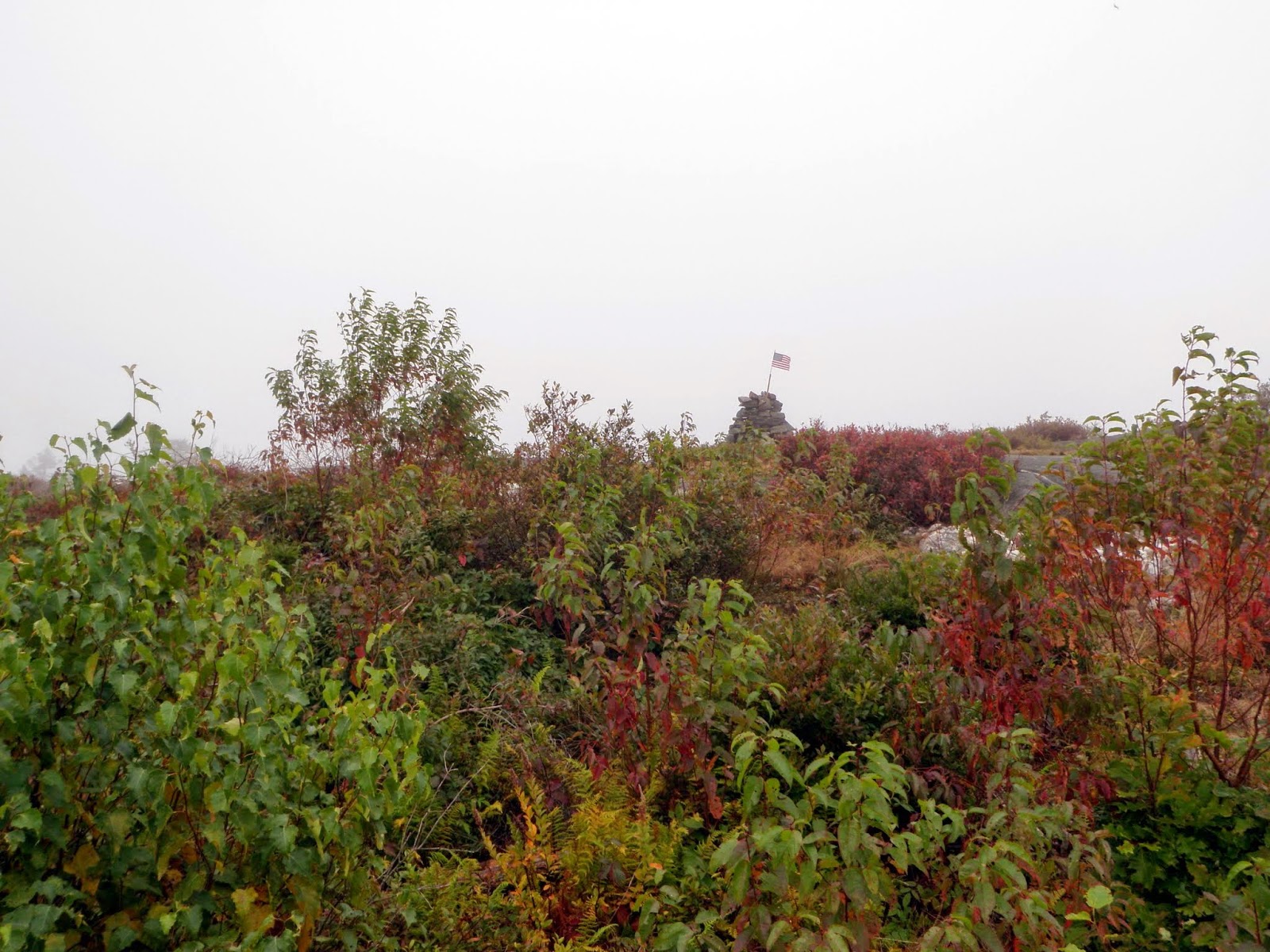
Note, I did manage to hit the high point but it is off trail and requires a bushwhack through hip high vegetation.

Saturday, September 27, 2014

Wachusett Mountain: 9/27/2014

Mileage: 7.05
Elevation gain: 1395'
Trails used: North Meadow Trail, Chapman Trail, Dickins Trail, Harrington Trail, Link Trail, Mountain House Trail, Windmill Farm Trail, Midstate Trail.


Desi and I had planned this hike for sometime now since we had a wedding to go to in nearby Westminster on Saturday evening.  We couldn't ask for a more perfect day either (well, maybe a little less heat and more of a breeze) but for being fall, you can't really complain.

We started this hike at a parking area for the Wachusett Meadow Wildlife Sanctuary, a 1,200 acre sanctuary with about 12 miles of trails and plenty of wildlife viewing opportunities as well as old growth forests.  Information can be found here.  Make sure to grab a map before you head out.  They are located outside of the restrooms for the visitor center.

The Midstate Trail runs through the sanctuary on its way towards Wachusett Mountain.  The Midstate Trail is a 92 mile hiking trail that runs from the border of Rhode Island, through Worcester County in Massachusetts and continues to the Massachusetts/New Hampshire border (just over the summit of Mount Watatic.  It then continues on as the Wapack Trail in New Hampshire.

The route we took is a longer route but it is less than 1000 feet of elevation gain throughout probably 3/4th of the hike and the last push to Wachusett being the most elevation gain.  There are a bunch of trails that you can take from all 4 directions to get to the summit.


Looking into South Meadow from the parking area at the visitor center for the Wachussett Meadow Wildlife Sanctuary. 


The North Meadow Trail.  It's basically a large mowed field with a path around the perimeter, that links up with various other trails on the wildlife sanctuary.


The trail was typically this nice through the whole first part of the trail, up to the start of the climb for the Harrington Trail.


There are a lot of trail options in the Wachusett Meadow Wildlife Sanctuary like this two trails: the West-Border Trail and Glacial Boulder Trail.  We would continue straight on the Chapman Trail until the sanctuary boundary.


The trails were pretty easy to follow, and blazing is spacious.  At this point, you are hiking on the Midstate Trail.


The edge of the sanctuary.  From here it turns into the Dickens Trail and is roughly 5 miles to the summit of Wachusett Mountain.  It didn't feel like 5 miles though.


The trail goes over Westminster Road and goes back into the woods.  Still easy hiking to here.


It starts getting rocky and a bit steep once you cross over West Road.


We saw snakes galore today.  I think we counted at least 7 on the way up and back down.  One I almost stepped on and it went automatically into coiled up defense mode.


The junction of the Mountain House Trail and the Link Trail (which connects to the Harrington Trail).  Turn left to head to the summit.


Approaching the summit of Wachusett Mountain, which you can either hike or drive to the summit.  A lot of people drove today.  There is a fire tower located behind the communications array but the stairs were retracted so you couldn't go up for views.


The view of hazy Mount Monadnock in New Hampshire from the summit of Wachusett Mountain (elevation 2006').


Views to the south from the summit observation tower on Wachusett Mountain.


More views back towards the southwest and the way we came.  Yes, those are wind turbines and we did pass them on the way up.


Desi heading back down the Harrington Trail, which is pretty steep from here back down to the Link Trail which connects to the Mountain House Trail.


The Summit Access Road that heads up to the summit of Wachusett Mountain.  It is only open during certain seasons and is about 2.35 miles long.


More trail goodness.  I wish all trails could be this wide and easy to move along.


One of the two wind turbines that you can climb up to via the Windmill Farm Trail.  The only restrictions are to access the area at your own risk.  


The view from the old logging area where the wind turbines now reside.


The only water crossing (that was dry) along the route that runs along a nice marsh area.


A nice hike with some easy miles.  The views from Wachusett were really nice and we were even treated to some migrating hawks or falcons (couldn't tell exactly what they were since they were a good ways up).  A definite popular mountain on a nice day as evidenced by the split majority of hikers we passed going up and down as well as the people who drove to the summit.

Please, as I said, pick up a map or research the route ahead of time.  With the vast amount of trails available, it could be really easy for someone to lose their way.

Sunday, September 21, 2014

Kittredge Hill - Silver Mountain: 9/21/2014*

Kittredge Hill

Mileage: 3.7
Elevation gain: 880'
Trails used: road walk, Monadnock-Sunapee Greenway.  


Sunday's weather looked to be better than Saturdays so I wanted to get some extra miles in, and not go up north to hike since it was NASCAR race weekend. Plus, the Highland games were going on in Lincoln so it would be a traffic nightmare.  So I headed west towards the Pillsbury State Park area and its plethora of smaller peaks to find something interesting to hike.  I decided on Kittredge Hill since it was trailed and would be a nice warm-up hike if I planned on doing a second one.

Kittredge Hill is in Sullivan County, New Hampshire and is along the Monadnock-Sunapee Greenway which is a 50 mile hiking trail that runs from Mount Monadnock in Jaffrey, New Hampshire to Mount Sunapee in Newbury, New Hampshire.  The trail system is nice; blazing and signage to direct you and the trails are well maintained.


Walking down Washington-Bradford Road (Halfmoon Pond Road) which is a class V road.  I didn't want to drive Cindy down the road just in case (you could drive down to the trail if you take it easy, I found out) so I parked at a pull-out right before the road sign.


This is where the Monadnock-Sunapee Greenway crosses the road and heads down this active logging road.  Its blazed in white and you can see the arrow pointing the way.


The trail branches off from the logging road and heads up towards the Ridge Link Trail.


There is only one water crossing and it has a bridge so it was no problem.


The trail was pretty steady for the whole length of the almost 1.5 mile one way to the summit.


A junction of the Bear Pond Trail and Ridge Trail.  Make sure to turn here to head to the summit of Kittredge Hill.


Easy woods walking on a slightly humid day.


A rock step section heading up to the summit area of Kittredge Hill.


The summit area of Kittredge Hill (elevation 2116' ), which is about 50-75 feet off of the trail.


I turned around and headed back down. You come across this recent logging slash cut on the way up/down.  The only blemish on this hike today


Silver Mountain

Mileage: 1.4
Elevation gain: 490'
Trails used: Silver Mountain Trail, bushwhack.


A quick hour jaunt and I wanted to do another hike as the first one netted about 3.7 miles so off I went after a quick look at the gazetteer.  I settled on Silver Mountain which is part of the Ashuelot River Headwaters Forest , after I looked at Bean Mountain and decided it was a bit too long on a so-so day.

Silver Mountain is located in Lempster, New Hampshire.  You can reach the trail head off of South Road, which is a pretty rough road off of Mountain Road.  Directions are listed on the link above.  Funny thing is I had no clue this mountain had a trail; I started this as a bushwhack to just below the summit where I found the yellow blazes (duh!).  Oh well, it was still fun to do. 


I started this hike off as a bushwhack, which was pretty steep to start.  Most of the woods along the road are posted No Trespassing.


Open woods for the whole hike and you come across ledge areas on the way up.


Approaching the summit area of Silver Mountain (elevation 2160'), that has a good sized cairn with an American flag flying proudly in the nice breeze.


Misty rain moved in, eliminating any views I would get for this hike.


I noticed this yellow X and thought it might be for the summit of Silver Mountain, but then I noticed more blazes so I followed them, which turned out to be a trail.


Like I said, zero views.  Bummer.


The Silver Mountain trail was easy to follow and yellow blazed.  It even crosses a snowmobile trail on the way up/down.


The gate for the start of the Silver Mountain Trail, which was about .25 miles away from where I parked Cindy.  Boy was I ashamed.


A nice quick two hikes back to back but the humid was bringing in some showers so it was time to call it a day and head home to watch some football.  Both hikes were enjoyable; trails easy to follow and well maintained.  Silver Mountain would be nice on a good day so definitely putting this one on the "will return to" list.