The Gallop - Antone Mountain
Mileage: 6.80
Elevation gain: 1850 feet
Trails used: Old Town Road, Gallop Road, Lodge Road, Barton Trail, Viewpoint Spur, Viewpoint Trail, Antone Road, Ski Trail.
Highlight(s): Merck Forest and Farmland Center, several views from the summit of Antone Mountain.
I had eyed this one for some time in a book we have here at the house, but it was more of a hindrance due to the lengthy drive it would take to get to southwestern Vermont. Today though I felt like driving to get some foliage views as reports of northern foliage views were pretty spotty.
The Gallop and Mount Antone are located in Rupert, Vermont and in the Merck Forest and Farmland Center. The Merck Forest and Farmland Center has a farm, over 30 miles of hiking trails and cabins/lean to's to rent. You could even ride on horse-back around the trails, and snowshoe in winter. There are numerous hiking trails to use in the area so it would be good to get a map at the trailhead. There are slight views from the wooded summits of both The Gallop and Antone Mountain.
Merck Forest and Farmland Center
Merck Forest and Farmland Center Trails
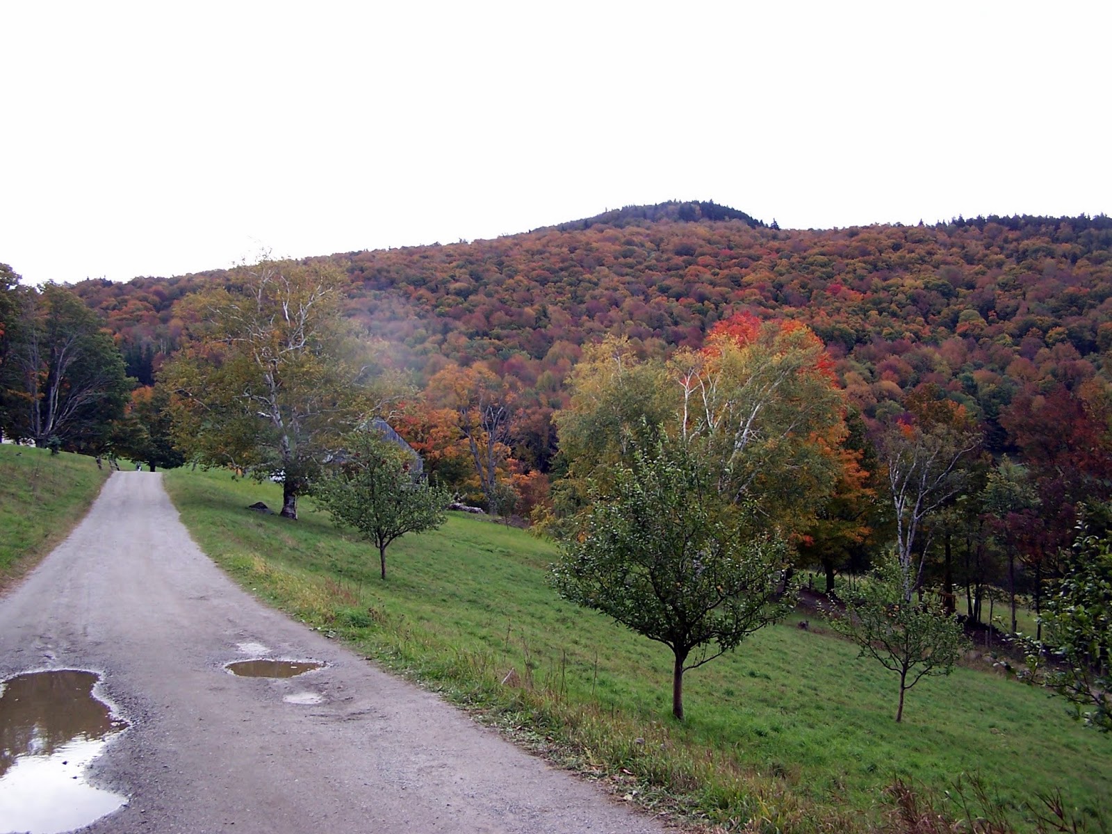
After parking outside at the Merck Forest and Farmland Center parking area, I began the walk along Old Town Road, with views of Gallop Peak in the background.
Still walking along Old Town Road. All major trail junctions are signed so it is pretty easy to follow them or make your way through the property.

An early morning look into New York from Old Town Road.

I picked Gallop Road to use to make my way up to The Gallop's summit. Having one of the maps provided at the trailhead came in handy, although all the trail junctions have signs.

I am still heading up Gallop Road to get to Barton Trail, which I would then take to the summit of The Gallop.

The junction for the Barton Trail and Lodge Road. I turned here to head up towards the summit area of The Gallop.

Starting off on the Barton Trail was steep but it leveled off as you cross the ridge which has roughly three summit bumps.

Beautiful open woods on the summit ridge of The Gallop.

The high point of The Gallop (elevation: 2585 feet). I believe it is the third bump to the southwest along the summit ridge.

The Barton Trail signs and arrows pointing which direction to turn. All the trails had these symbols and signage. I reversed course and headed back down to Lodge Road.

The views looking towards Antone Mountain from a small view point along the Barton Trail.

The views looking towards Antone Mountain from the aptly named Viewpoint Trail/Road. There was a cabin you can rent here with this sweet view.

More views from the Viewpoint Trail/Road of Shattertack Mountain and Egg Mountain, both in eastern Vermont.

A new lean-to shelter in the process of being built along Antone Road.

The short spur path/junction that branches off of Antone Road towards the summit of Antone Mountain.

The views from the summit area of Antone Mountain looking towards Dorset Mountain and The Gallop. Salt Ash Mountain is in the background.

The views looking from the summit area of Antone Mountain of Woodlawn Mountain and Tinmouth Mountain.

View panorama from the summit of Antone Mountain.

The high point for Antone Mountain (elevation: 2600 feet).


Walking back down Antone Road was quick and easy; I passed around 15 people heading up to the summit of Antone Mountain on my way back to my car.

Sometimes as you walk along cross country ski trails they give you views like these looking into New York.

A late day look towards the Adirondacks in New York from Old Town Road.

On the way down Old Town Road back to the car, looking back to the sugar hose with The Gallop in the background.

There was no easy way to drive home from here so I drove through Rutland, Vermont and headed towards points unknown. I had a nice drive through Ludlow, Vermont and had fun with the foliage. I decided to head along route 100 and check out a hike that we have passed a few times in the past.
Slack Hill
Mileage: 3.05
Elevation gain: 670 feet
Trails used: Slack Hill Trail.
Highlight(s): vista view off the Slack Hill Trail.
Brian and I have passed the Calvin Coolidge State Forest numerous times and almost stopped to do a hike here a few months ago, but between having hiked several peaks already, the time of day and the fact that we would have to pay to hike didn't appeal to us at the time. Today was the day I would finally do this hike, as I was looking for something quick to do on the way home.
Slack Hill is located in Plymouth, Vermont and in the Calvin Coolidge State Forest. There are numerous camping sites, as well as RV spots, rest rooms and hot showers. There are picnic areas and a group camping area, as well as hiking trails in the area. In season, you need to pay to get into the park but it was only four dollars so not a big deal. The actual summit of Slack Hill is wooded and trail-less, so you need to do a short bushwhack through open woods to reach the summit area. There is a view point along the Slack Hill Trail as well.
Coolidge Range Summer Recreational Trails
I parked right next to the Coolidge State Park office and took the Slack Hill Trail to the vista. From there, I would backtrack and then bushwhack to the actual summit of Slack Hill.

The Slack Hill Trail was a nice moderate walk in the woods and easy to follow.

The only good view along the Slack Hill Trail of Mount Ascutney and Mount Tom.

I made my way back to an easier section of woods to start my bushwhack to the summit of Slack Hill.

There were slightly thicker woods on the summit of Slack Hill (elevation: 2174 feet). It made it difficult to tell which summit bump was highest.

I made a beeline from the summit area of Slack Hill back to the Slack Hill Trail through mainly open woods, which was better than my route to the summit.

Two straight forward hikes in western Vermont. The first hike I saw no one until I was on Antone Road on my way to the summit of Antone Mountain, when I passed probably about 15 people. On the way back to the car, I passed about 30 + people out enjoying the hiking trails, the foliage and the history of the farm area. The second hike I saw no one, except the park personnel at the entrance when I paid the five dollars to hike the trail.
Antone Mountain was a nice walk in the woods. Slack Hill was also a nice walk in the woods, yet it didn't have much appeal (unless you count the small view point). Otherwise, Antone Mountain and The Gallop were the highlights of the day.
No comments:
Post a Comment