Saturday, September 26, 2015

Boyce Mountain * Kirby Peak * Burnt Hill * Robert Frost Mountain: 9/26/2015

Desi was going to hike Mount Eisenhower with Becky. Brian was going to hike Mount Osceola and East Osceola with Jim and Cathy. So I would be going out solo for this Saturday, and where else would I head but into Vermont. While one day I will section hike the Long Trail, I am also making it a point (over time) to do all the side trails that lead up to the Long Trail. It is a rather ambitious endeavor with all the other plans and lists I am doing but one that will be gratifying over time.


Boyce Mountain - Kirby Peak - Burnt Hill

Mileage: 7.35
Elevation gain: 2345 feet
Trails used: Burnt Hill Trail/Norske Trail, Long Trail, bushwhack.
Highlight(s): Long Trail, register on the summit of Kirby Peak.


We were in the area not to long ago when we hiked Breadloaf Mountain and Mount Wilson so while the drive to get here was long, it was very easy to find the trailhead for the Burnt Hill Trail. It was actually on the cool side when I got to the trailhead so it was the first time in a long time that I wore a long sleeve shirt to hike. I was also the only person at the parking area so I would probably see very few people on today's hike, which is the way I like it at this time of year.

Boyce Mountain is located in Ripton and Hancock, Vermont. Kirby Peak and Burnt Hill are located in Ripton, Vermont. All three peaks are in the Breadloaf Wilderness, and all three are on or along the Long Trail. The Long Trail runs over the wooded, view-less summit of Boyce Mountain (the high point is slightly off trail in the woods). Kirby Peak was reached by Long Trail and a short bushwhack to the wooded, view-less summit. Burnt Hill was along the Long Trail with a short bushwhack to its wooded, view-less summit.

Boyce Mountain and Kirby Peak are on the Vermont 100 Highest List/Vermont 200 Highest List and the Vermont 3k List. 


The beginning of the Burnt Hill Trail/Norske XC Trail off of Forest Road 59. There is room for several cars at the trailhead.


From this point along the Burnt Hill Trail, you are crossing into the Breadloaf Wilderness. There is a register to sign into and a map of the area.


The Burnt Hill Trail breaks off of the Norske XC Trail after about 0.7 miles, then begins a steady climb up to the Long Trail.


From this section of the Burnt Hill Trail with these nice rock steps, it gets a bit steeper up to the Burnt Hill Trail/Long Trail junction.


The junction of the Burnt Hill Trail/Long Trail. I would head north on the Long Trail and hit Boyce Mountain first, and then double back and bushwhack to Kirby Peak.


The first sections of the Long Trail I used to reach Boyce Mountain were nice and level which made for a nice and easy woods walk.


The Boyce Shelter along the Long Trail, which is currently closed. It took me a minute to realize why: the wooden pylons holding the shelter up are bent at an angle so putting too much weight on the shelter will make it collapse.


The wooded summit area of Boyce Mountain (elevation: 3323 feet). The actual high point was slightly off of the Long Trail.


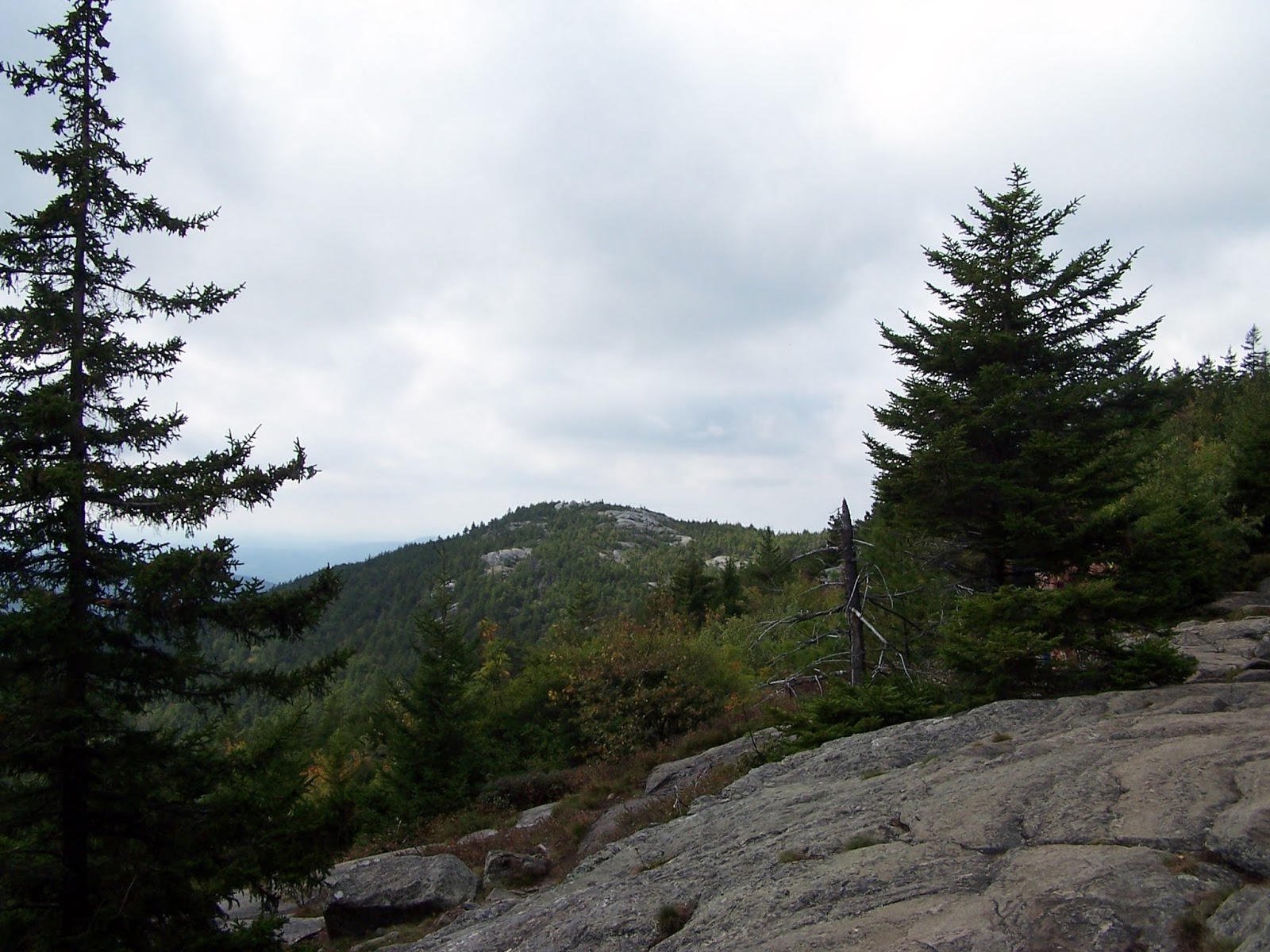
There is a short spur path, not a legal one by the looks of it, that gave me a slight view of nearby Gillespie Mountain and the Northfield - Braintree Mountain Ranges.


I began my bushwhack to Kirby Peak through open woods, which turned into some scrappy spruce towards the summit area, and then opened up again.


The register on the wooded summit of Kirby Peak (elevation:  3140 feet). I would then bushwhack south-southwest off the summit back down to the Long Trail.


Once back on the Long Trail, it was a quick hike back to the Burnt Hill Trail/Long Trail junction and then on to the summit of Burnt Hill.


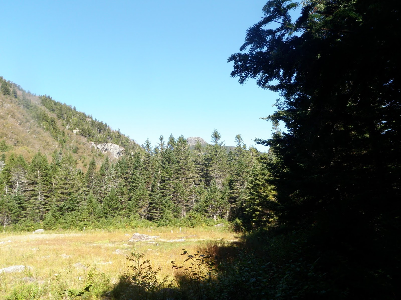
With the name Burnt Hill, you would think there would be views but alas, there were none. The high point of Burnt Hill (elevation: 3040 feet) was slightly off trail in the woods.


This would probably be the toughest water crossing to do but with the low rainfall lately, it was extremely easy to cross.


Once I was back to the car, I found a good way to do one more hike. I had originally planned to do Gillespie Mountain which is near the Texas Falls Recreation area but it would take me longer to bushwhack than this next hike which was a bit further to drive to but easier to access.

Robert Frost Mountain

Mileage: 2.35
Elevation gain: 685 feet
Trails used: none. old logging roads, bushwhack, snowmobile trail.
Highlight(s)former fire tower peak.


Its highly doubtful if Robert Frost ever hiked this peak in Vermont yet it bears his name. I had looked at hiking this several times so upon finding an interesting route that people use to run to the summit, I decided to give it a go on this nice fall day. I forgot what awaited me on the summit of Robert Frost Mountain when I got there though, which made this a bonus to the day's hikes.

Robert Frost Mountain is located in Ripton, Vermont. There are a number of old logging roads (as well as an active one) in the area, and USFS road 95 is the main road that heads into the area. It is most likely gated in winter which would make this approach much longer. I used the logging roads, snowmobile trail and a small bushwhack to reach the summit of Robert Frost Mountain where there are slight views into New York. The fire tower that once stoods here has been removed, but the cement footings as well as miscellaneous debris remain.

I parked the car at a logging road off of USFS road 95/Dragon Brook Road.


I used old logging roads/snowmobile trails to a certain point, then bushwhacked up to a snowmobile trail that went to the summit of Robert Frost Mountain.


The summit area of Robert Frost Mountain (elevation: 2513 feet). The high point was either where the old fire tower was or a few hundred feet to the north.


There was an outhouse on the summit area of Robert Frost Mountain. It was placed here for the snowmobilers who come to this summit in the winter.


The cement footings for the fire tower that used to be on Robert Frost Mountain.


There were lots of old fire tower artifacts on the summit, including this steel cable tie down. There was also plenty of wood, the metal box spring of a bed and some wire scattered about.


The second potential high point for Robert Frost Mountain, which was about 200 feet away from the old fire tower.


This is possibly an old well on the summit of Robert Frost Mountain.


The views from the summit area of Robert Frost Mountain looking into New York. I believe it is the Macomb Mountain/South Dix area in the Adirondack's.


Slightly different views into New York of the Adirondacks from the summit area of Robert Frost Mountain. Unfortunately, my knowledge of peaks in New York is very poor so I am not sure what's what.


While I was walking down the snowmobile trail, I noticed this sign for the Robert Frost Lookout and decided to check it out.


Unfortunately, since this peaks probably see's a lot more activity in the winter, the views were not that impressive as they were blocked by tree's.


Once I was back on the logging road, I jumped on a fallen tree to hop down off of it and landed on a branch and twisted my ankle. I knew instantly that I hurt it as it was the ankle I had hurt years ago (bad sprain) so I was lucky I was only about a half mile from the car. The drive home was awful due to the pain. I hopped around Sunday but with lots of ice and advil, I managed to keep it from getting worse.

A couple of nice hikes with awesome weather. It was a bit cool to start the hike but it warmed enough that I managed to get back into my T-shirt. Too bad there were very few views for both hikes but I managed to get a few more peaks done before it starts getting worse outside (snow!).

Saturday, September 19, 2015

Mount Monadnock: 9/19/2015

Mileage: 4.10
Elevation gain: 1840 feet
Trails used: White Dot Trail, White Cross Trail.
Highlight(s): 360 degree views from summit and ledges of Mount Monadnock, various trails to use.


I know. Who in their right mind would do Mount Monadnock, one of the busiest hiking areas in New Hampshire, on a nice summer day? Normally, I detest hiking this mountain and I have only done it two other times (once in summer and once in winter) so that says something about this hike, or my desire to do it. 

About a week ago, a Facebook post went out from two of our hiking friends from Quebec who was going to finish their New Hampshire 3k list and were going to finish it on Mount Monadnock. At first, I wasn't going to go because of the insanity I knew would be around. No one said they were going on Facebook, and not knowing if anyone was going at all, made our decision to go an easy one. I had people go on my New Hampshire 3k finish and it made it that more enjoyable and memorable in the long run. 

Mount Monadnock is located in Jaffrey and Dublin, New Hampshire. It is also the highest point in Cheshire County. Mount Monadnock's  claim to fame is that it is the second most hiked mountain in the world after Mount Fuji in Japan. There are numerous trails that you can use to reach the summit of Mount Monadnock, and the bald summit offers 360 degree views into New Hampshire, Massachusetts and Vermont.

Mount Monadnock is on the New Hampshire 200 Highest List and New Hampshire 3k list.  


Mount Monadnock Trails website

Monadnock State Park


We headed up the White Dot Trial that starts at the Monadnock State Park Headquarters building off of Poole Road. The White Dot Trail is easy to find: just follow all the people.


Desi beginning the hike up the White Cross Trail, which we hoped would be the least used of the two trails we could take up to the summit of Mount Monadnock, the White Dot Trail or White Cross Trail.


The White Cross Trail is the less steep alternative to the White Dot Trail, and often used for descent in conjunction with the White Dot Trail.


There are several view points along the White Cross Trail like this one looking towards the peaks in the Wapack Range, heading into Massachusetts.


This area is known as The Switchback and has a nice little set of stone steps you can use if you don't want to climb the granite slabs.


There were views looking toward Pack Monadnock from the White Cross Trail.


A zoomed in view of Mount Wachusett in Massachusetts from the White Cross Trail.


Baby cedar waxwings in their nest waiting for the mother bird to come feed them. It was probably a monumental task due to all the hawks flying around the summit area.


We get views towards Bald Rock from the White Cross Trail as it climbs out of the trees, right around the Smith Connecting Link and just below the summit of Mount Monadnock.


The summit area of Mount Monadnock comes into view just before the junction with the White Dot Trail, which continues to the summit.


Looking up to the summit area of Mount Monadnock. We sat a few hundred feet away from the junction of the White Dot Trail/White Cross Trail to see if Jean and Julie were heading up. We waited here for about 45 minutes, then decided to head down the White Dot Trail.


Just as we were heading down the White Dot Trail, here comes Jean, Julie and Victor so we did an about face and headed up to the summit of Mount Monadnock. This is looking towards North Pack Monadnock and Pack Monadnock just below the summit of Mount Monadnock.


The views looking down to Bald Rock and over to Gap Mountain as we climb to the summit of Mount Monadnock.


Jean, Julie, Victor and Desi almost to the summit of Mount Monadnock.


Jean-Sebastien Roux, Julie Chevalier and their son Victor on the summit of Mount Monadnock (elevation: 3165 feet) which marks the completion of their New Hampshire 3k journey.


The last parting shots of Bald Rock as we descend from the summit of Mount Monadnock.


Yes, trail etiquette is dying slowly and we saw everything today from barefoot hikers, to huge groups of kids and parents but all of this was to be expected. It was still a nice day out as the clouds and wind kept it comfortable enough for hiking. The views are always decent from the summit of Mount Monadnock and if you don't mind a crowd (or mob scene), this hike is top notch. It was nice to join Jean and Julie as they finished their New Hampshire 3k's and look forward to hiking with them in the future. 

Tuesday, September 15, 2015

Ethan Allen Mountain * Ethan Allen East Peak: 9/15/2015

Mileage: 8.95 miles
Elevation gain: 3090 feet
Trails used: Monroe Trail, Dean Trail, Long Trail, bushwhack, Allis Trail.
Highlight(s): Long Trail, open woods bushwhack, register on the summit of Ethan Allen East Peak.


I got the call Monday afternoon and had another day off due to issues at work. The previous two days were rainy and on the cooler side so today was going to be a better day to hike. I figured I would need to do something with some sort of views and had a few peaks in mind, but decided on Ethan Allen Mountain. We had used the Monroe Trail, and Dean Trail to make it to Wind Gap, then took the Long Trail North to get to the summit of Camels Hump. We didn't take the one mile detour to the summit of Ethan Allen Mountain at that time though since we figured it would make the day longer. With a nice breeze and despite the temperatures heading into the 80's, it was a perfect day for a hike.

Ethan Allen Mountain and Ethan Allen East Peak are located in Duxbury, Vermont and also in Camels Hump State Forest. There are several trails that you can take to reach the summit of Ethan Allen Mountain, which has views from several areas on the summit and also from the Long Trail. The summit of Ethan Allen East Peak is wooded and view-less. There are also no trails that go to Ethan Allen East Peak so a lengthy bushwhack is required.

Ethan Allen Mountain and Ethan Allen East Peak are on the Vermont 100 Highest List, the Vermont 200 Highest List and the Vermont 3k List.


Camels Hump State Park

Camels Hump State Park Trails


I parked at the winter lot for the Camels Hump State Park, as I didn't trust my car driving up to the main lot. I would take the Monroe Trail to head up towards the Long Trail. Desi and I took this trail several years ago when we hiked Camels Hump.


The blue blazed Monroe Trail is pretty east to follow and mellow until it reaches the junction with the Dean Trail.


The junction of the Monroe Trail/Dean Trail. The Dean Trail, from here to Wind Gap is also pretty mellow as far as elevation goes. Two nice trails to link up to get to the Long Trail.


There are various stream crossings but the three major ones all have bridges to cross. The water wasn't flowing that much, despite the rain for the past two days prior.


Right before you reach Wind Gap, this beaver pond offers a nice view of Camels Hump.


A nice blurry picture of the Long Trail, Allis Trail, and Dean Trail junction. I would take the Long Trail south to Ethan Allen Mountain.


The Long Trail passes by the Montclair Glen Lodge, which has ten bunks. A caretaker is here in season and a fee is charged to stay here.


After the Montclair Glen Lodge, the Long Trail started off mellow but then got steep as I began the climb towards the summit of Ethan Allen Mountain. I passed three Long Trail thru hikers at this point.


The hardest section of the Long Trail between Wind Gap and the summit of Ethan Allen Mountain was this wet, steep ledge area.


The views from the northern summit of Ethan Allen Mountain looking towards southeastern Vermont, and Ethan Allen East Peak which would be my next objective.


The views from the northern summit of Ethan Allen Mountain looking northwest towards the Worcester Mountain Range and Putnam State Forest area.


The north summit of Ethan Allen Mountain (elevation: 3680 feet), which is the slightly lower summit of the two summits of Ethan Allen Mountain.


A short hike south is the southern summit of Ethan Allen Mountain (elevation: 3688 feet), which is the highest point for this peak.


I started my bushwhack towards Ethan Allen East Peak by heading southeast down a steep section from the summit of Ethan Allen Mountain, then made it into nice open woods.


The woods remained open throughout the bushwhack over to Ethan Allen East Peak, as I followed various herd paths through fern and hobblebush.


A quick glimpse of Ethan Allen East Peak, as I am about 0.30 miles away from the summit. It sometimes looks like it is further away than it really is.


The registers on the summit of Ethan Allen East Peak (elevation: 3160 feet). There are no views from this wooded summit.


Once I was done signing in, I decided to make a line for the Dean Trail which was still almost two miles away from Ethan Allen East Peak.


I found myself taking too much time bushwhacking so I decided to do some elevation gain and hit the Allis Trail. I managed to come out of the woods right where it junctions to the south with the Long Trail. There were views looking south towards Ethan Allen Mountain from the Allis Trail, and there was a bench here to rest and take in the views.


A view of Camels Hump from the Allis Trail viewpoint.


Once I made it back to the Dean Trail, I kicked up the pace and headed back to the car in roughly an hour. After that it was time for the nice drive home.

It was nice to hit Ethan Allen Mountain, and although Ethan Allen East Peak was in open woods for the whole hike, I really dislike bushwhacks of more than two miles. The pleasant weather and decent views made up for that though. A perfect day off from work for a hike.