Saturday, March 28, 2015

Bald Top (VT): 3/28/2015

Mileage: 7.4 (3.05 for Bald Top)
Elevation gain: 1760' (1060' for Bald Top)
Trails used: Bald Top Trail/Cross Rivendell Trail.


Some hikes you go through a case of "no matter how good you're plans are, they could possibly get screwed up in some way, shape or form".  Today was one of those days, unfortunately.  We knew there would be snow showers at some point today, which would hinder views of any kind so we went with our bread and butter: a bushwhack to two, possibly three peaks in Vermont.

Failed attempt number one:  Corporation Mountain and Round Mountain.


We parked outside the gate for the Chittendon Brook Campground, which is obviously closed for winter, but open for cross country skiing and snowshoeing.


While walking on the cross country ski trails, we came across this moose which had been feeding on the hobblebush buds along side of the road.


Brian walking back to the car after we decided to call the hike due to horrible snowshoeing conditions.  We didn't feel like breaking trail through 4+ miles of snow today.


Yes, it wasn't the snow coming down that would be a problem.  It was the snow already on the ground, which turned out to be rather horrible for snowshoeing today.  The top was a hard crusty snow so when you stepped on top of it, you sank down to about your knee and had to work harder to get it out to take another step.  

So, I had a second hike in the wings for a plan B hike.  It turned out it was not too far down the road from where we were so off we went.

Failed attempt number two: The Darning Needle.


We parked off of Townsend Brook Road and were going to use the VAST snowmobile trail system to go within less than half a mile of the summit of the Darning Needle.  We walked in about a mile before Brian realized we overshot the snowmobile trail that branches off the main trail and heads towards the summit.


Like the prior hike, once we hit the secondary trail, the snow downhill.  Almost the exact same conditions as the prior hike.  The problem was that this secondary trail had not seen any recent snowmobile traffic so it wasn't as packed down and groomed as the main trail.  So it was strike two.

Eventually, I looked at the map and saw Bald Top.  I had done some information gathering recently and knew that it had trails to the summit.  We possibly couldn't strike out again, could we?

Bald Top is located in Fairlee, Vermont and the hike utilizes a section of the Cross Rivendell Trail.    A crude map for the hike and a few other trails in the area can be found here.  Information on the Cross Rivendell Trail can be found here.


We parked at the Blood Brook Road Trailhead and started off snowshoeing on this snowmobile trail, that does not go all the way to the summit.


The Bald Top Trailhead kiosk.  There is a map of the Cross Rivendell Trail, as well as general hiking information available here.  Sadly, there were no actual trail maps for us to take.


Not sure if it was logger's who did this or locals, but it was kind of neat nonetheless.


Brian pushed his luck though and Treebeard thought he would take a bit out of this smelly orc.


The snowmobile route continues along this stand of trees.


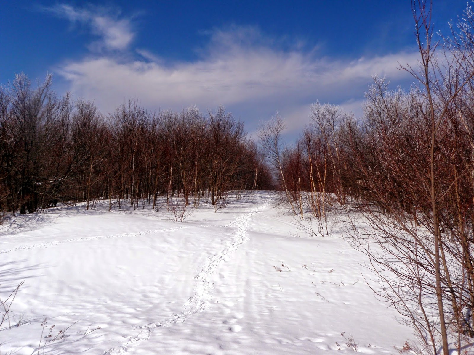
We would turn left and head up the Bald Top Trail to the summit of Bald Top.  In some spots, the snow was soft and mushy, and others it was hardpacked.  In a few areas, signs of spring (no snow) made their presence known.


Finally approaching the summit of Bald Top.  Sadly, since it was snowing, we would not get very many long distance views from its open summit.


The summit area of Bald Top Mountain (elevation 1776').  Several different trails head in different directions from the summit (one looked to be a private trail), including the Cross Rivendell Trail that heads into New Hampshire.


Nearby May Hill and Echo Mountain from the summit of Bald Top.


With very little chance for views making an appearance, we decided to head back down.


We decided to hop off the Bald Top Trail and bushwhack down on some old cross country ski tracks.  We came across this logging area that looked like a snowmobile had been through here.


Nearby horse farm along the Bald Top Trail/snowmobile trail.


Sometimes you can't do what you set out to do so you improvise.  We did that and we saw each effort turn into defeat due to the snow.  The last hike was a hail mary and although it didn't totally disappoint, it wasn't exactly what we wanted to do for all the time spent driving.  Spring time is here but nicer weather is still around the corner.

Saturday, March 21, 2015

Borden Mountain (MA) - Mount Raimer (NY) - Mount Olga (VT): 3/21/2015

I was still feeling the effects of a week long illness but decided the fresh air might do me some good.  So, as usual, Brian and I made a last minute meet time for early Saturday morning with no clue really where we would hike.  It was snowing lightly when we left New Hampshire and by the time we made it into Vermont, and the Massachusetts it was snowing pretty good.


Borden Mountain

Mileage: 2.15
Elevation gain: 415'
Trails used: snowmobile trail, roadwalk.


We decided our first hike would be Borden Mountain in Massachusetts, as at this time of year we could use the packed down snowmobile trails to our advantage.  The tricky part would be driving down Central Shaft Road into the State Forest.  It's a good thing they keep the roads plowed in winter.

Borden Mountain is located in Savoy, Massachusetts and also in the Savoy Mountain State Forest.  It is a part of the Hoosac Mountain Range. Savoy Mountain State Forest is home to several ponds for fishing, campsites with 4 log cabins to rent, hiking/biking/cross country skiing trails, and several waterfalls. 

At the parking area for the Busby Trail, we found a map for the park on one of the kiosk and I am sure you can print it online or stop at the Forest Headquarter's to get one.  Here is some more information on the park itself


We parked right near this snowmobile trail and started hiking down Adams Road to get to Tower Road, which we would take to the summit of Borden Mountain.


Heading up Tower Road towards the summit of Borden Mountain.  


The fire tower and high point on Borden Mountain (elevation 2509').  The fire tower is not accessible anymore as there is a gate around the facility.


Why snowmobilers can't pack out what they bring in.  I see this a lot on different peaks.  The Caps Ridge Trail head a few years ago comes to mind.


An odd looking communications tower just off the summit of Borden Mountain.


A view of the local landscape while walking along the snowmobile trail.  Yes, it is snowing.


A quick hike with light snow falling pretty much the whole hike.  It is definitely easier walking on the snowmobile trails as they usually keep some of them groomed and the hard packed snow makes for better snowshoeing.  Once back at the car, we looked at the Massachusetts Gazetteer for an idea on hike #2.

Mount Raimer

Mileage: 1.75
Elevation gain: 560'
Trails used: Taconic Crest Trail, bushwhack.


With hike number one done, we looked for some other peaks in the area.  We started looking at the gazetteer and were drawn to a couple of peaks along the border between Massachusetts and New York, along with a few that were in the Mount Greylock area.  We decided on the short drive through North Adams, Massachusetts and hit a mountain along the Massachusetts and New York border's.

Mount Raimer is located in Williamstown, Massachusetts and Petersburgh and Berlin, New York. Mount Raimer was home to the defunct Petersburg Pass ski area, which was then changed to the Taconic Trails, and finally Mount Raimer.  It is also a part of the Taconic Mountains and the Taconic Crest Trail traverses the mountain but not the summit.   Some information on the Taconic Crest Trail can be found on their blog.  Information on the old Petersburg Pass ski area can be found here.


Looking towards Mount Greylock (in the clouds) from the parking area for the old Petersburg Pass ski area at the height of land off of New York State Route 2.


Looking up one of the old ski trails for Mount Raimer from the parking lot.


Brian walking up the Taconic Crest Trail, which was steep at this point.  We walked from the old ski area parking lot, then branched off on a snowmobile trail.  Not sure if it is an official one or someone was just bombing around the area but we used it to almost reach the summit.


We hopped off the snowmobile trail and came upon this cool ice crystals on the tree's as we snowshoe up an old ski trail to the summit area of Mount Raimer.


Some of the old ski area concrete supports for the Poma lifts were still in place.


The summit area for Mount Raimer (elevation 2572').


Spring snowshoeing at its finest.  Brian likes it that much.


We hiked down several old grown in ski trails with views into the surrounding area in New York.  It was quicker than and better scenery than hiking back down the hiking trail.


Almost back to the car, we got this view of the Taconic Mountains across from Mount Raimer.


Almost an identical picture from the first one, except there are less clouds to be seen and Mount Greylock was out in the open.


A quick round trip hike and we were back at the car early.  So we decided to make this a state trifecta; a hike in three different states as we were going to head back to New Hampshire via driving through Vermont.  We planned to do a hike which we tried doing several weeks ago but were stopped by a snow storm, and since the weather was pretty nice we figured we could get some nice views.

Mount Olga

Mileage: 2.15
Elevation gain: 615'
Trails used: Mount Olga Trail.


We drove into Vermont and got on Route 9, which would take us by Molly Stark State Park and Mount Olga.  We figured since the weather had been warmer as of late, the high snowbank that stopped us recently would be significantly diminished.  We were right.  

Mount Olga is located in Wilmington, Vermont and in the Molly Stark State Park.  Molly Stark State Park has a campground and hiking trails to the fire tower on the summit of Mount Olga.  Cross country skiing and snowshoeing is allowed in winter.  For more information on Molly Stark State Park and/or a map of the trails in the area, click on the links.


Brian getting the snowshoes ready at the gate to head into Molly Stark State Park.  Three weekends ago, this was about a 4 foot snowbank.  Today you can park almost behind the gate.


After walking up the road a bit, we turned left on the Mount Olga Trail as we would do this as a loop hike. 


The trail was packed down by snowshoers and barebooters so we opted for snowshoes.  The Mount Olga Trail is never really steep so that was a plus today.


I think the firetower is this way.  Or so says this sign.


The fire tower on Mount Olga (elevation 2418'), which you can climb all the way into the cab for the views of the surrounding area.


Looking west from the fire tower towards Haystack Mountain and Mount Snow.  Stratton Mountain is off to the right.


More views from the summit tower on Mount Olga of Stratton Mountain, Rice Hill and Bromley Mountains ski trails just visible in between the two.


Views from the summit fire tower on Mount Olga of Greylock Mountain (background) with the wind turbines on Crum Hill and Blackpoll Mountains in Massachusetts.


More unknown peaks (to me) looking into Massachusetts from the fire tower on Mount Olga.


Looking south into Massachusetts from the summit fire tower on Mount Olga.


The inside of the old fire wardens cabin.  I was hoping to get some spirit orbs with this picture but alas, nothing.


Back down the the junction and heading back through the campground to the car.


They have lean-to shelters, with picnic tables and firepits.  Pretty cool.


The Molly Stark State Park entrance where we parked my car off of Route 9.


A fun day of hiking with an equally fun, but long, day of driving.  I would definitely recommend Mount Olga as you can hike up to the summit and then enjoy the views from the fire tower.  The other two hikes, while easy and nice, were only marginally worth doing.  Very little in the way of views but the scenery was pleasant.

Wednesday, March 11, 2015

Black Mountain (Benton): 3/11/2015

Mileage: 3.6
Elevation gain: 1730'
Trails used: Chippewa Trail.


I had the second of two days off from work to go hiking so I wanted to play it safe and go low key and not punish myself after hiking the Kinsmans the day before.  I needed something that would be broken out with views as the weather was forecasted for highs in the 40s and partly sunny skies.

Black Mountain is located in Benton and Haverhill, New Hampshire.  It is also located in the Black Mountain State Forest.  Some information can be found here.   I also decided to visit the lime kilns that are in the area on the way back down.  Of note, the Chippewa Trail is maintained by a good friend of mine, Mike Saltmarsh (AKA Salty, as he is know to us hikers) so I was doing this hike also to give him information on spring time trail maintenance he would have to do.

Black Mountain is on the New Hampshire 52 With-A-View (52 WAV) and New Hampshire Fire Tower List.


The start of the Chippewa Trail off of Lime Kiln Road.  The small trail head parking area was actually plowed out today.


Walking along the Chippewa Trail, which is part old logging road, part trail.  The snow was very mushy from the recent warmer weather so I wore snowshoes start to finish.


Beginning the ascent of Black Mountain up the Chippewa Trail, which heads up this old woods road with a steady ascent at first.


Black Mountain looming ahead.  Sometimes it seems like it is very high up and that you have a lot of elevation gain to reach the summit.


While I was heading up the Chippewa Trail, I managed to clear a few smaller sized blowdowns that I could move on my own, as well as smaller branches.


The Chippewa Trail has a good amount of yellow blazing, more than I remember being there when Desi and I first did this same hike.


Beginning the steep climb up the Chippewa Trail through nice woods.


A neat shot of what I think are red pines that you walk through on the way to the summit of Black Mountain.


The Chippewa Trail makes its way over this ledge area with good views.


Views to Piermont Mountain, Mount Cube and Smarts Mountain from some ledges just below the summit of Black Mountain.


Views into Vermont looking at the Knox Mountains, Butterfield Mountain, Signal Mountain and Camels Hump barely visible in the background.


Just when you think you are nearing the summit of Black Mountain, you still have to climb around these ledges to reach it.


Approaching the summit area of Black Mountain (elevation 2830').


Views towards the Kinsmans, Mount Wolf and Mount Liberty and Mount Flume from the summit area of Black Mountain.


Mount Moosilauke (in the clouds) from the summit of Black Mountain.


Views of Sugarloaf Mountain and the Hogsback, Mount Jeffers and Smarts Mountain, Mount Cube and Piermont Mountain (right) from the summit area of Black Mountain.


Coming down the ledges just below the summit of Black Mountain.  There were quite a few bare areas of rock so it was slow going on the snowshoes.


Beginning the steep descent of the Chippewa Trail in very soft snow.  The already warm weather made the snow like mashed potatoes so it was fun managing to not slip going down.


Almost back to the car, I decided to visit the remnants of lime kilns that are in the area.


A little information (if you can read it) on why the kilns are here and how they operated.


The bigger lime kiln which has been restored over the years.


The view of Sugarloaf Mountain from the frozen over beaver pond area along the Chippewa Trail on the way back to the car.


A woodpecker has gone to town on this tree.


A productive two days of hiking with warmer temperatures briefly teasing me with a preview of what I want to come SOON!  Enough with the snow and cold temperatures already.

Second time was the charm on this one.  I managed decent views this time around although the minor elevation gain did manage to wipe me out for today's hike.  It was probably because I was coming down with this pesky cold.   This hike can also be approached from the Black Mountain Trail on the north side of Black Mountain, but as Mike does a good job on the trail work, give it a try.