Sunday, April 27, 2014

Bald Mountain (Antrim): 4/27/2014

Mileage: 2.90
Elevation gain: 990' 
Trails Used: Tamposi Trail, Bald Mountain Trail, Tudor Trail.


This turned out to be a spur of the moment hike with Desi on Sunday, after a morning spent shopping.   We were going to do Ragged Mountain at first, but then I noticed in the Southern New Hampshire Trail Guide book a shorter hike which happened to be Bald Mountain, which is shorter and less elevation gain which was perfect for a Sunday hike.

Bald Mountain is located in Antrim, New Hampshire and is also in the dePierrefeu-Willard Pond Wildlife Sanctuary and is owned by the Audobon Society of New Hampshire.  More information for this hike can be found here.  Willard Pond is nearby which offers fly fishing, swimming and hiking in the area.  Another nice hike in the area is Goodhue Hill, which is directly across from Bald Mountain.


The kiosk located at the Tamposi Trail (Bald Mountain) parking area where we started the hike.  The trail goes into the woods on the left side of the parking area.  The map is shown in the right hand corner of the kiosk and has various trails listed.


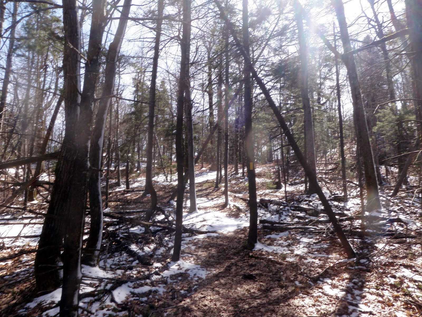
The start of the Tamposi Trail.  This trail is blazed with yellow rectangles.


The trail climbs steadily throw rocky areas with numerous interesting cave's and rock formations.  


The Tamposi Trail heading up.


Very open woods down low which is perfect for wildlife viewing/sighting.


Recent rubbings, possibly deer chewing on the bark.  Some of the rubbings were about 7-8 feet high so most likely when there was snow on the ground.


Spur Trail that follows an old logging road through more recent logging cuts and an old apple orchard.  We did not go down this trail today but it looked to be fairly easy to follow.


The junction for the Spur Trail, which is roughly about 1.3 miles one way.  We would be heading up the Tamposi Trail to the summit of Bald Mountain.


Desi up near the summit area of Bald Mountain (elevation 2037').  No actual views from up here so you have to go down to the ledges on the Bald Mountain Trail to get them.


Grand Monadnock in the background, with Skakutakee (left) and Thumb (right) Mountains in the foreground.  Taken from the ledge outlook areas just below the summit coming down the Bald Mountain Trail.


Zoomed in view of Mount Monadnock from the ledges below the summit of Bald Mountain.


Goodhue Hill (foreground) with Crotched Mountain in the background, and a few mountains in the Wapack Range to the right.


Panorama of the Wapack Range all the way over to Mount Monadnock.


 The Bald Mountain Trail, just below the ledge overlook which is still pretty easy to follow.


View of Willard Pond from some lower ledges, with Crotched Mountain to the right.


A zoomed in view of Crotched Mountain.


Looking back towards Willard Mountain, a northern peak of Bald Mountain.


The Bald Mountain/Tudor Trail junction.


The Tudor Trail skirts along the shore of Willard Pond.  A lot of rocks were strewn about along the trail.


There were also several bridges along this section over some water crossings feeding into Willard Pond.


Nice easy walking along the pond on the Tudor Trail.


A look across Willard Pond to Goodhue Hill.  Another trail goes up to the summit if you follow the Mill Pond and Goodhue Trails.


Quite a few tree's down from beaver activity.  A few of the tree's were missing completely but there was no sign of a beaver dam or hut nearby.


A few benches were placed along the shore line of the pond, including this one with this plaque. 


The start of the Tudor Trail which is off of Willard Pond Road and connects to the Bald Mountain Trail.


Overall, a pleasant loop hike with some decent views and some good elevation gain.  On a nice day, you could sit by the pond or maybe even go for a swim.  There is even a boat ramp so one could even kayak/canoe around the pond as well as do some fishing.  

Tuesday, April 22, 2014

Winslow Ledge - AT Section Hike (Dartmouth Skiway to Smarts Brook Trailhead): 4/22/2014

Mileage: 5.75
Elevation gain: 1670 feet
Trails used: Appalachian Trail, bushwhack. 
Highlight(s): Appalachian Trail, open woods bushwhack, ski trails.


I took the day off for a dentist appointment in the morning, and wanted to finish the small section of the Appalachian Trail that Brian and I did not do a month ago due to the snow depths. What a difference a month of warmer weather makes. Also, while in the area, I wanted to hit the actual summit of Winslow Ledge, which is a bit higher up than the ski area goes. It was a nice crisp spring day for this hike and there was a bit of snow left, although it was mainly confined to the ski trails.

This section of trail starts at the Dartmouth Skiway parking area, onto the Appalachian Trail and then to the other end where the Appalachian Trail then climbs up to Smarts Mountain (another hike, another time). It is approximately 2 miles one way, but it is mostly level walking.

Winslow Ledge is located in Lyme, New Hampshire. There are no official trails that go to the wooded, view-less summit but you can take a combination of Appalachian Trail and snowmobile trails to get to the peak, or simply walk up the ski trails and do a nice bushwhack.

Dartmouth Skiway


I parked at the Dartmouth Skiway parking area off of Dorchester Road and started hiking on the Appalachian Trail. I got these views of Winslow Ledge and the Dartmouth Skiway, which still managed to have some snow on its slopes.


This section of the Appalachian Trail looks so much different with zero snow, which also makes for easier hiking.


The Appalachian Trail crosses this snowmobile trail that we used this winter to take down to the road and out of the deep snow.


This was the hardest water crossing of the day along this section of the Appalachian Trail, which was pretty easy.


You can see the Appalachian Trail sign on the tree and white blaze on the other side of the water crossing.


This is the other end of this section of the Appalachian Trail, which is directly across the street from the Lambert Ridge Trailhead, which heads up towards Smarts Mountain.  I would turn around and head back from here.


A Appalachian Trail mileage marker. It's only 1730 miles to go to reach Georgia. It was shortly after the marker that I began the bushwhack towards Winslow Ledge.


I came across a combination of old woods roads and snowmobile trails and decided to see if I could take them up to the summit area of Winslow Ledge.


With the melting snow still up high, there was flowing water everywhere you stepped, including this nice little chute.


Even more logging road/snowmobile trail goodness which made it quite a bit easier for me to get up to the summit of Winslow Ledge.


Another snowmobile trail that makes a final push to the summit of Winslow Ledge.


Me standing by the summit register for Winslow Ledge (elevation: 2260 feet).


The views through the trees and from a ledge just below the summit of Winslow Ledge looking towards Moose Mountain.


A view of the Holts Ledge ski area, with snow on its ski slopes still, and Bear Hill as I was heading back down to the car through open woods.


There were open woods for pretty much the whole hike and on the bushwhack. There are lots of old logging cuts, as the pricker bushes were still a nuisance.


Looking down from the top of the ski lift area of Winslow Ledge. It was actually easier to walk down the still hard pack snow than it was to walk on the ground.


The views of nearby Holts Ledge with Bear Hill behind it as I almost down to the Dartmouth Skiway parking area.


It turned out to be a nice half day for a hike. As I was hiking down, it started to rain a little but it felt good since the temperature's were in the 70's. A few more weeks of warmer temperatures and we should be able to do the Smarts Mountain/Mount Cube sections of the AT before we hit the harder sections in the summer months.

Monday, April 7, 2014

The Pinnacle - Lyndeborough Mountain - Rose Mountain: 4/7/2014*

Mileage: 4.2 miles
Elevation gain: 918 feet
Trails used: Helen's Trail, snowmobile/atv trails.
Highlight(s)


I had a few hours to kill after I got off work early and decided to hit these three peaks located pretty close to each other, and connected by snowmobile trails. This was also a fact finding mission for a rather ambitious hike we have planned for this weekend.
  
All three of these mountains are located in Lyndeborough, New Hampshire.


The Helen's Trail starts off of Mountain Road and can be easily missed. There are a few spots you can park the car so you can do this hike.


The Helen's Trail map at the start of the hike. The Helen's Trail is blazed in places with yellow squares and pretty easy to follow.


There was still some snow on the Helen's Trail in places but only about one to two inches. There were no problems to either walk through or around it and with the warmer temperature's, it will be gone soon.


The summit of The Pinnacle (elevation: 1703 feet), the first summit you'll hit. There are some decent views off of several ledges in the area if you poke around.


Some nice views over to North Uncanoonuc and South Uncanoonuc, and also Joe English Hill from the summit of The Pinnacle.


Keep an eye out for some trail signs that point the way across to Rose Mountain. You can actually end up going into private property if you're not paying attention.


The views of Mount Monadnock from the summit of The Pinnacle.


The views of nearby Crotched Mountain with its ski area, which isn't visible.


Walking along an old road and snowmobile trail, which had recent activity. If you stay on this, you'll hit all three summits.  


 An interesting lean-to on Lyndenborough Mountain's summit (elevation: 1650 feet).


There is also this hastily made bench and fire pit around the summit area of Lyndeborough Mountain. There are slight views from around the summit ledges.


On the way to Rose Mountain, there are these nice moose woods. There was recent signs of them around here from moose prints to scat.


A really old truck all alone in the woods. Debris was scattered about in the woods.


Heading up the snowmobile trail to the summit of Rose Mountain (elevation: 1730 feet).


There are lots of cairn's on the summit of Rose Mountain except someone's big head is in the way (behind the head selfie fail!).


The views looking back to The Pinnacle, where I first started the hike.


Nice quick hike over all three summits, and then in reverse and back to the car.   If I had charged my camera the night before, I could have gotten a few more pictures.  Low snow, temperature's in the 40's (but sunny) and an easy to follow trail made for easy going.  I would recommend this hike for people who don't want to do much elevation gain and want to get some views from the ledges.