Saturday, January 30, 2016

Big Bickford Mountain: 1/30/2016

Mileage: 4.5 miles
Elevation gain: 1700 feet
Trails used: Skookumchuck Trail, bushwhack.
Highlight(s): open woods bushwhack, register on the summit of Big Bickford Mountain.


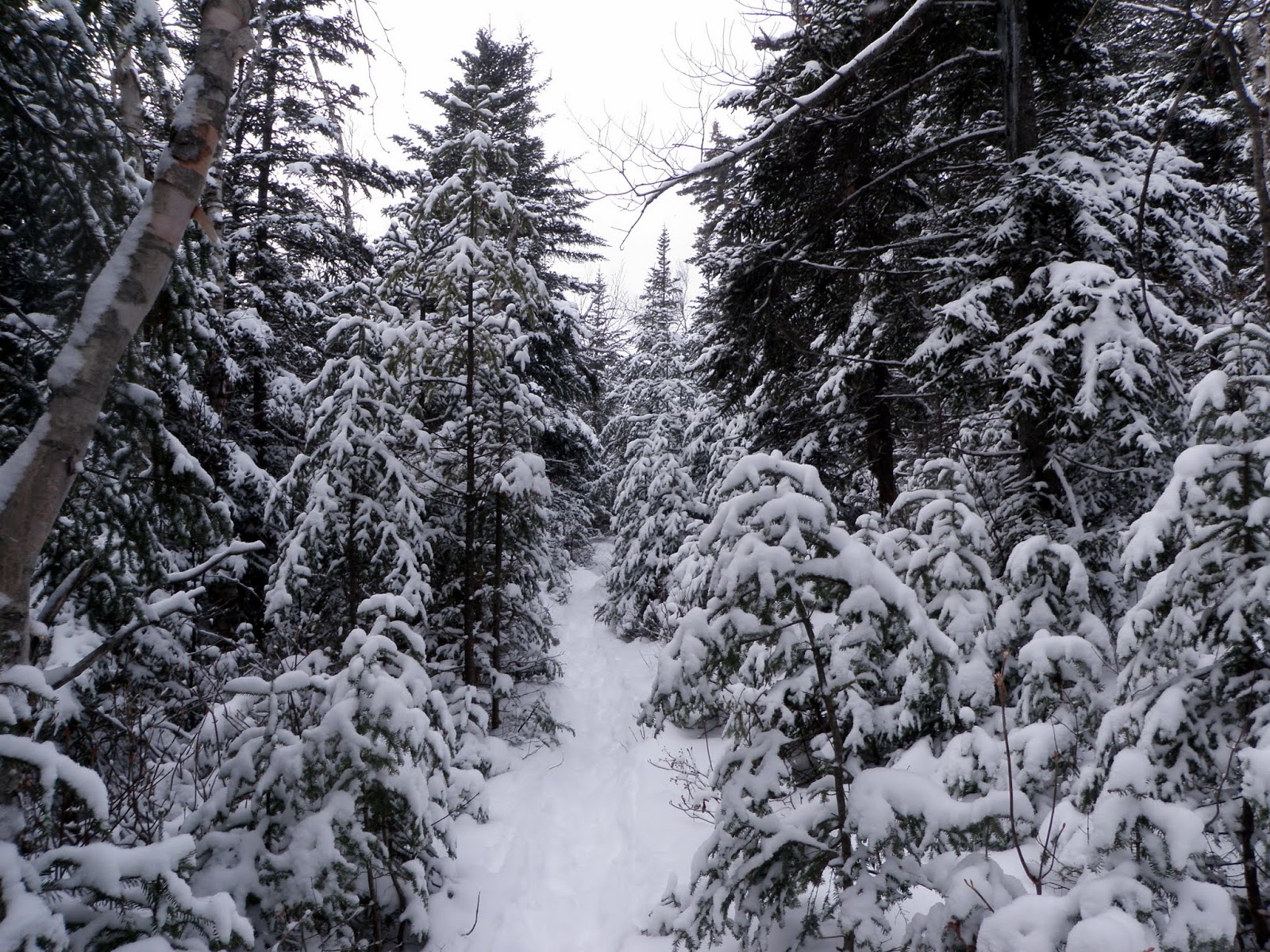
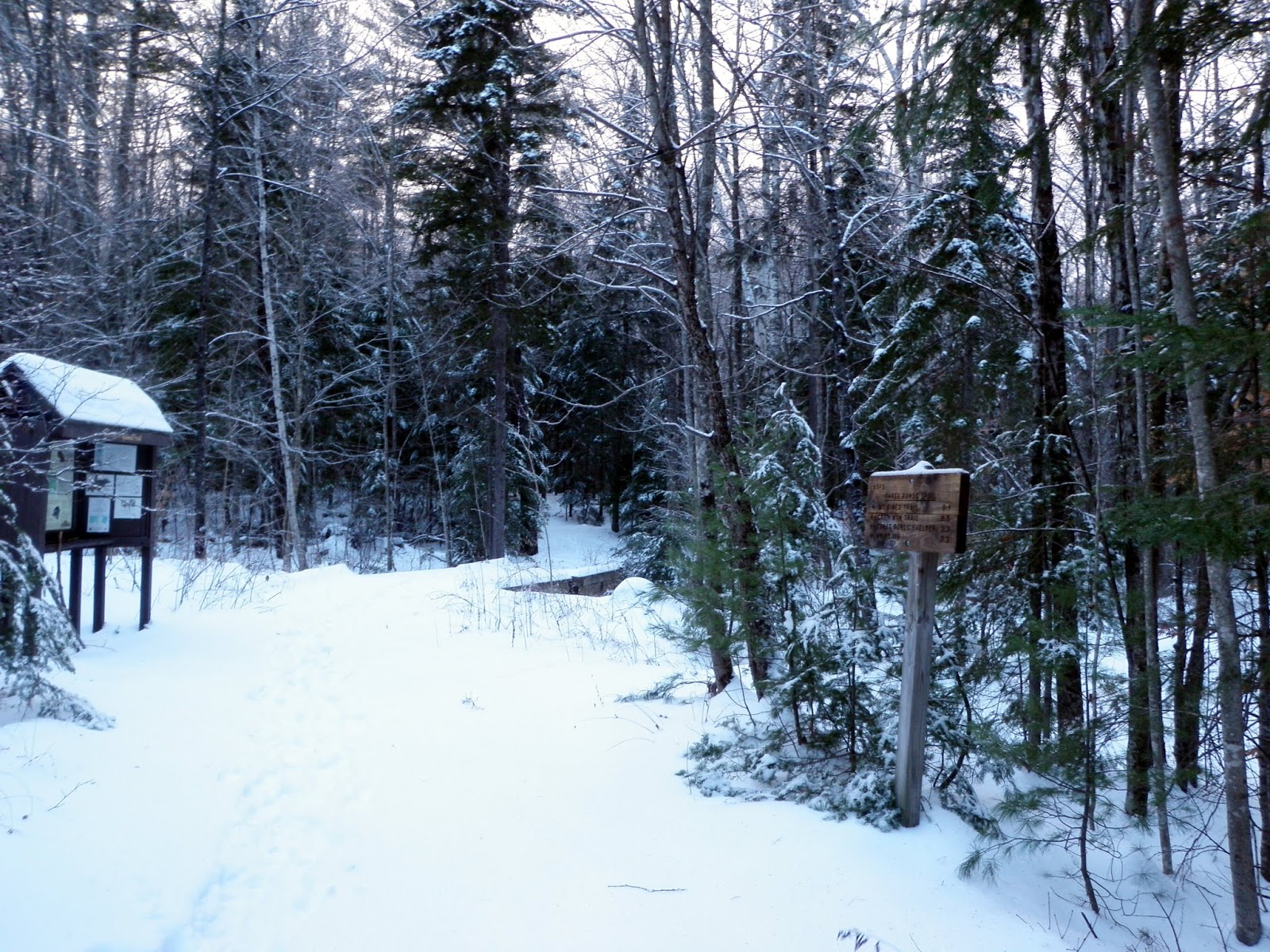
What a difference a few months makes, especially from one hiking season to another. A few months ago, I did this hike with Kris on a rainy day. The first time I did it with Desi, it was slightly overcast (a bushwhack that she liked). So, now it was time to give it a go in winter since the snow conditions were light and I could bare boot from the trailhead to the summit, without the need for snowshoes. I would only be doing Big Bickford Mountain and skipping Scarface Mountain on today's hike. When I arrived at the Skookumchuck Trailhead parking area, it was still snowing a bit and I was the only car parked there. Gearing up quick, I headed up the Skookumchuck Trail on a light layer of fresh snow.

Big Bickford Mountain is located in Franconia, New Hampshire. There are no trails that go to the wooded,view-less summit of Big Bickford Mountain so it requires a bushwhack to reach its high point.


Big Bickford Mountain is on the New Hampshire Two Hundred Highest List and New Hampshire 3K List.


I started off on the Skookumchuck Trail but ended up bushwhacking to the summit of Big Bickford Mountain after the first water crossing, which was a bit tricky to cross.


I took the southern ridge up to the summit of Big Bickford Mountain, and came across these fresh moose rubbings on these trees. I followed them for a bit but I saw nothing.


I passed through this old logging landing where the snow was almost knee deep in spots.


I hit this wide open birch glade just before the summit of Big Bickford Mountain. I followed recent moose tracks and found several places where the moose bedded down.


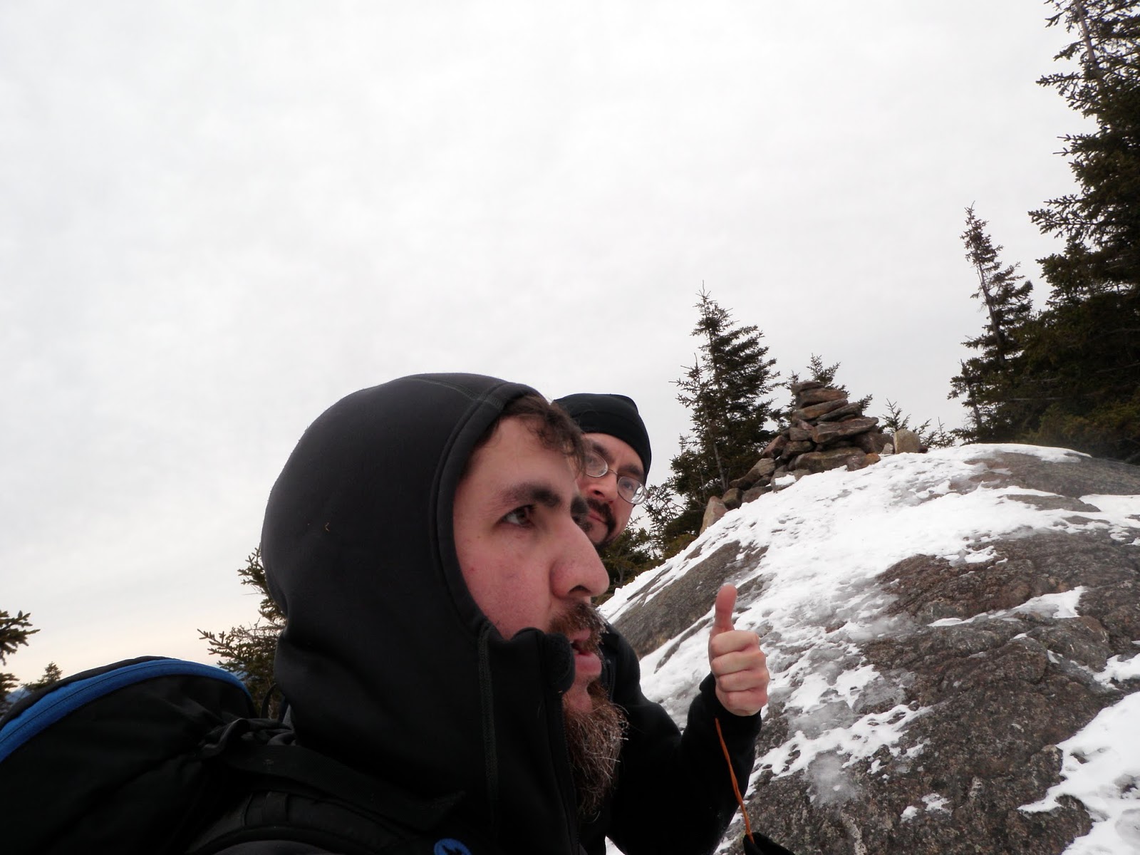
The jar register on the summit of Big Bickford Mountain (elevation: 3261 feet).


You can see my tracks as I follow them back down to my car, once again through open woods.


A fairly quick return trip had me back at the car just as the snow showers were ending. I managed to get this picture of Cannon Mountain and Mittersill Mountain.


A quick round trip hike, as the snow depths were firm and made it easy to walk on top of the snow. I wore Microspikes from the car, to the summit of Big Bickford Mountain and back down. As soon as I returned to the car, I decided to call it a day and head home. This was still a fruitful bushwhack of a peak that is always nice to visit, in any season.

Saturday, January 23, 2016

Mount Israel * Dinsmore Mountain: 1/23/2016

Location:
Mileage: 5.55 miles
Elevation gain: 2135 feet
Trails used: Wentworth Trail, bushwhack.
Highlight(s): views from ledges below the summit area of Mount Israel, views from the summit area of Mount Israel, register on the summit of Dinsmore Mountain.


Brian and I wanted to take it easy this week and do something with views that wouldn't be that difficult to do. Maybe something we have done before but in a different season so we decided on Mount Israel. I suggested adding a short bushwhack over to Dinsmore Mountain into the mix and a plan was hatched. As usual, bringing the plan to fruition would be a fun thing to attempt. While snow conditions still remained low, the hot then cold weather pattern had the snow in a mixture of hard packed snow and knee deep snow (on the bushwhack). It was going to be a cold, breezy winter day and cloudy but we would make the most of the day.

Mount Israel and Dinsmore Mountain are located in Sandwich, New Hampshire. There are views from the ledges below the summit of Mount Israel as well as views from the actual summit. There are no trails that go to the wooded,view-less summit of Dinsmore Mountain so it requires a bushwhack to reach its high point.


Mount Israel is on the New Hampshire 52 With A View (52WAV).


We took the Wentworth Trail, which was hard-packed snow. The Wentworth Trail starts to the left of the Mead Base Camp parking area.


The Wentworth Trail is pretty straight forward and easy to follow. We used Microspikes all day for this round trip hike.


The views from ledges below the western summit of Mount Israel looking towards Red Hill, with the Belknap Range behind it.


The views from ledges below the western summit of Mount Israel looking towards Mount Kearsarge, Ragged Mountain, Mount Sunapee (in the distance), and the nearby Rattlesnake Mountains (in the Squam Lakes area).


The views from the summit of Mount Israel looking towards the lower summit of Mount Israel with Tenney Mountain and Mount Cardigan behind it.


The views from the summit of Mount Israel looking towards Killington Peak and Pico Peak in Vermont. Dinsmore Mountain is nearby and our next objective.


The views from the summit of Mount Israel looking towards Mount Chocorua, Mount Paugus, Mount Passaconaway peeking over Mount Whiteface, East Sleeper, West Sleeper and the Tripyramids, with Flat Mountain and Young Mountain nearby.


The views from the summit of Mount Israel looking towards the Trpyramids, Sandwich Mountain and Black Mountain.


The views from the summit of Mount Israel looking towards Black Mountain, Mount Moosilauke, Cone Mountain, Mount Cushman and Mount Kineo.


The views looking towards Mount Paugus, Mount Paugus-South Peak and Mount Chocorua from the summit of Mount Israel.


Brian and I on the summit of Mount Israel (elevation: 2620 feet).


We branched off of the Wentworth Trail and started the bushwhack through open woods towards Dinsmore Mountain. In some spots, the snow was almost knee deep.


The jar register on the high point of Dinsmore Mountain (elevation: 2303 feet). The southern bump is the higher of the two summit bumps.


We bushwhacked down a drainage and made a beeline for the Wentworth Trail, through more open woods.


The bushwhack back to the car was a mixed bag of knee deep snow but going down is a lot easier than it is hiking up. We were both content with this hike so we didn't bother doing another hike and called it early, which is rare for us sometimes but with it being winter, it's better to be safe than sorry. It was a nice winter day to revisit Mount Israel considering conditions could have been worse.

Saturday, January 16, 2016

Mount Paugus: 1/16/2016

Mileage: 9.2 miles
Elevation gain: 2920 feet
Trails used: Gordon Path, Old Mast Road, Lawrence Trail, Kelly Trail.
Highlight(s): register on the summit of Mount Paugus, views from the ledges on Mount Paugus-South Peak.


The hike for this Saturday was actually meant to be a longer hike; head over to Mount Paugus, backtrack and hit Square Ledge and then back to the car. We knew it was going to be a cold winter day and we made it to the Ferncroft parking area with winds and falling snow, which was somewhat heavy. There were several cars already there and a few more pulled up as we began the hike.

Mount Paugus is located in Albany, New Hampshire and also in the Sandwich Range Wilderness. There are no trails that go to the wooded,view-less summit of Mount Paugus so it requires a combination of trails and a bushwhack to reach its high point.


Mount Paugus is on the New Hampshire Two Hundred Highest List and New Hampshire 3K List. Mount Paugus-South Peak is on the New Hampshire 52 With a View (52WAV).


We parked at the Ferncroft trailhead parking area and took the Gordon Path a short distance, and then taking the Old Mast Road up. There was recent foot traffic so the going was easy.


Walking along the Old Mast Road, which was easy to follow.


We are about to cross into the Sandwich Range Wilderness.


At the junction of the Walden Trail/Lawrence Trail/Old Mast Road/Square Ledge Trail. We would turn right and head down the Lawrence Trail which had not seen much foo traffic recently and had a light layer of fresh snow.


We made the mistake of losing the re-routed Lawrence Trail and following the old trail that goes up rather steeply. We ended up in thick, steep woods and these wet plateau areas so we bushwhacked back down to the trail.


The views looking towards Mount Passaconaway as we near the place where we would start the bushwhack to the summit of Mount Paugus along the Lawrence Trail.


The jar register on the main summit of Mount Paugus (elevation: 3198 feet). 


As we made our way back down to the Lawrence Trail, and onward to Mount Paugus-South Peak, we got this view of Mount Chocorua before the clouds surrounded it.


Moose rubbings/gnawing on a section of trees as we bushwhack towards the  Lawrence Trail.


Heading back along the Lawrence Trail was just as tough as it was going up to Mount Paugus. The light snow covered sections of ice that made footing sketchy.


We decided to take the Kelly Trail back down instead of the way we came in. The Kelly Trail runs along a small brook for almost the whole length, and we descended along a ravine. Footing was not bad, although ice still made its appearance.


We made it to the last section of the walk out on the Gordon Path and back to the car.


The snow came down for a better part of the day and even as we neared the end of the hike, the sun still tried peaking out for a few minutes. Our desire to continue on to Square Ledge petered out pretty much once we were done with the bushwhack to Mount Paugus, as the off course mishap made for a wetter day. We managed to make the best of the conditions, and although there were no views from Mount Paugus-South Peak, we still had a good day outdoors.

Saturday, January 9, 2016

Mount Kineo-East Peak: 1/9/2016

Mileage: 6.7 miles
Elevation gain: 1980 feet
Trails used: snowmobile trail, bushwhack.
Highlight(s): open woods bushwhack, canister on the summit of Mount Kineo-East Peak.


I would be heading out solo today and I wanted to do a bushwhack since snow conditions remained on the light side. It has been a crazy first few weeks of winter proper as temperatures and conditions have been all over the spectrum. There was more snow in the area from earlier in the week when Desi and I tried hiking up to Mount Kineo so I would be using some of the snowmobile trails in the area to help me reach the summit of Mount Kineo-East Peak.

Mount Kineo-East Peak is located in Ellsworth, New Hampshire. There are no trails that go to the wooded,view-less summit of Mount Kineo-East Peak so it requires a combination of snowmobile trails and a bushwhack to reach its high point.


Mount Kineo-East Peak is on New Hampshire 200 Highest List.


At a snowmobile interesection (155 North), I took a picture of the snowmobile trails in the area for future reference for hikes in the area.


I picked the direct route through open woods, at times steep, and headed directly towards the ridge to the west of the summit of Mount Kineo-East Peak.


I came out of the woods right around this research station and took the snowmobile trail across the ridge for the short bushwhack to Mount Kineo-East Peak.


Me on the summit of Mount Kineo-East Peak (elevation: 2981 feet).


The recently used snowmobile trail I used to reach the summit of Mount Kineo-East Peak and my return trip back to the car.


Buzzell Brook was still flowing as I made the hike out on the snowmobile trail back to my car.


It was a rather quick hike up to the summit of Mount Kineo-East Peak as the snow was firm and easy to walk on. This would make the second time I had been to this particular peak and first time in winter. It was almost serene walking in the woods with no sounds of the outside world going on. It started snowing a bit while I was on the ridge line going to and from the summit area but it wasn't bad. 

Saturday, January 2, 2016

Engine Hill South: 1/2/2016

Mileage: 6.7 miles
Elevation gain: 2255 feet
Trails used: Rocky Branch Trail, bushwhack.
Highlight(s): open woods bushwhack, register on the summit of Engine Hill South.


I messaged Kris about a month back and asked him what his plans were for the next few weeks/weekends (around Christmas and New Years). He told me the second of January would probably be doable so we waited to see how the weather would be before we planned anything out. His only stipulations would be a short hike since he hadn't hiked for some time and has had knee issues for awhile. Not a problem as Desi and i went out for a short hike on New Years Day. 

Our original pick for the day was Kearsarge North, but unfortunately I did not get a good sleep the night before and felt a bit under the weather so we settled on another peak that he needed to do: Engine Hill South. Since it was supposed to be cloudy and snow showers all day I figured this would be a better peak to do anyways, if we were to have a low chance for views. Plus, the mileage was about comparable with a little less elevation gain.

Engine Hill South is located in Sargents Purchase, New Hampshire. The Rocky Branch Trail is usually well trodden in the winter, as people use this trail to reach Mount Isolation. There are no trails that go to the wooded,view-less summit of Engine Hill South so it requires a combination of trails and a bushwhack to reach its high point.

Engine Hill South is on the New Hampshire Two Hundred Highest List and New Hampshire 3K List.


Kris heading up the start of the Rocky Branch Trail. We used Microspikes for the round trip hike to the summit of Engine Hill South.


Some sections of the Rocky Branch Trail were a muddy mess despite the recent snow. There hasn't been enough cold nights and snow to cover up the water crossings and low land areas.


Its beginning to look like true winter on this section of the Rocky Branch Trail before the height of land.


We started the bushwhack shortly after we crossed into the Presidential Range-Dry River Wilderness at the height of land.


Kris led us to the summit of Engine Hill South through mostly open woods, like this birch glade. The snow was about mid calf high but easy to walk in.


The jar register on the summit of Engine Hill South (elevation: 3244 feet). The moose antler has been there since the first time I was here in 2011.


Summit selfie with Kris on the summit of Engine Hill South. It was a quick sign in and snack break, and then following our tracks back to the Rocky Branch Trail.


The views of Engine Hill North peak from the birch glades we passed through on the bushwhack up to Engine Hill South.


We made it back to the cars at a decent time despite a later start. The weather wasn't bad although snow showers were a constant until we headed back to the cars and then slight views opened up. It was a quick hike back down. We met a couple who attempted the Engine Hill bushwhack with thoughts of doing Mount Isolation today but the bushwhack portion of the hike was not tracked out very well and it was slow going for the two of them, despite wearing snowshoes. Kris and I did not have that problem though, when we made the bushwhack wearing just microspikes. It was a nice hike overall.

Friday, January 1, 2016

Mount Kineo Trail (New Years Day Hike 2016): 1/1/2016

Mileage: 4.30 miles
Elevation gain: 715 feet
Trails used: Three Ponds Trail, Mount Kineo Trail.
Highlight(s): woods walk, cascades along Brown Brook.


This would be my third annual New Year's Day hike to begin the New Years (2015 was Stinson Mountain with Desi, 2014 was Mount Osceola-East Peak and Mount Osceola with Brian.) Desi and I had discussed a few peaks to do that shouldn't be a problem with the somewhat fresh snow we had received a few days prior. After looking at the maps and guidebooks, we decided on Mount Kineo which we could do a bushwhack to reach the summit if conditions were good. While it was cold, and there was a fair bit of snow on the ground, the going wasn't bad at first.


We drove the CRV to the unplowed parking area off of Stinson Lake Road for the Mount Kineo Trail, which is also used by snowmobiles.


There was an old snowshoe track down on the beginning part of the Mount Kineo Trail but we decided to not use snowshoes for this hike, which Desi had debated.


We turned left onto the Mount Kineo Trail, which is also a snowmobile trail (which had no recent traffic).


The Mount Kineo Trail runs along Brown Brook, which despite the cold temperatures, was still flowing well and not frozen completely.


We came along this little cascade on Brown Brook, just before the snowmobile bridge crossing.


The snowmobile bridge over Brown Brook and the junction of the Mount Kineo Trail and Donkey Hill Cutoff.


The snow was the deciding factor of the day for Desi, who hasn't hike very much lately. I could have kept up a good pace of breaking trail but with still a mile and a half to go, plus a bushwhack to reach the summit of Mount Kineo, we decided to turn around and call it a day. We reversed course and made it back to the car in decent time. With more snow, and a decent snowmobile packed out trail, we will attempt this one again at some point this year.