Saturday, February 22, 2014

Mount Hitchcock-East Peak: 2/22/2014*

Mileage: 7.4 miles
Elevation gain: 1445 feet
Trails used: Hancock Notch Trail, Cedar Brook Trail, bushwhack.
Highlight(s): canister on the summit of Mount Hitchcock-East Peak.


With Brian still out of commission and unable to do hikes with a good amount of elevation gain (he was doing the Lincoln Woods trail the same day), and Desi on call for work, I was undecided on what to do for Saturday. My first choice was to try a whack off the Lincoln Woods trail, but now knowing for sure if the Osseo Trail was broken out, I opted to go and take a walk into Hancock Notch. People doing North Hancock and South Hancock will use this approach.

Mount Hitchcock-East Peak is located in Lincoln, New Hampshire. There are no trails that go to the wooded,view-less summit of Mount Hitchcock-East Peak so it


Mount Hitchcock-East Peak is on the New Hampshire Two Hundred Highest List and the New Hampshire 3K List.


The always impressive views of the Osceola Mountains and Scar Ridge from the Hancock Overlook where the Hancock Notch Trailhead parking area is located.


Danger! A Highway crossing ahead. I was the only one who has probably gone through the gate this winter. Notice my "evil" shadow.


The Hancock Notch Trail was packed out but a bit soft already even though the days warmth had not yet settled in this early in the morning. There was a mixture of people with no traction, people with snowshoes and skiers on the trail ahead of me.


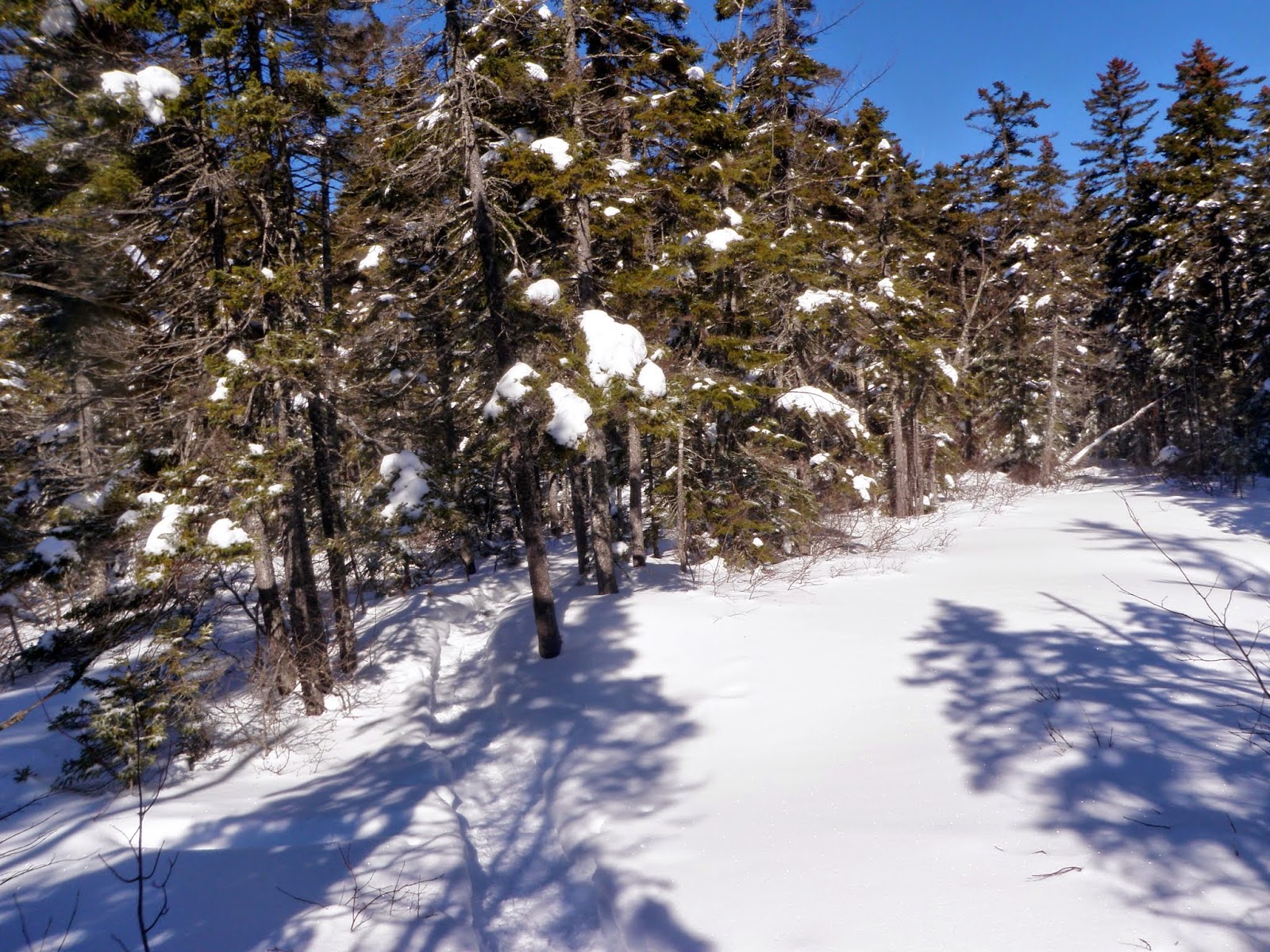
The snow covered trees in the woods down low right off the Hancock Notch Trail.


The junction for the Hancock Notch Trail and Cedar Brook Trail, which also leads to the Hancock Loop Trail.


A frozen over swamp area along the Cedar Brook Trail.


This is the Cedar Brook Trail just past the Hancock Loop Trail. I decided to skip North Hancock and South Hancock for a bushwhack to Mount Hitchcock-East Peak. The snow from this point on the Cedar Brook Trail to the actual bushwhack was about ankle deep. Notice the barely visible old snowshoe track.


I am now entering the Pemigewasset Wilderness. I would start my bushwhack just after this sign, at the HOL (height-of-land). From here to the summit, i did not take many pictures due to the deep snow (knee to thigh deep in most spots) and the slow pace I was going at to get there. It was a little less than half a mile to the summit but it took roughly an hour to cover that distance. Very tough conditions solo


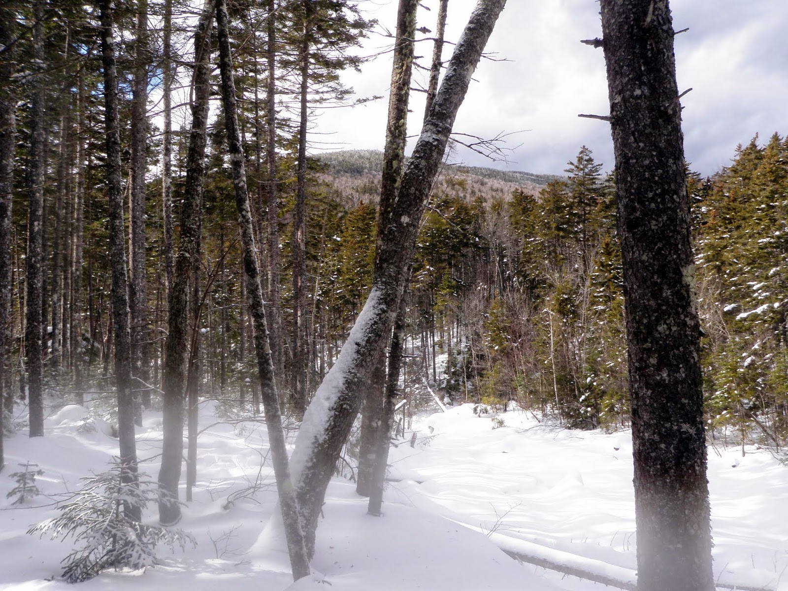
A view of North Hancock in between the snow covered tree's.


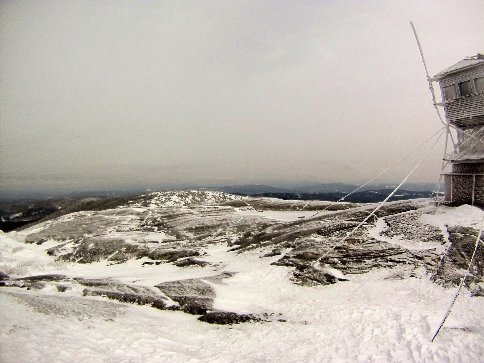
The very snow covered trees on the wooded summit of East Hitchcock (elevation: 3331 feet). The snow was almost thigh deep up here.


A nice moose area that would definitely be a wet place in warmer weather on the bushwhack back to the Cedar Brook Trail.


Finally back on the trail and hiking back to the car.  There was a bit of moisture on the camera lens which is why they appear blurry in the bottom portions.


A nice hike in on the snowshoe tracks but a tough solo whack with horrible snow conditions made for a semi comfortable jaunt out in decent weather (for once, this winter).  A little more than 7 miles puts a dent in the overall total but we can only hope, with much warmer weather, that the miles will start piling up more and more soon.  Spring, please come soon!!!

Sunday, February 16, 2014

Mount Garfield: 2/16/2014

Mileage: 12.5 miles
Elevation gain: 3265 feet
Trails used: road walk, Garfield Trail, Garfield Ridge Trail.

Highlight(s): views from the summit of Mount Garfield, former fire tower summit.


Midweek, Kris messaged me about possibly doing a hike with him and with Brian still out of commission, I throw out Mount Garfield as a suggestion. "So it was written, so shall it be done" we said. The only concern was that we were originally going to do this on Saturday, a few days after the roughly foot of snow that blanketed the area. With no trip reports, and the possibility of having to break trail, we waited until Sunday to do this hike. I met Kris at the park n' ride and we headed up to the parking area off of Route 3. After gearing up, we began the walk up Gale River Road to the Garfield Trail starting area.

Mount Garfield is located in Franconia, New Hampshire. The Appalachian Trail runs along Garfield Ridge and over the summit of Mount Garfield on its way to Maine. Mount Garfield is a shorter hike in summer as the road to the trail head is drive-able. There are good views from the summit of Mount Garfield.


Mount Garfield is on the New Hampshire Four Thousand Footer's List, the New England One Hundred Highest List, the New Hampshire One Hundred Highest List,  the New Hampshire Two Hundred Highest List, and the New Hampshire 3K List.


We parked at Five Corners and then walked up Gale River Road to the summer trail head, which is roughly about 1 mile in distance.


 Kris stops to survey the landscape and hike ahead on the road walk in.


 The start of the Garfield Trail. From here, to the junction with the Garfield Ridge Trail, it is roughly 4.8 miles of moderate terrain.


 The woods were nice and open down low with a decent snowshoe track laid down.


 The Garfield Trail starts heading up around 2300 feet, with quite a few switchbacks. The snow also started getting deeper and coated the trees more.


Winter makes a nice appearance as we are nearing the junction for the Garfield Ridge Trail.


The junction for Garfield Ridge. The summit of Mount Garfield is a steep 0.2 miles up.


Nearing the summit of Mount Garfield, with its old fire tower foundation and rime ice wonderland. Unfortunately, there were zero views today from the summit.


Kris taking a "selfie" on the summit of Mount Garfield (elevation: 4500 feet). It was VERY cold and VERY windy up here so we didn't stay long.


The views from the summit of Mount Garfield are much better than this. As usual, lately, the weather would not cooperate.


The views looking back towards the summit and fire tower foundation on Mount Garfield. You can barely see the sun trying to come out.


 The woods around the old Garfield Pond Trail, which we would pass on checking out today.


So, it was time to head back down...


....and as usual, the sun comes out to put a close to the day on the long hike out.


It was a long hike, with cold temperatures and brisk winds.  We passed quite a few people who had stayed at the shelter the night before, as well as several XC skiers who skinned up and skied down. It looked like it was a lot of fun. 

I know both Kris and I were pretty tired from the climb up but the hike out was fairly quick and uneventful, other than coming upon a snowmobile that had missed its turn and ended up in the ditch.

It was good to hike with Kris again, but I fear if I keep beating him up on these hikes, he might not want to hike with me anymore!!  It was still a good time to get out and hike, even if it was a so-so winter hike.

Saturday, February 8, 2014

Dixville Peak: 2/8/2014*

Mileage: 13.4 miles
Elevation gain: 2220 feet

Trails used: Snowmobile trail, bushwhack.
Highlight(s): 


For our Saturday hike, we decided we needed to head back into some familiar territory and re-visit a New Hampshire 3000 footer we had done before, but in a different season and pretty much drove all the way to the summit. Yet it was winter, so we knew we were in for a long walk on snowmobile/ATV trails and the day was supposed to be cold, so we made sure we were ready for bad weather and were going to make the best of it.

Dixville was a lovely mountain with decent views, but now props up the Northern end of a series of wind turbines stretching across the whole Phillips Brook/Kelsey area.  Once wild and pristine it now features industrial sized power lines, super wide and maintained roads, and of course the aforementioned "mighty "wind turbines.  The bonus to all of this is a super network of snowmobile and ATV trails, to which we took advantage of as it allowed us to spend the whole day on groomed trails.  Dixville Peak is in the Dixville Township.

Wind turbines:  eyesore or good for the environment/public?  You decide.

Dixville Peak is on the New Hampshire One Hundred Highest List,  the New Hampshire Two Hundred Highest List, and the New Hampshire 3K List.


The start of the snowmobile trail (which is also an active logging road in summer) we would use to reach our destination in the distance: Dixville Peak. We would spend a lot of time being buzzed by snowmobiles today.


The logging road is a super groomed snowmobile highway that makes for easy going. The only problem is that it goes on and on for miles.


As usual, the bonus of logging roads and snowmobile trails is that you can usually get views from them at some point.


Brian moving along slowly on the snowmobile trail with some northern New Hampshire peaks in the background.


 The wind turbines appear from the clouds on Mount Kelsey. These are the power lines feeding off the turbines, which run along the length of the roads.


There are quite a few snowmobile trail/logging road junctions that you can get lost on if you aren't paying attention.


In the woods along side the road, the snow was fairly deep.


The final approach on the snowmobile trail will get you close to the summit.  You can hear the noise from the wind turbines, even over the wind.


Normally this spot offers super views, but the snow squalls chose this time to move in on us.


End of the line!  The yellow gate is where the snowmobile trail ends and a sign warns off any further approach.  Access is strictly prohibited on the access roads leading up to the turbines.


The old snowmobile trail will get you a bit closer, but even this has a sign that warns of further approach (thankfully it has text on it, because the picture would lead one to be warned that wind turbines shoot asteroids at unsuspecting people!)


Heading back down to the trail from the summit, we came across knee to hip deep snow that has been untouched this winter.


On the long hike out (and in also) we came across a lot of old logging areas like this one.  


Brian making the long, cold journey back out to his car.


So a long 13.3 miles marked this trip to a great little peak in the farther reaches of the Great North Woods.  It was the longest trip since the start of the year, and a good way to make some miles.  Except for a pretty stiff and bitter wind at times, the weather in general managed to cooperate.  It would have been great to get more views from near the summit, but the snow squalls had moved in just long enough to make picture taking non-existent for the most part.  Still a nice day regardless!

Wednesday, February 5, 2014

Mount Cardigan: 2/5/2014*

Mileage: 4.15 miles
Elevation gain: 1525 feet
Trails used: road walk, West Ridge Trail.

Highlight(s): 


Desi had been getting over a bit of a chest cold for the last few weeks so I asked her if she wanted to go out for a nice snowshoe hike to get some fresh air into her lungs. I suggested Mount Cardigan, since we both like this peak a lot and have hiked here several times.  It was a resounding yes so off  we went.

Mount Cardigan is in Cardigan Mountain State Forest and also located in the towns of Orange and Alexandria, New Hampshire.  There is a fire tower that sits on the summit that is manned at various times in the "good weather" days (i.e. any time other than winter).  

It had snowed quite a bit from a recent storm a few days prior, so we decided to head up the West Ridge Trail not knowing exactly how the snow conditions truly were going to be.  We arrived to a mixture of hikers and skiers so the trail up would have a nice track.  While we weren't expecting the views to be present today, we thought the weather might clear up a bit so we could get something.

Mount Cardigan is on the New Hampshire Two Hundred Highest List and the New Hampshire 3K List.


Hiking up the snowshoe track that was in place from snowshoes and skiers.  This is part of the road that goes to the summer parking area for the West Ridge Trail head.


The summer parking area with slightly overcast skies, which would be the norm for the hike.  The road is not plowed this far in winter.


We stopped here for a rest before we would head up the West Ridge Trail towards the summit of Mount Cardigan.


The starting section of the West Ridge Trail, which leaves from the summer parking area.  The woods were nice through here and the trail was packed down very nicely from people heading up before us.


 Some gnarly looking trees covered in snow along the West Ridge Trail.


At the junction for the South Ridge/Rimrock Trail and West Ridge Trail.  There are very nice views and an interesting perspective of Mount Cardigan from both of these areas although we did not go today though due to the weather.


Some more sections of the West Ridge Trail.  This trail, from the summer parking lot, is roughly 1.5 miles to the summit.  Notice the XC ski tracks along with the snow shoe tracks.


The West Ridge Trail continues on as we get closer to the summit of Mount Cardigan.


We would cross Chuck's Bridge.  No trolls on duty today though.


We are fast approaching the summit.  This is looking back towards the Rimrock area.


Heading up to the summit, it was a mixture of bare granite and nice snow drifts, as well as rime ice.  We had to weave our way around to get up to the summit since we were both wearing snowshoes still.


There are numerous trails that intersect various portions of the mountain, from regular hiking trails to ski trails making for some interesting variations for hikes.


The summit of  Mount Cardigan (elevation 3123') and its fire tower, which at this time is obviously not manned.


The fire tower on the summit of Mount Cardigan and its rime ice coat.


Not very many views today.  Right as we reached the summit, the snow line moved in.


Rime ice that has built up on the support structure for the fire tower.


The hike out was quick, like it usually is when you are headed down.  We passed several people heading up just as the weather moved in.


One last picture.  Desi and I just below the summit.  It was really COLD up on the summit.

A nice winter hike up a nice mountain as usual.  It's the first winter trek up Cardigan for either of us but it was an enjoyable one.  Plus, it went quick as we didn't have to break trail for any length and the weather held off for the most part.  On a nicer day, we would definitely have to return to check out a few more of the other trails this area has to offer.