Thursday, January 30, 2014

Butterfield Mountain * Signal Mountain: 1/30/2014

Mileage: 8.5 miles
Elevation gain: 2875 feet
Trails used: none. VAST (Vermont Association of Snow Travelers) snowmobile trails, bushwhack.
Highlight(s): open woods bushwhacks, register on the summit of Butterfield Mountain, register on the summit of Signal Mountain.


I got a rare day off from work so with the weather forecast for a perfectly nice (i.e no snow, no cold) winter day, I decided I wanted to get back to doing some hiking in Vermont. I kicked around various ideas, and decided on doing Butterfield Mountain and Signal Mountain, since they were nearby and I didn't have to worry about a car spot since I would be solo. I pulled into the Groton State Forest entrance off of Gore Road and geared up to begin my hike on snowmobile trails, then transition to snowshoes for the bushwhack to the summits of Butterfield Mountain and Signal Mountain.

Signal Mountain is located in Groton, Vermont. Butterfield Mountain is located in Orange, Vermont. Butterfield Mountain and Signal Mountain are also located in the Groton State Forest. There are no trails that go to the wooded,view-less summits of Butterfield Mountain and Signal Mountain so it requires a bushwhack to reach both high points.
   

Signal Mountain and Butterfield Mountain are on the Vermont One Hundred Highest List, the Vermont Two Hundred Highest List, and the Vermont 3K List.


I parked at the VAST parking area just outside of the Groton State Forest entrance off Gore Road. I was the only one here all day.


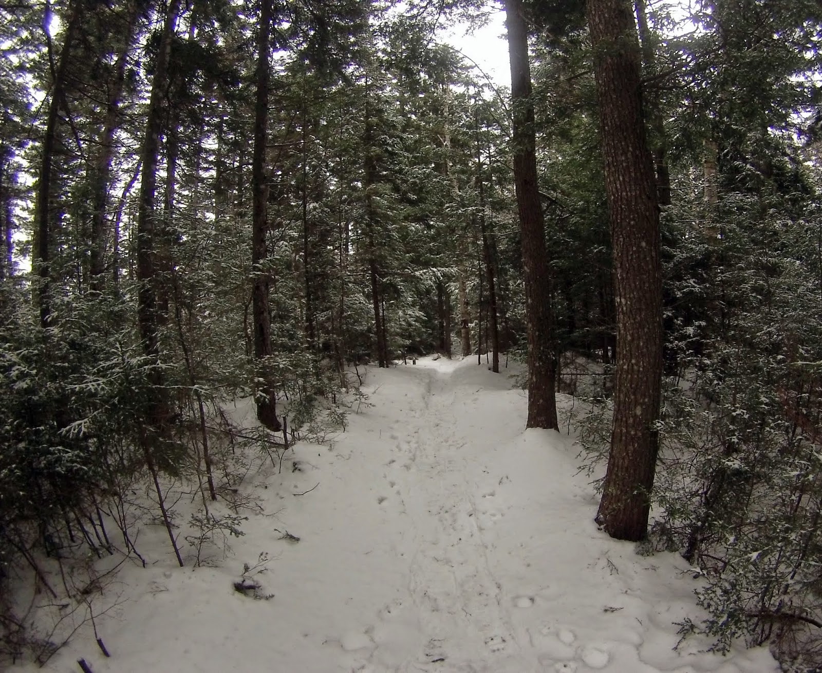
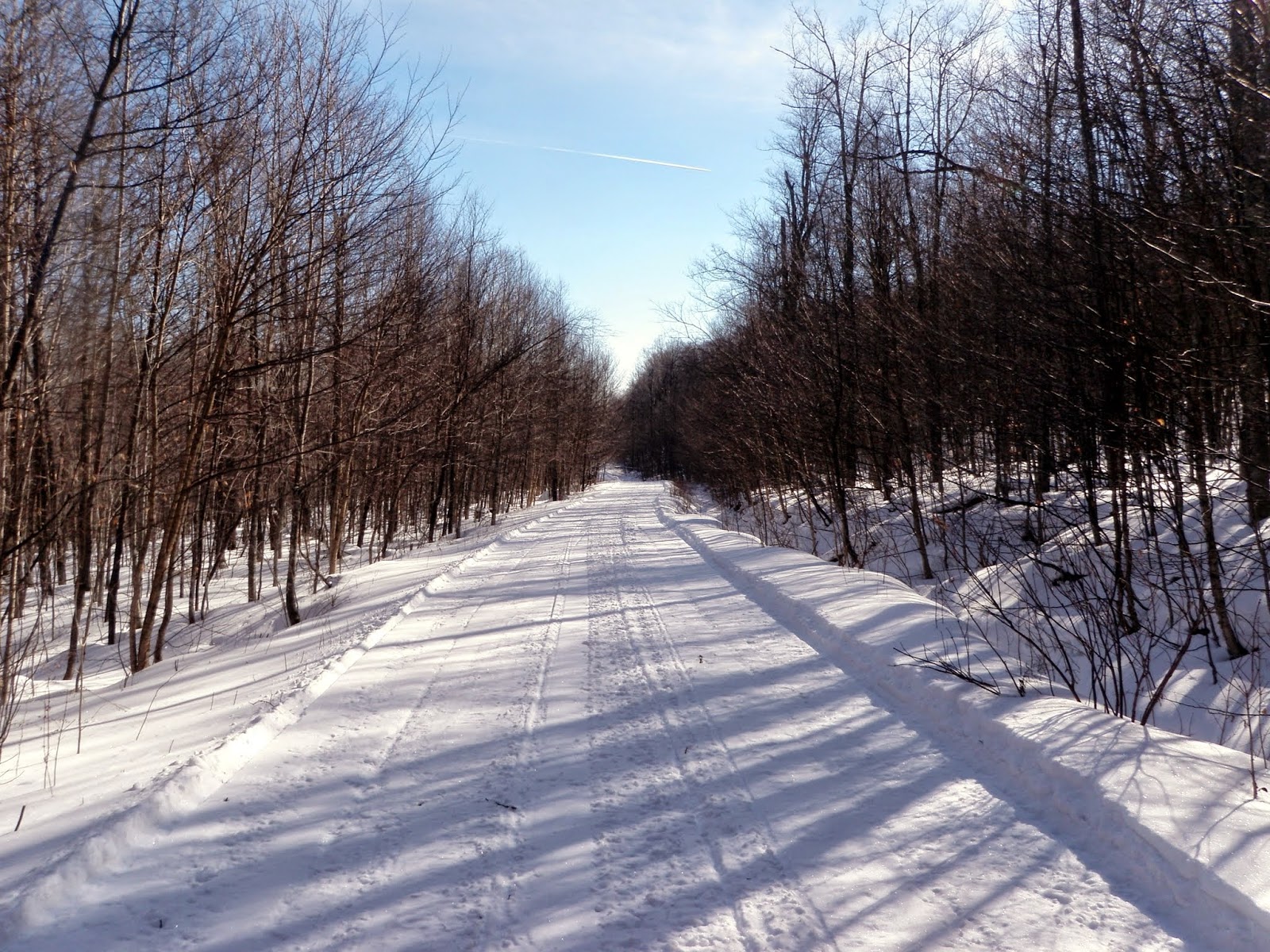
The beginning section of the snowmobile trail I started off hiking on. It was well groomed and wide which made for nice quick walking. There was very little snowmobile traffic today.


 Sometimes when you are hiking, you come across some really weird and/or interesting things. This is a doe hide that someone decided to hang alongside the snowmobile trail.


There was also this tire hanging from a tree in the middle of nowhere.


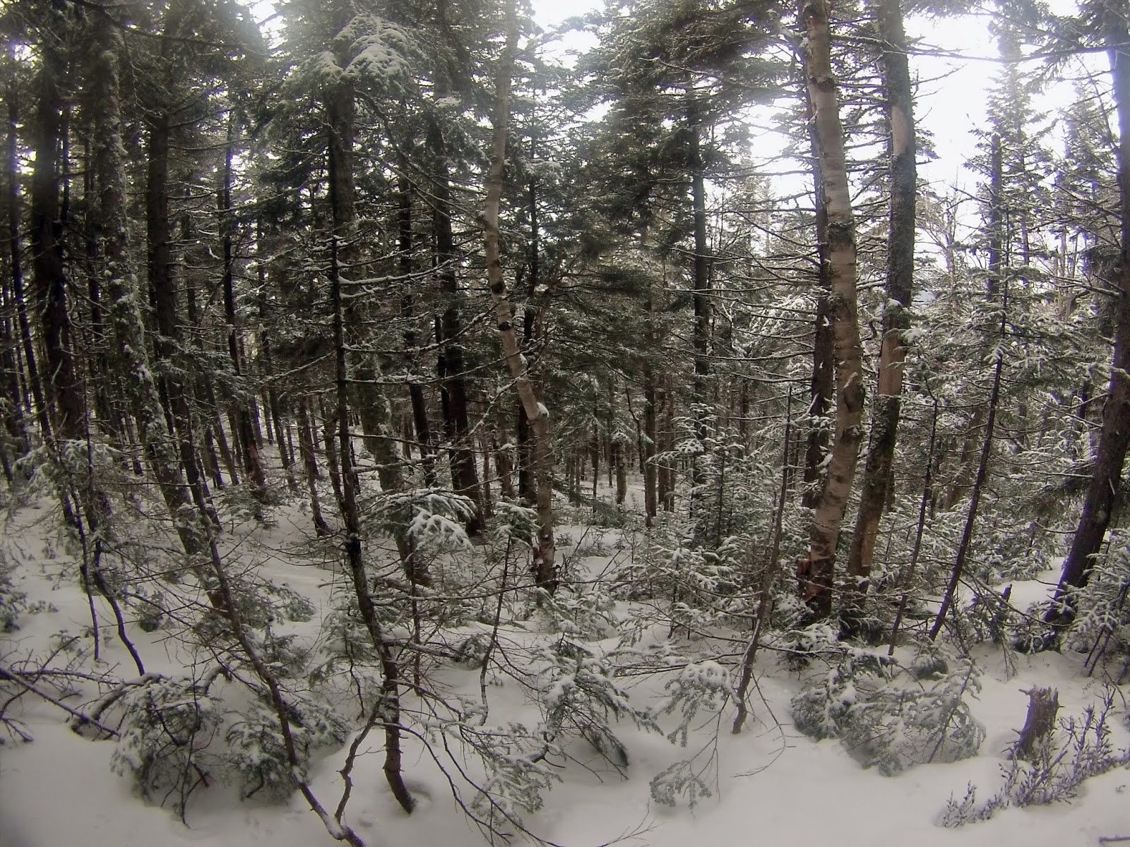
The woods were nice and open on my way up to Butterfield Mountain. I followed a mixture of old logging roads and old snowmobile tracks. The snow was never really deep and snowshoes were not used throughout the hike.


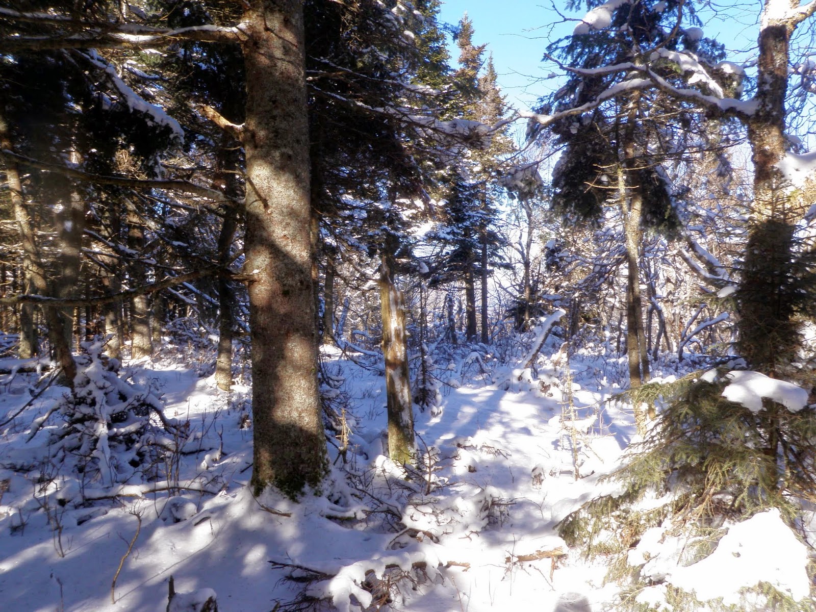
 The woods nearing the summit ridge of Butterfield Mountain. I could see into New Hampshire with clear skies and there was zero wind. This is definitely perfect winter hiking conditions.


The woods on the summit of Mount Butterfield (elevation: 3167 feet).  There was lots of recent moose activity here on the summit.


Me at the summit register for Butterfield Mountain.


 The woods were just as nice heading back down to the snowmobile trail and made for a quick descent. The snow was a bit deeper in spots here but still easy to travel in.


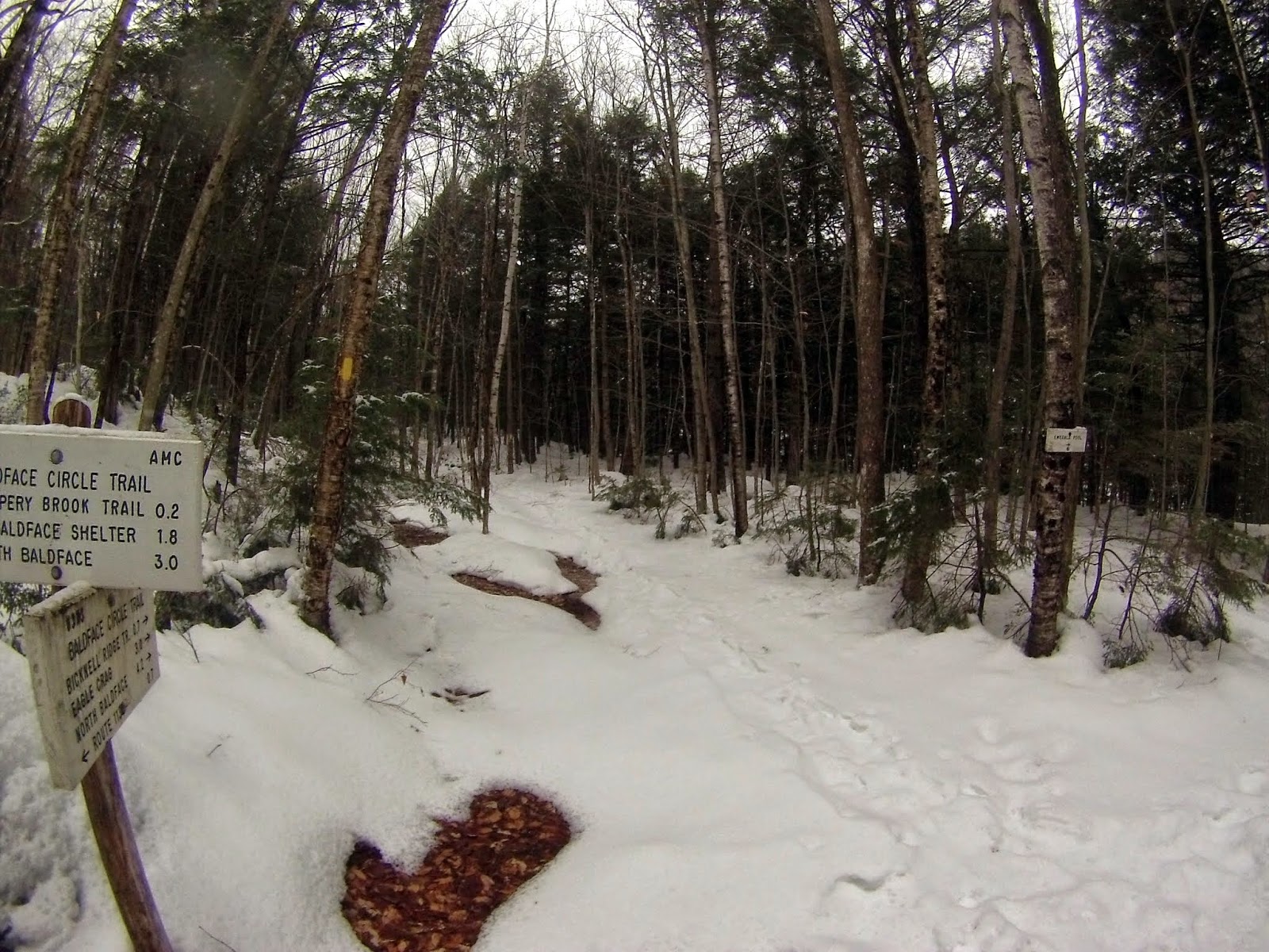
Once back on the snowmobile trail, I would take this for about half a mile for my approach up to Signal Mountain. I like the snowmobile signs here in Vermont.


The way up was steep and direct but the woods stayed wide open. This is the view looking back towards Butterfield Mountain.


Me at the summit register for Signal Mountain (elevation: 3352 feet).  It was not as open as Butterfield Mountain's summit but still just as easy to navigate.


I have been impressed with how nice the woods are in Vermont for doing bushwhacks. It only took me 20 minutes roughly to get back down to where I started my hike up.


Now, I am finally heading out. It was a quick 1.5 mile hike back to the car but it was nice and quiet. No snowmobile traffic to be seen all day.


Overall, this was a quick solo hike of about 8.5 miles through beautiful woods with nice weather to boot. Having the snowmobile trails to use to access these peaks made it that much easier. I will say that I really like hiking in Vermont and there will be more reports to come. Any day not working is a good day in the woods!

Sunday, January 26, 2014

Pemigewasset East Side Hike: 1/26/2014

Mileage: 8.9 miles
Elevation gain: 830 feet
Trails Used: East Side Trail, Pine Island Trail.

Highlight(s): none.


Brian was getting over a cold so instead of heading out for a solo hike, I had decided the day before to hike with Mike and do a bushwhack to Mount Hitchcock-North Peak (he wanted to do a recon mission). The day was going to be bitterly cold, like most of this winter has been so far, so we were going to have to be well prepared. Mike parked at the Lincoln Woods parking area, paid the fee this time, and we proceeded to get changed/ready in the restrooms there (it had a propane heater!). We headed out into the bitter cold for a fun hike.

We would be heading into the Pemigewassett Wilderness, which is part of the White Mountain National Forest and heavily logged in the late 19th and early 20th centuries.

(Wait, did I say I was hiking with Mike?   Queue dream sequence....................)


The day started like almost any other winter hiking day; really early and very cold.  The thermometer on the Ranger station says 0 degree's but with the windchill I would imagine it was about -15.


 The always pleasurable road hike along the East Branch of the Pemigewasset River. Notice the washed out section alongside the East Side Trail.


Into the woods we go as we begin the bushwhack towards Mount Hitchcock-North Peak. We come across an old logging road in really nice open woods.


  We aborted the bushwhack so back to the East Side Trail we go. There were XC ski tracks from a day or two ago, as it snowed last night. We decided to go as far as we could before "someone" got tired (Mike, it was Mike).


We came along this magic red box. It said "Food Only, No Trash" so Mike figured he could get a quick snack.....


.....luckily, I was there to save him after the box tried to devour him. Or maybe it was spitting him out. It does say "No Trash" on the side.


Walking along another washed out section of the East Side Trail.


Several pictures of the icy East Branch. We thought about crossing it several times but thought better of it. The ice was pretty thin in spots so definitely a smart idea not to cross.


We made it to the Cedar Brook crossing. This is as far as we would go today. The ice was deceptively thin in a lot of areas with no real easy way to cross.


The views looking towards Whaleback Mountain and Mount Flume from along the East Side Trail. It was almost clear but brutally cold.


The start of the Pine Island Trail which we would do on the way back to the car.


The area here was damaged by Hurricane Irene in 2011. The trail was relocated in spots.


Another washed out section along the Pine Island Trail.


Although it was an easy hike, there was really not much variation in this particular section of the Pine Island Trail.


After awhile, and with tired legs, this is where Mike decided he could not go on. I decided I would have to go back for him in the spring.


The last picture of the East Branch from the suspension bridge near Lincoln Woods looking towards the Kancamagus Highway.  


This is when i woke up and realized it all had to be a dream.  Or was it.....

Not a bad day overall. Yes it was cold and while we did not manage to do what we had planned, I did get to hike with Mike, which is extremely rare in winter, and also added some mileage to the totals for the month/year.  At this time of the year, thats always a plus.

Sunday, January 19, 2014

Mount Kancamagus: 1/19/2014

Mileage: 6.60 miles
Elevation gain: 1960 feet
Trails used: Livermore Trail, bushwhack.

Highlight(s): open woods bushwhack, canister on the summit of Mount Kancamagus.


Kris asked me if I wanted to join him for a hike, a day after Brian and I did the hike for South Baldface and Sable Mountain, so I said yes without hesitation. Kris wanted something with not too much distance and decent elevation so since he needed Mount Kancamagus, that was what we agreed upon. Driving north in light snow only hinted at what the days weather would be like. Snow squalls and low visibility would be the norm for today. 

Mount Kancamagus is located in Livermore, New Hampshire. It is part of the Sandwich Range, which extends from Mount Chocorua to Sandwich Mountain. There are no trails that go to the wooded,view-less summit of Mount Kancamagus so it requires a bushwhack to reach its high point.


Mount Kancamagus is on the New Hampshire One Hundred Highest List, the New Hampshire Two Hundred Highest List, and the New Hampshire 3K List.


The Livermore Trailhead now starts at this logging road/landing off of the Kancamagus Highway and reconnects with the Livermore Trail. It was snowing very lightly up to this point.


There was a faint snowshoe track left over from the previous days hikers but a majority of the day was spent snowshoeing through fresh powder.


 Kris up ahead breaking trail, which I let him do gladly. I was still sore from the previous days hike/bushwhack to South Baldface and Sable Mountain.


 This part of the Livermore Trail is fairly steep and requires a bit of side hilling, which is hard to do in snowshoes. It also goes right through a drainage into Livermore Pass.


 We started the bushwhack right around the high point of Livermore Pass. The snow came down a bit more as we headed to the summit of Mount Kancamagus.


 Nice open woods for a majority of the hike up the ridge to the summit and plenty of snow.


 On the plateau heading to the summit of Mount Kancamagus (elevation: 3763 feet). On the summit itself, there are no views to be had except for all the snow laden trees.


The summit canister for Mount Kancamagus.


The logging road on the hike out. The snow was coming down harder at this point so we were definitely glad to be back at the car so we could get warm.


The day overall was fun, except for the hike down from the summit.  I managed to drift a bit off our tracks we took going up and ended up in a nice snowy fir blow-down area. After that, we ended up in an open glades-like gully/drainage that brought us back down to the trail. I managed to find another moose antler coming off the summit which brings the total of moose shed's found this year so far to 5.

While the snow is a pain to hike/bushwhack in, it was fun hiking with Kris and he managed to get an easy bushwhack peak done so all is good. The winter will end and then the easier hiking will begin.

Saturday, January 18, 2014

South Baldface * Sable Mountain: 1/18/2014

Mileage: 11.05 miles
Elevation gain: 4115 feet
Trails used: Baldface Circle Trail, Slippery Brook Trail, bushwhack.
Highlights(s): 360 views from the summit of South Baldface, open woods bushwhack to Sable Mountain, register on the summit of Sable Mountain.


With snow predicted early this day, Brian and I decided to return to a couple of peaks near the Baldface Mountains: Sable Mountain and Chandler Mountain(which can only be reached by bushwhacking). From the start of the hike, the snow failed to begin when predicted (and indeed would not start until 3:30) and the potential for long range views still remained high. We figured this would be a tough hike overall, not really knowing how snow conditions would be for both of these peaks.

Intending to take the Slippery Brook trail to the junction with Eastman, the plan was to begin the bushwhack over to the two target peaks. When you are having too much fun you get careless, and we missed the junction early on. Now, half way up to South Baldface we decided “hey, why not” and decided to do South Baldface as we would get some views and then whack over to Sable Mountain and maybe Chandler Mountain from there. We didn't realize what an adventure that would ensue for the day.

South Baldface is located in Chatham, New Hampshire and Sable Mountain is located southwest of both North Baldface and South Baldface.  The Baldfaces are a popular hike in the summer with views galore for pretty much the duration of the hike. Sable Mountain is a wooded summit but views can be had along the way and slight views from the summit. There are no trails that go to the wooded,view-less summit of Sable Mountain (a trail once ran over the summit of Sable Mountain and Chandler Mountain; you can find cairns and traces of the old trail still) so it requires a bushwhack to reach its high point.


South Baldface and Sable Mountain are on the New Hampshire One Hundred Highest List, the New Hampshire Two Hundred Highest List, and the New Hampshire 3K List.


Brian starting the day/hike at the Baldface Circle Trailhead by putting on his microspikes.


The Baldface Circle Trail starts off through some nice open hardwoods with a decent snowshoe track laid down.


There is very little elevation gain on this section of the Baldface Circle Trail.


We make it to the first junction where the Baldface Circle Trail splits and where we would take the Slippery Brook Trail up. We could see recent traffic on both routes.


Early on, were just cruising along. There are several water crossings along the way, but most were not frozen over like this one.


We did get some views of the nice open woods with the sun poking through early on. It wouldn't last, though. It was around here that we realized we took the wrong trail up and were headed for South Baldface.


We are starting to approach the Baldface shelter. You can see the ledges going up to South Baldface through the trees.


The Baldface shelter which is just below the ledges of South Baldface. The cabin can sleep 6 to 8 people and has a fire ring and composting toilet.


We are starting the climb up the ledges from the Baldface shelter towards the summit of South Baldface. This was probably the easiest stretch heading up.


The ledges would prove the most taxing (and hair raising!) part of the day as the January thaw and the coating of light snow over it made for slippery and very icy condition's. It took us about an hour to maneuver our way up towards the summit of South Baldface.


Not only is it very icy, it is also very steep. This is definitely not recommended for ascending without some sort of traction device (Microspikes, crampons, etc). Descending in these kind of conditions would be out of the question on a day like today.


Brian coming up the Baldface Circle Trail behind me. The views started coming out, with views into Maine of the Royce Mountains and the Caribou-Speckled Mountain region.


Almost to the top of the South Baldface ledges but out of the hardest part of the climb.


Looking up as we are nearing the summit of South Baldface.


The views from South Baldface of Baldface Knob with Eastman Mountain just behind it, and Kearsarge North in the background.


The views northwest looking towards North Baldface with the Carter-Moriah Range, Carter Dome and the Presidential Range from the summit of South Baldface.


The views looking towards Sable Mountain and Chandler Mountain from the summit of South Baldface.


The views looking into Maine from the summit of South Baldface.


The summit of South Baldface (elevation: 3570 feet) looks like a barren moonscape right now.


We headed for North Baldface but decided conditions were too good to pass up so we decided to head over to Sable Mountain. We started the bushwhack almost in the col between North Baldface and South Baldface. Here, we found the dream woods of every whacker, nice and open. Sometimes it doesn't get any better than this.


Yes, even while doing a bushwhack you can get views. Here I am looking back towards South Baldface and from where we started the hike.


I think this is as thick as the woods would get all day, minus a few brief feet of trees on the ridge heading up to Sable Mountain.


Even more open woods on the bushwhack to Sable Mountain. This entire area is a moose paradise with birch glades galore.


The summit canister on Sable Mountain (elevation: 3519 feet). This old antler has been on this summit for about 2 years as I have personally been here 4 times in those 2 years. We found a total of around 5 antlers, but only 3 keepers.


The bushwhack back over to the Slippery Brook Trail was also through open, nice woods.


We are back on the Slippery Brook Trail finally. We still had about a 3 mile hike out and back to the car with about 20 pounds of moose antlers on our backs.


Once back on the Baldface Circle Trail, its an easy almost flat hike back to the trail head.


Once back to trails we moved along on tender legs, with each of us carrying an extra 15 or 20 pounds in antler weight. The snow started falling about 3:30, but thankfully we were now near the end of this very long day. Alas the drive was not going to be quick. By the time we started the drive home the roads had started to get very sloppy, and a normally long drive took longer. But it was a small price to pay for a gorgeous day out in the woods.  Add to the fact that we brought home some nice moose antler's and got in some good miles, we can't really complain overall.