Elevation gain: 765'
Trails used: Summit Trail, Echo Canyon Trail, Turkey Pass Trail, Loop Trail.
This would be the first of three hikes I would do while visiting family in Texas. We convinced my mom to come with us for this one. Also joining me would be my brother Tim, his wife Melinda and her sister, Rita. The weather was not looking too good for today's hike and when we left San Antonio, it was very cool and breezy. It wasn't until we were driving north that it started raining for a good distance.
Enchanted Rock State Natural Area is located in the Llano Uplift, a geologic dome of Precambrian rock and home to some of the oldest rock formations and unique minerals in the "central mineral region". It is also located in Llano and Gillespie County, Texas and is a pink granite monadnock and a batholith. Enchanted Rock is one of the largest rock formations in the Llano Uplift.
We had to pay at the Visitor Center to hike, and then moved to the hiker parking area. The rain was pretty much gone at this point but it was very windy. For good information on the Enchanted Rock State Natural Area, go to here or the Texas State Park website.
Cactus that was right outside of the car as we parked at the visitor center to go pay.

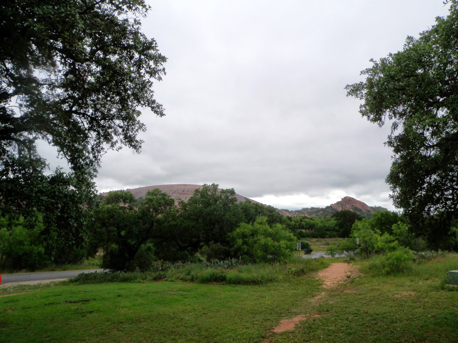
The view of Enchanted Rock and Freshman Mountain from the parking area.
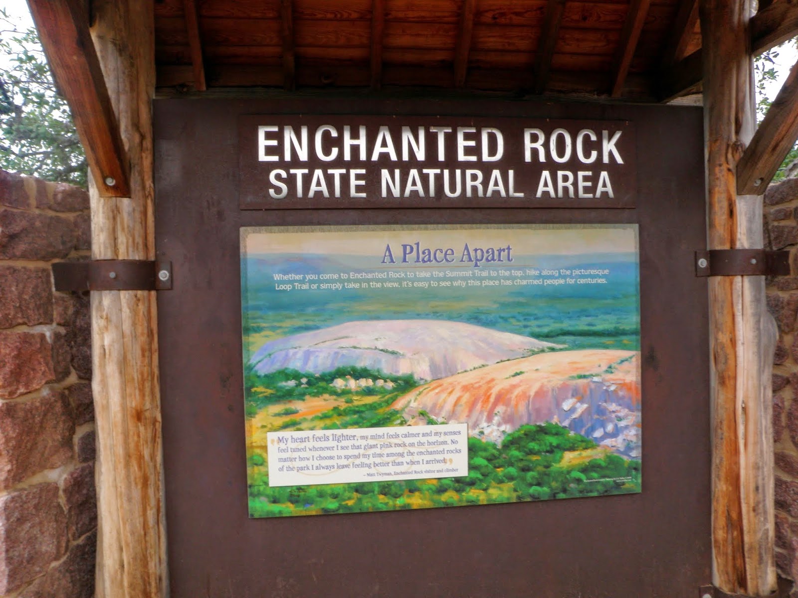
The main trailhead sign for the Enchanted Rock State Natural Area.
Rita heading out as Enchanted Rock looms nearby.

Parts of the sheer granite rock we would have to climb to reach the summit of Enchanted Rock.

Sandy Creek, which is one of the few water crossings in Enchanted Rock State Natural Area.

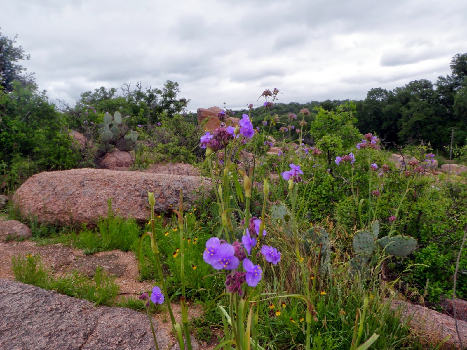
The flowers were blooming nicely from all the rain the area had gotten recently. Texas had more rain in April than New Hampshire did surprisingly.
The Enchanted Rock Summit Trail is easy to follow and well maintained as evidenced by these impressive rock steps.

Nearby Turkey Peak which is a popular rock climbing spot despite its small height.

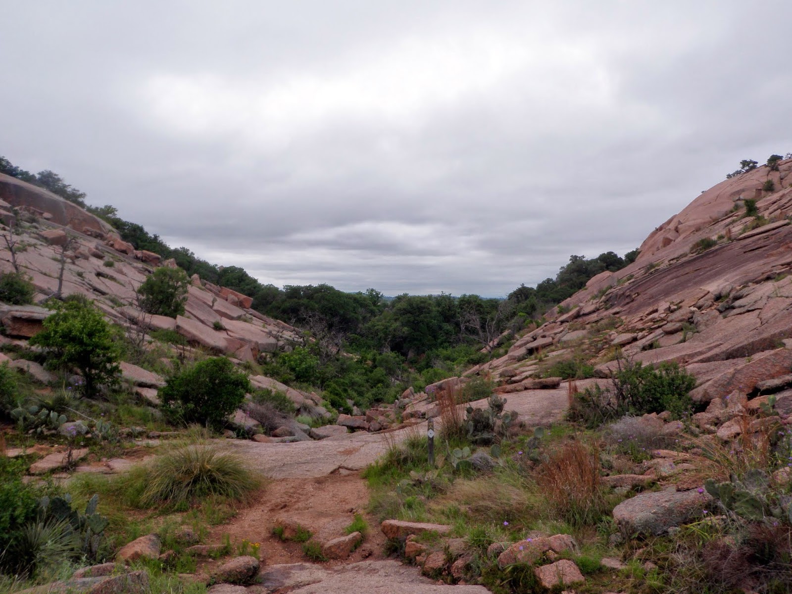
The junction for the Enchanted Rock Summit Trail and Echo Canyon Trail. From here up, it was a walk on smooth granite so there were areas where the granite was wet from a few rain showers that went through the area earlier before we arrived.

Heading up the slick pink granite towards the summit area of Enchanted Rock. It had rained several hours prior, hence the water coming down.

A view from the summit of Enchanted Rock (elevation 1825').

Nearby views looking north to Dutch Mountain, Watch Mountain and Bullhead Mountain from the summit area of Enchanted Rock.

Zoomed in of Dutch Mountain, Watch Mountain and Bullhead Mountain from the summit area of Enchanted Rock.

Looking southwest to a minor summit of Enchanted Rock. It has the same features and looked like a miniature version of Enchanted Rock.

Nearby Freshman Mountain to the northeast of Enchanted Rock.

Got this neat little view in between the rocks as we were coming down off the summit of Enchanted Rock and heading to the Echo Canyon Trail.

At the junction for the Enchanted Rock Summit Trail and Echo Canyon Trail. Even with all the rain lately, it was relatively dry in the canyon.

The ground trying to swallow Melinda whole. Actually she fit almost perfectly in this little hole, although it looks like she is using the restroom.

More wildflowers in bloom. I think these are white dipladenia.

The vast difference in the vegetation between the summit and in the canyons was amazing.

Various birds made an appearance, like this cardinal.

A look down into Echo Canyon. The Echo Canyon Trail is easy to follow with white rectangles at various points. Colored blazes led to rock climbing routes.
Have fun spotting what is in this picture. I think it might be a black squirrel but it was hard to figure out what it might be.

Of course all the green vegetation was where the water was in Echo Canyon. The Echo Canyon Trail works its way through this strand of tree's.

There be water in the center of Echo Canyon. There was also a few caves as well as these large boulders in the area.

After a short privy break, we continued on the Echo Canyon Trail as it makes a northeastern trek around Enchanted Rock.

The pink granite on the north side of Enchanted Rock, where people can do some rock climbing in this area.


My mom getting ready to head down the Turkey Pass Trail.

The expanded view of the Turkey Pass Trail, which was easier to hike through than the Echo Canyon Trail as it was less of a rock hop and more of a hike.

Turkey vultures rule this side of the canyon. I think this is a male trying to entice the female.


Freshman Mountain looming close to the Turkey Pass Trail. I skipped hiking up to this little peak even though there were several "trails" that led to the summit.

Overlooking the Turkey Pass area from the Turkey Pass Trail.

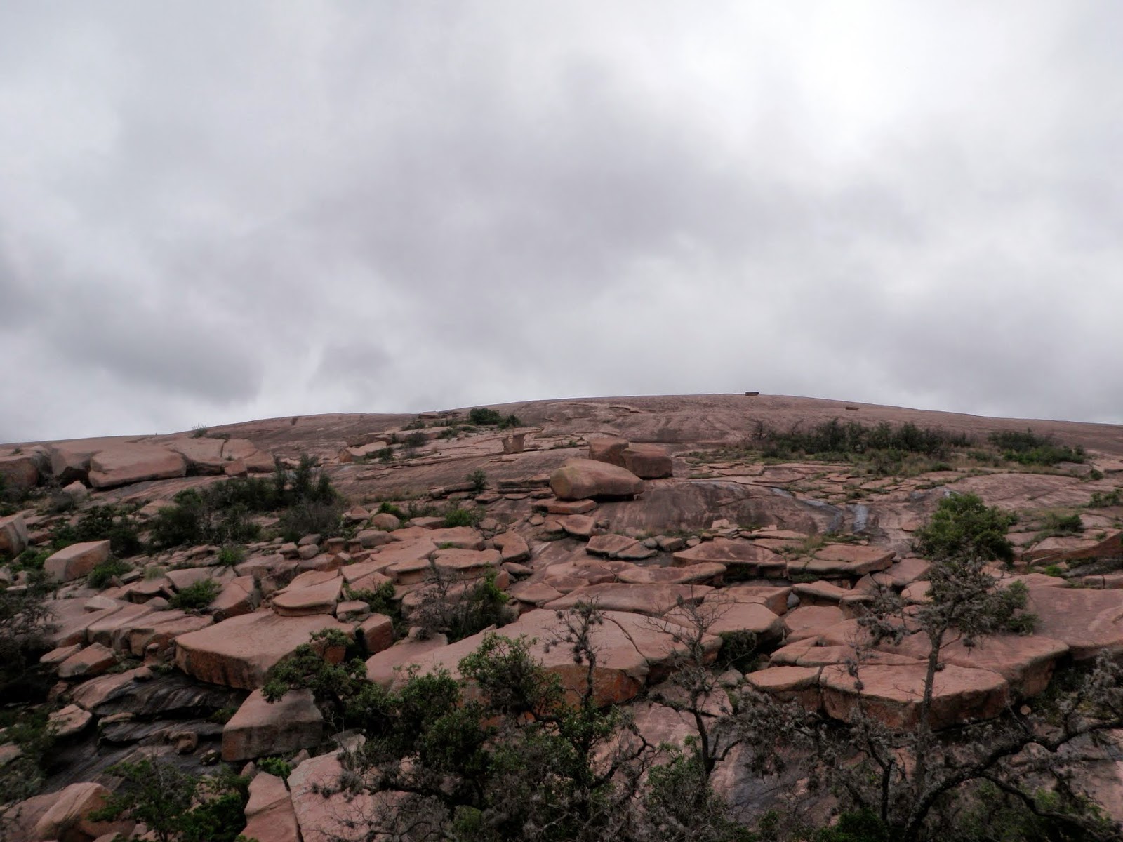
One final steep look up the pink granite dome of Enchanted Rock.
Frog Pond, which is near the junction of the Turkey Pass Trail and Loop Trail. It was one of the few spots we saw that had water.

A close view of Turkey Peak as we are almost finished with the hike.

A nice healthy spot of Firewheel's growing along side some cactus.

A zoomed out view of the Firewheel patch and Enchanted Rock.

Not exactly sure what these are but they looked almost like pepper's of some sort but I don't think that's what they are.

Everyone pretty much survived the hike, minus Melinda who managed to fall over and smack her face and left a pretty good black and blue mark. As a bonus to the day, I found thirty dollars near the rest rooms and waited for a few to see if anyone claimed it. When no one did, well....lunch was on me! We would drive back through Fredricksburg to go to a nice little German restaurant.
This was a nice refreshing hike and it felt better given that it was nice and windy and probably in the high 60's, which is nice hiking weather to me. The views were nice from the summit of Enchanted Rock and the surrounding area. The hikes through the canyons were like a walk through time with varied terrain and vegetation.
They do close this area off during times of high volume and when weather is bad so check online or call ahead to save yourself any trouble.
No comments:
Post a Comment