After doing some quick information gathering online, I decided I was going to work on some town high points and string together a few peaks together to see how many I could get done in one day. Another list to work on........
Wilkins Point/Storey Hill
Mileage: 1.50
Elevation gain: 220'
Trails used: none. roadwalk, bushwhack.
Leaving the house at about 745 am, I drove from the house and made my way over to New Boston, New Hampshire. The hardest part about doing these peaks today would be the driving, for one, and trying to figure out which roads to take to access the highpoints.
Wilkins Point is located in Mont Vernon, New Hampshire and is the high point for Mont Vernon. Storey Hill is located a few feet across from Wilkins Point in New Boston, New Hampshire. There is a trail (Morrissette Trail) that goes from the low point in Mont Vernon to Wilkins Point. A quick online search should get you information. The summit of Storey Hill requires a short bushwhack from Wilkins Point.
Wilkins Point is located in Mont Vernon, New Hampshire and is the high point for Mont Vernon. Storey Hill is located a few feet across from Wilkins Point in New Boston, New Hampshire. There is a trail (Morrissette Trail) that goes from the low point in Mont Vernon to Wilkins Point. A quick online search should get you information. The summit of Storey Hill requires a short bushwhack from Wilkins Point.
I parked at this snow bank on South Hill Road/Taylor Hill Road, which is a class 6 road. Someone with a high clearance vehicle could potentially get further up the road, in better conditions of course.

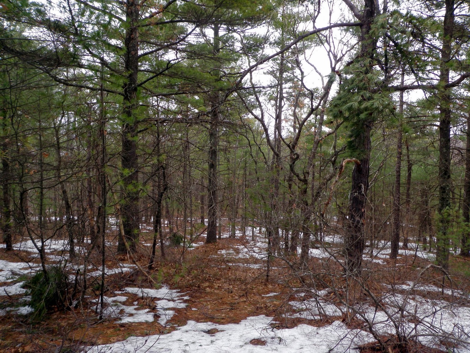
The area in which I was hiking is a heavily forested area, most likely within the last few years. You do get some views of the Wapack Range through the tree's, regardless.

Wilkins Point (elevation 1015'), which is the Mont Vernon high point. I did not find the trail that supposedly leads you to this spot.

I continued over the rock wall and made the short bushwhack over to the high point for Storey Hill (elevation 1025') in New Boston which is marked by this small cairn.

Passing a large sized logging landing on the way back to the car.

A quick round trip back to the car. Snow along the road walk was spotty; in the woods, it was about 1-1.5 feet deep. Looking at my list, it was off to my second hike of the day on another lengthy drive.
Rocky Hill
Mileage: 2.20
Elevation gain: 250'
Trails used: Main Jeep Trail, Bear Cub Run Trail, Dead Wood Knoll Trail, bushwhack.
I would be going in blind on this hike as I was not familiar with the area at all. I did see a truck parked at a kiosk so I decided to investigate to see if I was possibly in the right spot. Turns out, I was so off I went.
Rocky Hill is located in Litchfield, New Hampshire and is also the high point for Litchfield. I could not find much information on this state park but I did manage to find a rough Google map for the trail system in the area.


Another quick round trip hike although it could get confusing following some of the trails and/or herd paths that are around here. The woods were wide open and there was signs of deer, moose and grouse or turkey in the area so a good hunting area. I would imagine you would need to wear hunter orange in season.
My next hike on the agenda would be somewhat closer to this hike and a bit easier to figure out how to approach making it to the summit.
I would be going in blind on this hike as I was not familiar with the area at all. I did see a truck parked at a kiosk so I decided to investigate to see if I was possibly in the right spot. Turns out, I was so off I went.
Rocky Hill is located in Litchfield, New Hampshire and is also the high point for Litchfield. I could not find much information on this state park but I did manage to find a rough Google map for the trail system in the area.
The parking area off of Hillcrest Avenue for Litchfield State Forest. There is a really rough map of the trails in the area and no descriptions at all, so be careful if you hike here.
A zoomed out view of the boulders at the start of the Main Jeep Trail.
The Main Jeep Trail heading in. I managed to not need any traction as the snow was very spotty in sections and not deep at all.
I decided to take the Bear Cub Run Trail which makes it way to a snowmobile trail and then up to the summit area for Rocky Hill.
A fenced in water tower resides near the summit of Rocky Hill. This is a secondary summit area but you can't get close to the tower.
The slightly higher summit area for Rocky Hill (elevation 357'). Unfortunately, it is a wooded summit so there are no views.
I decided to follow a green blazed trail which I am convinced is a hunters trail, but is an actual trail (very herd pathy). I came across this chair which overlooks a nice deer area, as evidenced by the amount of deer tracks and scat.
Another quick round trip hike although it could get confusing following some of the trails and/or herd paths that are around here. The woods were wide open and there was signs of deer, moose and grouse or turkey in the area so a good hunting area. I would imagine you would need to wear hunter orange in season.
My next hike on the agenda would be somewhat closer to this hike and a bit easier to figure out how to approach making it to the summit.
Mount Misery
Mileage: 1.40
Elevation gain: 305'
Trails used: none. bushwhack.
Mount Misery is located in Auburn, New Hampshire and is one of three peaks (Mount Miner and Mine Hill, being the other two peaks) that lay claim to the high point for Auburn. There are no official trails that run to this viewless summit so a short bushwhack is required. There is an old woods road but I am not sure where it starts and where it ends.
I parked on the side of Bypass 28 at a gravel pullout and headed into the woods, which were wide open and easy to navigate through. Like Rocky Hill, there were lots of herd paths and recent signs of deer moving about.

Probably about 500 feet in, I came across this ATV/snowmobile trail but I only used it for a short bit as it runs along someone's property and I didn't want to risk running into Private Property issues, which there were none at this point.

Views of the Uncanoonuc's and Joe English Hill from the ATV/snowmobile trail.

Several spots vied for the high point of Mount Misery and there are no official markings to say where it is so just hike around the open summit area and call it good.

What I believe is the high point for Mount Misery (elevation 580').

Reversing my route, I headed back to the car after a really quick hike from my car to the summit and back. It's always funny to come popping out of the woods and people drive by and are probably saying "what the hell?". The next hike would be really close by and the third of the three peaks in the area with claims to be the highest point in Auburn.
Mount Miner
Mileage: 1.15
Elevation gain: 200'
Trails used: ATV/unnamed trail.
Mount Miner is located in Auburn, New Hampshire and at 582 feet, lays claim on some maps, as the highest point in Auburn although there is no real way currently to judge that. I could not find much information online about the history of this peak, as by the looks of the quarry like area and fenced in summit there should be something somewhere.
There is an ATV path as well as foot path that leads to the view-less high point of Mount Miner, but I did not poke around the area to see if I could find any views.
There is an ATV path as well as foot path that leads to the view-less high point of Mount Miner, but I did not poke around the area to see if I could find any views.
I parked at the end of Dartmouth Road and headed up this dirt road, and came across a recently used ATV path into the woods.

I bypassed the trail and went straight to a bushwhack to the main summit of Mount Miner through very open woods. There were very recent signs of moose and deer here.
The actual high point for Mount Miner (elevation 582') is at the two pines straight ahead.

The locals make this their party area as evidenced by the fire pit and miscellaneous debris and trash strewn about up here.

Going back down, I found the foot path people use and took it to its junction with a very recently used ATV trail.

I am guessing this is how the ATV'ers get in. They peeled back the fence to make it big enough for the ATVs to make it through.

Old support's for some sort of structure that was on some ledges near where I went into the woods to reach Mount Miner's summit.

Looking across Massabesic Lake and Mine Hill from some ledges below Mine Hill's summit.

You can just barely make out the Uncanoonucs from the ledges.

There was a car next to me when I returned but not sure where the person(s) who were in it were as I did not see a single person on any of my hikes today. Since it was still relatively early in the day, I decided to try another quick peak after I made a quick stop in Hooksett.
Quimby Mountain
Mileage: 0.5
Elevation gain: 125'
Trails used: none. bushwhack.
There was not much information online for my last hike of the day but it would turn out to be the shortest, if not, easiest hike of the day. The hardest part was finding a place to park and access this peak.
Quimby Mountain is located in Hooksett, New Hampshire and is also the highpoint in Hooksett. There are decent views from this bald summit but it does require a short bushwhack up a steep cliff to reach the summit.
I parked at the end of Quimby Mountain Road, and was careful to avoid some No Trespassing and Private Property signs and headed down this dirt road.

I had to bushwhack up this cliff to reach the summit of Quimby Mountain.

The bald summit area for Quimby Mountain (elevation 902') and its views towards the Uncanoonuc's and Joe English Hill.

A nice day overall. No weather to worry about and I never put my backpack on for any of these five hikes. That's how quick and easy they were. I scouted out 3 more peaks and could have done two more but just decided to call it a day and head home. Still, any day in the woods is better than a day at work.
No comments:
Post a Comment