Owlshead Mountain
Mileage: 2.05
Elevation gain: 485 feet
Trails used: road walk, Owls Head Trail.
Highlight(s): short easy hike, fire tower on the summit, views from fire tower and ledges below the fire tower, Groton State Forest.
I tried finding this hike several years ago but with no map at the time, and spotty online information, I never did manage to hike this peak. This time around, I mentioned it to Brian that we could do a short hike before Elmore Mountain (another fire tower peak that he wanted to do) so we made the "short" detour and made this our first hike.
Owls Head Mountain is located in Groton, Vermont and also in the Groton State Forest. Groton State Forest is the second largest tract of land owned by the state of Vermont and has numerous hiking trails, horseback riding, and camping in designated areas. The stone tower and ledges on the summit of Owls Head Mountain offer nice views to nearby peaks and lakes around the Groton State Forest area.
Groton State Park Trails
State Parks in Groton State Forest
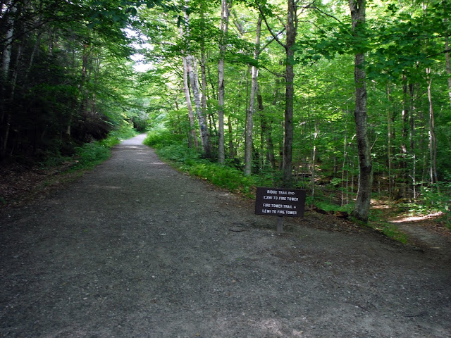
We parked just off the road outside of the gate off of VT 232. In the off-seasons the gate is closed, so it requires a road walk to reach the actual Owls Head Trail.
When the gate is open (at 10 a.m.), you can park at the Owls Head picnic area and then do the short hike up to the summit of Owls Head Mountain.
Brian at the fire tower on the summit of Owls Head Mountain (elevation: 1952 feet).
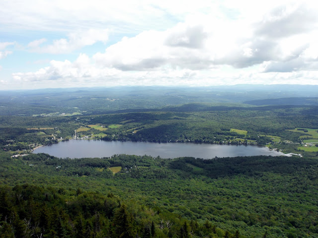
A nice undercast from the ledges on Owls Head Mountain looking towards Little Spruce Mountain and Signal Mountain.
Kettle Pond with an undercast in between Hardwood Mountain (left) and Kettle Mountain (right) with Camels Hump and Ethan Allen Mountain from the ledges on Owls Head Mountain.
Another overcast view looking towards Spruce Mountain from the ledges on the summit of Owls Head Mountain.
The octagonal stone fire tower on the summit of Owls Head Mountain that was constructed by the Civilian Conservation Corps (CCC) in the 1930's.
As seen in the picture above, this sign board gives you a little history on the views from the summit ledges on Owls Head Mountain.
The interior of the stone fire tower on the summit of Owls Head Mountain.
The Owls Head Trail was short and steep in a few spots but well built and easy to follow.
We headed back down the trail and made it back to the picnic area to find out that one of the Groton State Park staff was cleaning the area and had left the gate open. If only we had waited 15 minutes to head up to the summit, we could have parked closer and had less of a road walk. We still made quick work of the hike and road walk so it wasn't too bad. In winter, you would have to do the road walk anyways. Next up on the hike list: Elmore Mountain and its fire tower.
Elmore Mountain
Mileage: 3.30
Elevation gain: 1265 feet
Trails used: road walk, Fire Tower Trail.
Highlight(s): nice trail, fire tower on the summit of Elmore Mountain, views from fire tower and from ledges on site of old fire wardens cabin.
This is the hike that enticed Brian into joining me for today's hikes in Vermont. With the nice weather and nice trailed hiking, we should get awesome views from the fire tower on Elmore Montain and we were not to be disappointed today. The drive over was fairly straight forward and it was through nice Vermont farm country so it was another bonus.
Elmore Mountain is located in Lake Elmore, Vermont and also in Elmore State Park and is the northern most peak in the Worcester Mountain range. There is camping available as well as water activities in Elmore State Park, so it would be nice to take a swim after a nice hike up to the fire tower. There are several trails that go up to the fire tower on the summit of Elmore Mountain, where you can get 360 degree views. Views are also possible from the site of the old fire wardens cabin.
The hiker parking area for Elmore Mountain. You start the hike by walking around the gated road to reach the actual trail(s) to get to Elmore Mountain.
One of several old stone fireplaces in the area around Elmore Mountain.
There are two choices for hiking trails on this side that go to the summit of Elmore Mountain: the short Fire Tower Trail (which we took) and the longer Ridge Trail that goes to Balanced Rock and makes a loop.
The blue blazed Fire Tower Trail down low was a well trodden path and easy to follow. It was muddy in a few sections but there are enough rock steps to make your way across.
There are some interesting rock formations as you begin the climb up to the summit of Elmore Mountain along the Fire Tower Trail.
Brian on the last steep stretch up to the summit of Elmore Mountain. There was a wooden ladder and the rock were wet from the rain the day before so be careful here.
The fire tower on the summit of Elmore Mountain (elevation: 2608 feet).
The views southwest of the Worcester Range which consists of Mount Worcester, Mount Putnam, Mount Hunger, Stowe Pinnacle and White Rocks Mountain. Barely visible to the left of Mount Worcester is Killington Peak.
Looking towards Lake Elmore from the fire tower on Elmore Mountain.
Looking west from the fire tower on Elmore Mountain to the Mount Mansfield area, almost dead center. To the right is the Spruce Peak, Madonna Peak, Morse Mountain and Sterling Mountains, and the left is Bolton Mountain, Mount Mayo, Mount Clark and Dewey Mountain.
Looking north from the fire tower on Elmore Mountain towards Belvidere Mountain, Haystack Mountain, and the Jay Peak area. To the left is the Cold Hollow Mountains.
The old fire wardens cabin area where the fireplace and foundation are all that remains. You can see the Elmore Mountain fire tower just above the tree's. Decent views from here also of Lake Elmore and into New Hampshire.
In several spots along the Fire Tower Trail, you get glimpses of these nice open woods that Vermont is known for.
Another old stone fireplace next to the parking area for Elmore Mountain.
We reversed course and headed back the way we came. We thought about taking the Ridge Trail down and around (and to Balancing Rock) but it was another 2 miles back to the car so we opted for the direct route we took up. We passed lots of people on the way down who were headed to the fire tower for the views so this is a popular peak in summer. It also looks like it would be a nice snowshoe trek in winter.
Elmore State Park
Google view Elmore Fire Tower Trail
Elmore State Park Map
Spruce Peak - Madonna Peak
Mileage: 7.0
Elevation gain: 2560 feet
Trails used: Sterling Pond Trail, Long Trail, various ski trails.
Highlight(s): high elevation trout pond, views from ski peak areas, Long Trail.
One more hike and I debated doing another trailed hike or bushwhack giving that we would be starting either one at around noon time, so I went with the trailed hike thinking that being on trail we could make better time than hiking around in the woods. It probably wouldn't have mattered either way really as by the time we found parking and began the hike, it was getting late but we pressed on.
Spruce Peak is located in Stowe, Vermont and a part of the Mount Mansfield State Forest. Madonna Peak is located in Morristown, Vermont and also a part of the Mount Mansfield State Forest. Spruce Peak and Madonna Peak are along the Long Trail, and the hike up to Sterling Pond is a popular one. I have provided a map of the hiking areas around Madonna Peak, and also a map of the trails in the Smugglers Notch area.
Spruce Peak and Madonna Peak are on the Vermont 100 Highest List, the Vermont 200 Highest List and the Vermont 3k List.
We parked the car along Smugglers Notch, which is quite popular with rock climbers. Here is a nice section looking towards the Mount Mansfield area.
We decided to take the Sterling Pond Trail, which rises steeply up from Smugglers Notch towards Sterling Pond.
Once we got to the junction of the Long Trail and Sterling Pond Trail, we headed south towards Spruce Peak and took a few ski trails and a short spur path to reach the summit.
The views from the actual summit of Spruce Peak (elevation: 3320 feet) looking towards the Stowe Mountain Ski Area and one of Mount Mansfield's features, "The Nose" which has several communications towers on it. Also, there were views north towards Bolton Mountain and Camels Hump.
The views of two of Mount Mansfield's prominent features: The Nose and The Chin, which is Vermont's highest point, from the summit of Spruce Peak.
Looking to the southeast from the ski area on Spruce Peak towards the Worcester Mountain Range, where Elmore Mountain is located.
The views of nearby Madonna Peak from some ski trails on Spruce Peak.
Looking along the ski lift line on Spruce Peak looking into southern Vermont.
Back at the junction for the Long Trail and Sterling Pond Trail, we headed towards Sterling Pond and then we would hike over to Madonna Peak.
Sterling Pond which sits at about 3000 feet. It is stocked with trout so we saw several people fishing as we did the hike around along the Long Trail. The string is to keep people off of the fragile vegetation around the pond.
As the Long Trail heads north from Sterling Pond, you climb this steep section on some neat looking wooden steps.
The Long Trail is easy to follow as it makes its way from Sterling Pond over to Madonna Peak but it was very muddy in quite a few sections.
The final steep stretch towards the summit of Madonna Peak along the Long Trail.
Looking back the way we came towards a minor sub bump along the Long Trail, with Stowe Mountains ski trails to the left.
Looking towards Sterling Mountain from the summit area of Madonna Peak.
Looking towards Mount Mansfield from the summit area of Madonna Peak.
The warming hut on the summit of Madonna Peak (elevation: 3640 feet). It was a nice place to sit and rest before we headed down.
The views looking north into Vermont from the summit of Madonna Peak with Morse Mountain (right), Cold Hollow Mountain and the Jay Peak area, in the background.
One of the various ski trails we used to head back down to the road for the hike back to the car. This is looking back towards Madonna Peak.
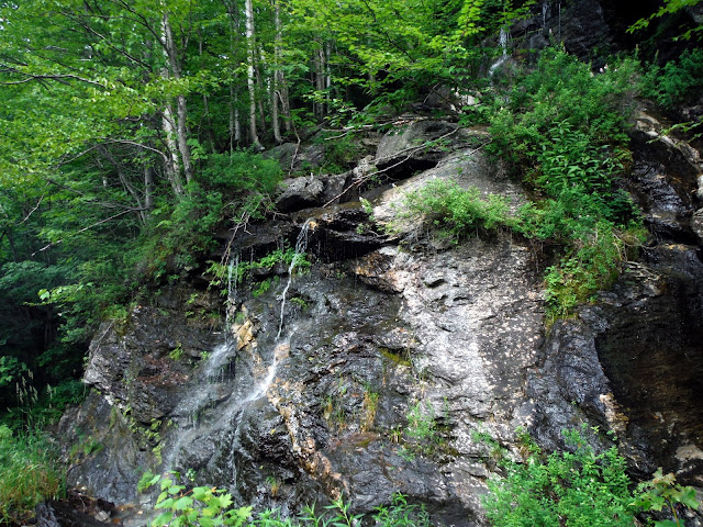
We had about a mile to walk through Smugglers Notch to get back to my car and passed several areas where water was falling down at a good pace.
Other than the road walk this wasn't a bad day overall. We got two fire tower views hikes in, as well as a nice hike along the Long Trail nabbing two ski area peaks. We saw no one on the first hike other than a state employee, and then we saw lots of people on the last two hikes. Worthy destinations for all three hikes.


Enjoyed the Owl's Head info...however, I'm fuzzy on where to turn off Rte. 232 to get to the gate you mention. Any info would be really appreciated.
ReplyDeletehttp://www.vtstateparks.com/pdfs/groton_trails.pdf
ReplyDeleteCopy and paste. You should see 232 on the top of the map. During operational hours, the gate will be open so it might be difficult to find.