I have been wanting to do my first hike for quite some time but never really fit it into any hiking plans. It also required a bit of research to figure out where to begin the hike. So today would be as good as any to make an attempt. The weather started off very windy and cold.
Tenney Mountain
Mileage: 4.25
Elevation gain: 1675'
Trails used: none. atv trail/service road, bushwhack.
You can still see the old ski trails for Tenney Mountain as you head north/south on I93 but you can also now see the gigantic wind turbines that now sit on the defunct ski area. It is always a shame when something as majestic as a mountain is turned into something as hideous looking as the wind turbines tend to be, and there will always be the detractors who say wind energy is needed over other forms of energy. I tend to err on the side of nature though.
Tenney Mountain is located in Groton and Plymouth, New Hampshire. The main summit area is in Groton. The old ski area resided on the northeast side of the mountain and several of the old ski lifts are still standing, as well as the base station and the lift buildings. Some history for the old ski are is here.
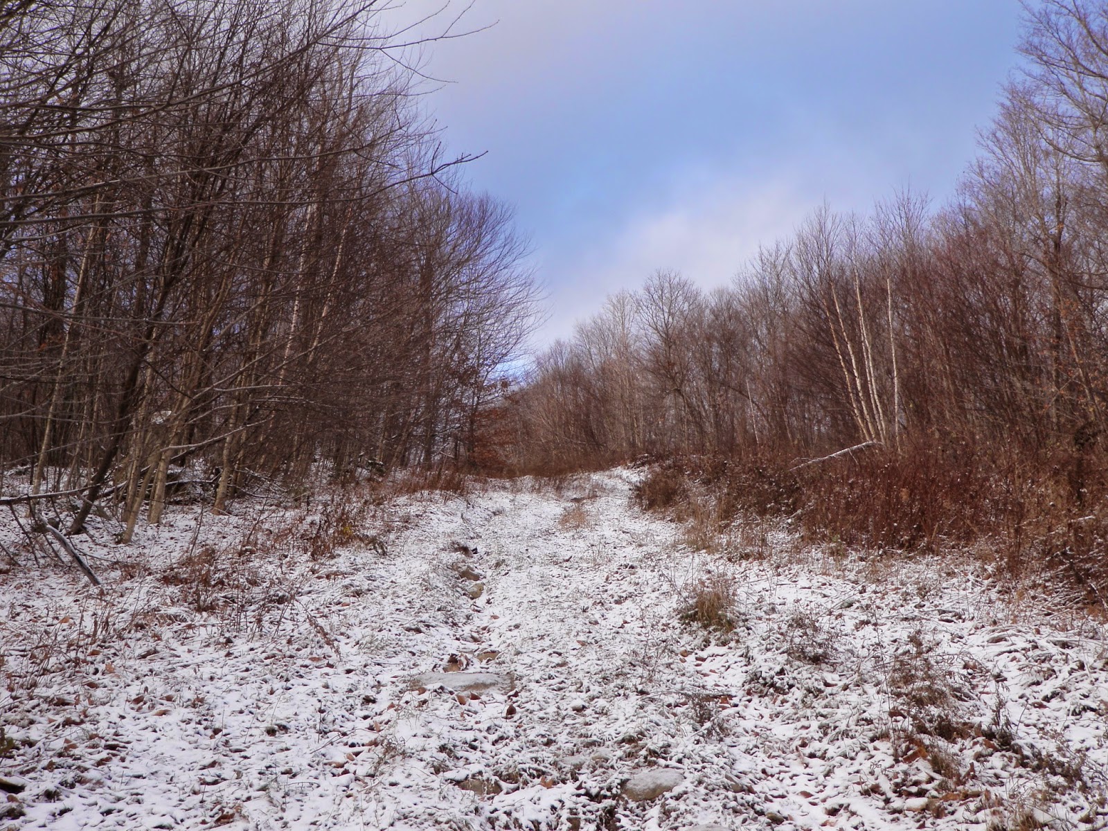
Starting my hike by walking up an access road/ATV trail/old ski trail to the summit. You start getting views pretty quickly as you head up. You can see some of the old chair lifts at the bottom of the picture.

Still heading up. The snow and ice started making its appearance more and more.
I started getting more views heading up the ski trails. You can just barely see Mount Chocorua all the way in the background.

The Shooting Star ski trail sign is still up on the tree.

I could hear them on the way up and catch a glimpse of a blade turning but it wasn't until the top of the ski area that I got my first real glimpses of the wind turbines.

The old T bar lift was still standing. You could just picture the people streaming their way up to the top to ski down, rinse and repeat. Sad it had to come to this.

Even more wind turbines. They stretch for a good ways across the summit.

Heading up to the summit via this huge clear cut area. Its bad enough hiking through all the slash but when there's two to three inches of snow down, its much worse.

Views towards Killington in Vermont, and its ski trails.

I was surprised just how close Mount Cardigan is to Tenney Mountain.

Looking from the Ossipee's to the Northern White Mountain Peaks. Franconia Notch and Cannon Mountain were in the clouds this morning.

Mount Crosby is close by as well. The actual summit of Tenney Mountain (elevation 2350') is in a wooded area just off the clear cut. These are the best views from just below the summit.

Heading back down now and another view from the access road.

The only water crossing I would have to deal with on the way down and that's only because I wasn't paying attention and missed my turn to cross an old bridge.

The base station for the closed ski area. There are No Trespassing signs posted so please respect them and be careful heading up the access road.

North Hall Pond Hill
Elevation gain: 210'
Trails used: none. bushwhack.
I drove around to a few spots to find another hike and was denied by No Trespassing signs at every turn. I finally decided to try a few peaks in the Sandwich Notch area but it would require (from where I was, without wasting more time driving) to drive Sandwich Notch Road.
If you have never driven Sandwich Notch Road, you are surely missing out. Sandwich Notch Road connects the Waterville Valley region with the Lakes Region and is a rough gravel road that is not maintained in winter. It was actually tough on my Civic to get over a few spots and you will probably not do more than 10-15 mph if you are not in a high clearance vehicle. For some interesting history on Sandwich Notch Road, go here.
North Hall Pond Hill is located in Sandwich, New Hampshire and is near the Hall Ponds area off of Sandwich Notch Road. There are no trails that go to its summit so it requires a short bushwhack.
There was open woods heading up to the summit area. There was about 2-3 inches of soft snow on the ground. This is actually the high point of North Hall Pond Hill (elevation 1960' ).

This is about as open as a bushwhack can get, minus birch glade bushwhacking.

A quick round trip bushwhack back down to Sandwich Notch Road where Cindy waited.

Sandwich Notch Road Hill
Mileage: 1.40Elevation gain: 565'
Trails used: none. bushwhack.
My third and last hike of the day was just down Sandwich Notch Road, but it still seemed like an eternity driving slowly up the road. I found two spots I could use to bushwhack up to the summit but they would have been really steep climbs. I finally found a new pull-out with some sort of path/road behind some rocks so I parked and off I went.
Sandwich Notch Road Hill, or NE Doublehead, is also located in Sandwich, New Hampshire. There are no trails to this peak so it requires a bushwhack to reach its summit.
I started the hike on this old logging/woods road but would quickly jump into the woods as it was not angling the way I wanted it to go.

A glimpse of Dinsmore Mountain through the trees.

Heading up to the summit through mostly open woods.

Views towards Doublehead and Mount Squam in the Squam Mountain Range.

The blurry summit of Sandwich Notch Road Hill (elevation 2020') and its new summit jar (which was not placed by me).

Where I parked. Being hunting season, I am sure this trail/path gets good use.

I ended my day on Sandwich Notch Road Hill and decided to head home early after a quick stop at the grocery store in Tilton.
It was a cold start in the morning but as the day wore on, it got a little more tolerable. I was able to take the warm hat and gloves off for the second and third hike but with winter fast approaching (as evidenced by the snow on the ground), having to wear warm clothes will be the norm for the next few months.
No comments:
Post a Comment