Elevation gain: 1020'
Trails used: Walking Trail (orange),Elwell Trail (yellow), Rest Area Loop (red), Goose Pond (orange).
Sunday, Desi and I headed out for another hike as the weather was looking nice. We decided on doing the two Sugarloaf peaks across from Newfound Lake and Wellington State Beach. The trail starts at the parking area for the Elwell Trail (off of West Shore Road), which continues on to Bear Mountain and eventually Mount Cardigan.
Little Sugarloaf Mountain and Sugarloaf Mountain are located in Alexandria, New Hampshire. The trail system is very well done for this section of the Elwell trail, and various other trails in the area. Signs are color coded and easy to follow, and are stationed at every junction so it's not easy to get lost.
Almost as soon as we arrived, the bug's were upon us and throughout the hike it was a mixture of either black flies and mosquitoes or both at the same time. The breeze did little to quell them.
Desi starting out on the Walking Trail/snowmobile trail that connects with the Elwell Trail.

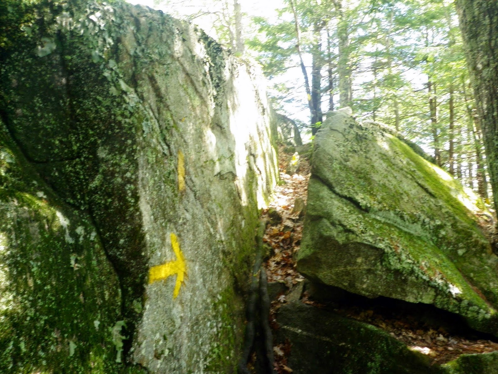
Example of the signage throughout this hike. It's color coordinated depending on which trails you want to use. We took the yellow trail (Elwell Trail) to Little Sugarloaf Mountain.

The trail is also a snowmobile trail for parts of the hike so it was very easy to follow.

Heading on over to Little Sugarloaf Mountain/ Sugarloaf Mountain.

Ledges abound for both Sugarloaf summit's and the surrounding area's.

Pretty self explanatory. Almost to the summit of Little Sugarloaf Mountain.

One of the views of Newfound Lake from some ledges on the summit of Little Sugarloaf Mountain (elevation 1002').

We would stay on the Elwell Trail (yellow) on the hike over to Sugarloaf Mountain.

The trail system was very easy to follow throughout the entire hike, as everything is color coordinated. Just pay attention to what trail color each trail is using.

Really nice woods through the hike with just enough cover for the bugs to have fun.

A bonus: if you do this hike, you too can save money on you car insurance.

Quite a few Lady Pink Slippers along the trail.

Orange (Gilman) Mountain is seen through the tree's from the summit of Sugarloaf Mountain (elevation 1370').

Looking over to Plymouth Mountain from summit ledges around Sugarloaf Mountain.

The views towards Hersey Mountain (background) and Newfound Lake.

The Garden of Gethsemane. In the Gospels, it was a garden located at the bottom of the Mount of Olives in Jerusalem were Jesus prayed the night before his Crucifixion. Not sure why the sign says this here so if anyone knows, please do tell.

We took the Goose Pond Trail (orange) when we got to the junction and then back to the car.

Besides the bugs and slight humidity, this was a nice short hike. This hike is perfect for kids and families as there is not much elevation gain. A bonus would be to go the the state beach and go for a swim afterwards. This would also make for a nice winter snowshoe hike with more views, since the leaves would be gone (and NO bugs!).
I enjoyed your post. I wanted to share that I hiked the same yellow trail from the parking area off W. Shore Rd, to Little Sugarloaf and Big Sugarloaf yesterday (4/19/16) with my adult daughter. It was a beautiful day with great views of Newfound Lake. This area has special meaning to me as I used to vacation on the Lake (in the old Nutting Beach area), back in the 60s-70s, and I have brought my own family there for vacations several times over the years. I wanted to post an experience we had during the hike and hopefully someone that is knowledgeable of the area can comment. Instead of doubling back down the same trail, we decided to go over Sugarloaf and try to find the trail I used to take up from the other side, it was a trail head that was located behind the old Nutting Beach general store, behind a barn, near the campground during that time. I assumed the trail head may now be located in the Ledges condo community. We began to follow the yellow trail down, with signage towards Bear mtn, and looked for a trail branch off to the right, towards the lake. We never found it. And as the yellow trail began meander away from the lake and started to climb towards Bear mtn, we decided to back-track a little and then go off trail towards the lake. After only a few hundred yards down, we encountered a Mama bear and her cubs... about 50-100 yards off, and thankfully, they began to scurry away from us. We did the same, backtracking up the hill, to the yellow trail and moved swiftly back over this trail over the Sugarloafs again and back to the parking area. It was an exciting encounter, and we're glad the outcome was just a sighting and no more, and it was a reminder the risks of going off trail. But here is my question: Does a trail still exist on the North side of Sugraloaf, to a trailhead that exits lakeside, perhaps in or around the Ledges community?
ReplyDeleteThanks,
Tom Keegan
ltkeegs@gmail.com
Hi, Gregg Chase grandson of Iris chase proprietor of Nutting Beach. I can see the trail you refer to clearly in my mind but unfortunately it is long gone now . This trail was marked by red soup can lids nailed to the trees and maintain by camp Mogley. Once a year the camp would come over to Nuttings, feed the kids some Nutty Buddies from the store while they sat on the granite steps that were cut into the hill and then put them to work keeping the trail well marked and maintained. Great to here someone that appreciates the way things used to be back then. Spending my childhood at Nuttings is something that will stay fresh in my mind forever. It's great to hear from someone else.that enjoyed the way it used to be in a much simpler and better world.
Delete