Once again, I perused my maps and checked the internet for information to figure out a game plan for the day. As I drove up I89, I decided my first hike I would attempt would take me to Kings Hill.
Kings Hill
Mileage: 3.30
Elevation gain: 1016'
Trails used: none. snowmobile trail, ski trail, bushwhack, Sunapee-Ragged-Kearsage Greenway.
Kings Hill is located in Sutton, New Hampshire and was home to the (now defunct) King Ridge Ski Area. You can see some of the trails from I89 as you drive towards Vermont. If you want more information on this old ski area, it can be found here.
Since the ski area was closed, there has been some recent logging done on the northwest side of the mountain as well as two communications towers placed right around the old summit. This area is prime wildlife habitat as well with signs of moose, deer, coyote and bear all moving about the area.
I parked at the King Hill Reservation entrance off of King Hill Road. This road is a snowmobile trail in winter.

I hiked down the snowmobile trail and then came to a logging landing where I turned to begin my hike up one of the old ski trails.

An old power conduit, possibly from one of the ski lifts. There were several of these still left on the ski trail.

I got this view of Mount Kearsarge when I looked back from the ski trail.

A little ways up, I looked back and got both Ragged Mountain and Mount Kearsarge in the same picture. There's still some color out on the tree's.

There are two different communication towers just below the actual summit of Kings Hill.

I had a rare shoe sighting right outside one of the communication tower enclosures.

The summit area of Kings Hill (elevation 1930') is in this strand of tree's. Pretty easy to navigate through here but the ground was very soft from the rain.

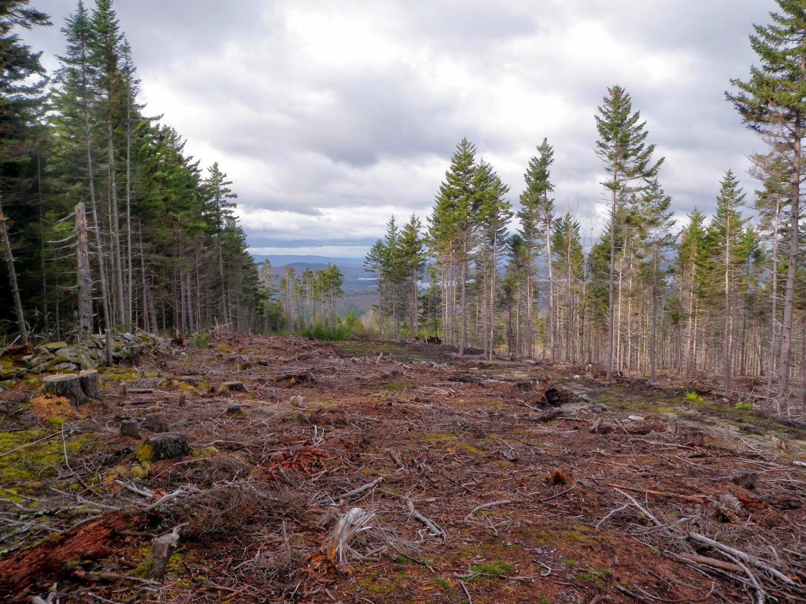
A large swath of trees that have been cleared right around the summit. I ran into a hunter and his dog here, checking his trail camera to see what's been in the area.
He told me to head down the logging cut a bit to get a really nice view.

A panorama of the logging cut. Distant views of Croydon and Grantham peaks.

The hunter also told me to head over the summit and head down the snowmobile trail and bypass heading back down the ski trail. I know there were hunters in the area because I heard several audible whistles that were human made.

Once back down the snowmobile trail, I noticed that it was part of the Sunapee-Ragged-Kearsarge Greenway and this was the trail right before it turned into Kings Hill Road.

Osgood Hill
Mileage: 3.65
Elevation gain: 939'
Trails used: Bailey Brook Trail, Kulish Ledges Trail
I looked through the list of possible second hikes I could do, and after I checked out a few of them, I decided to try Osgood Hill via the Kulish Ledge Trail.
Osgood Hill is located in Nelson, New Hampshire. While reading some information online about Osgood Hill, I came across a video that stated there was an old trail that went up to Osgood Hill (or Black Top as it is also referenced) but I wasn't sure exactly where it started from and heard it was tough to follow. I then saw that Kulish Ledges had a trail system built/maintained by residents of Nelson, New Hampshire and the Harris Center for Conservation Education. For a map and general information for this hike, go here.


I decided to call it a day after these two since I spent more time driving around than I did actually hiking (like we do sometimes). Overall, not a bad day of hiking. The first hike I would recommend if you like a little different variety i.e. off trail hiking. The second hike is family friendly. There are laminated maps available at the beginning of the hike but please put them back for others to use.
I looked through the list of possible second hikes I could do, and after I checked out a few of them, I decided to try Osgood Hill via the Kulish Ledge Trail.
Osgood Hill is located in Nelson, New Hampshire. While reading some information online about Osgood Hill, I came across a video that stated there was an old trail that went up to Osgood Hill (or Black Top as it is also referenced) but I wasn't sure exactly where it started from and heard it was tough to follow. I then saw that Kulish Ledges had a trail system built/maintained by residents of Nelson, New Hampshire and the Harris Center for Conservation Education. For a map and general information for this hike, go here.
The trail heads into the woods from the parking area which is off of Old Stoddard Road. There is room for three to four cars but it was very wet and muddy so use caution.
The trail is easy to follow with good signage so it shouldn't be too tough to stay on trail.
The only water crossing has the Bailey Brook Bridge to get one across.
Picture taken from the bridge looking towards the pond that feeds water into Bailey Brook.
The trail runs besides this beaver pond for a few feet before it heads uphill towards Osgood Hill and the Kulish Ledges. There was actually a beaver in the water enjoying himself.
The trail still looked new in some spots but it was a pleasant hike up. It was a little slippery due to the wet leaves from the rain that fell for a few minutes.
Along the trail, there is this old cast iron cook stove and not really sure why it was there.
The trail actually keeps heading onward past the Kulish Ledge area so I decided to see how much closer to the summit of Osgood Hill I could get. I still ended up having to do a bushwhack to reach the summit. I'm not sure where this trail comes up.
After a short bushwhack off of the trail, I managed to find the old Black Top Trail and took it to the summit of Osgood Hill. There is this sign and white blazes still so pay attention.
The summit area for Osgood Hill/Black Top (elevation 2233'), which was wide open but still no views to be found on this summit.
There is this wooden picnic table on the summit as well.
The Kulish Ledges. I decided against staying long on the ledges as the view wasn't anything spectacular and there was about 10 people in this small area.
I worked my way pretty quickly back down to the car. There were these two log bridges that crossed wet sections but it is still a pretty dry trail.
I decided to call it a day after these two since I spent more time driving around than I did actually hiking (like we do sometimes). Overall, not a bad day of hiking. The first hike I would recommend if you like a little different variety i.e. off trail hiking. The second hike is family friendly. There are laminated maps available at the beginning of the hike but please put them back for others to use.
No comments:
Post a Comment