Elevation gain: 1580 feet
Trails used: Slippery Brook Trail, road walk, bushwhack.
Highlight(s): none.
Brian was on an off day of hiking, and Desi was doing trail work in the Belknap's, so I would be hiking alone. This days hike would probably not be fun as the threat of rain would be around most of the day and the chance for views, if any, would be limited. Combine that with a road walk and bushwhack and it was going to be a long day in the woods for two peaks separated by about a mile. The drive to the trailhead for the Mountain Pond Trail was slow and when I got there, and started to gear up the black flies were already swarming. They, along with drizzle and overcast skies, would be around for the majority of this hike.
Round Mountain and Slope Mountain are located in Chatham, New Hampshire. There are no trails that go to the wooded, view-less summits of Round Mountain and Slope Mountain so it so it requires a combination of trails and a bushwhack to reach their high points. There are ledges around the summit of Slope Mountain which could provide views.
I walked around the gate outside the parking area for the Mountain Pond Trail as I made my way to the end of Slippery Brook Road.
The actual start of the Slippery Brook Trail, which starts off as an old woods road. I did not stay on it long before I headed into the woods to bushwhack to the summit of Round Mountain.
Walking along the Slippery Brook Trail with Round Mountain coming into view.
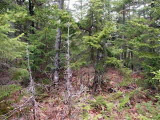
The woods were wide open as I approached the summit of Round Mountain.
One of a few possible summit high points for Round Mountain (elevation: 2181 feet).
I headed down into a marshy area in between Round Mountain and Slope Mountain in open woods. I had to cross Mcdonough Brook which wasn't too hard.
The woods on the summit of Slope Mountain (elevation: 2008 feet) were a bit scrappy and there were three bumps that could contend for highest point.
Someone thinks this small cairn denotes the high point of Slope Mountain.
I followed various old logging roads and snowmobile trails as I made my way back to the car.
One of several beaver ponds I had to move around or climb across the dam so I could make it back to my car. It was very swampy in between Round Mountain and Slope Mountain.
At first, on my way back, I wanted to angle more towards Mountain Pond and then use the hiking trail to get back to the car. The numerous old logging roads would make that task more difficult so I just opted to make a bee line back to where I parked instead of trying to find the trail. Once again, while changing my shoes, the black flies were even worse at this point so it was a hurry and get in the car and take off kind of thing, effectively ending today's hikes.


No comments:
Post a Comment