Elevation gain: 595 feet
Trails used: old logging roads, forests roads, bushwhack.
Highlight(s): views from the summit of Plausawa Hill, views from the summit of Garvin Hill.
Brian and I had taken Tuesday off of work to attend a Corrosion of Conformity, Clutch, and Lamb of God concert at the House of Blues in Boston, and had Wednesday off as well to recuperate from the long night. Brian was going to take it easy and probably hike the Uncanoonuc Mountains which are near to his house, while I was originally not going to do much to do besides some grocery shopping. As I was going to be in the area in Concord anyways, I decided to do a few town high points. The first high point is visible when I drive from Contoocook into Concord and I had always wondered what exactly the peak was. Now I know. When I arrived at my starting destination, the black fly swarm was on me immediately and worse by the time I returned to the car.
Plausawa Hill is located in Pembroke, New Hampshire. Plausawa Hill is also the highest point in Pembroke. The Chichester town high point and Garvin Hill are located in Chichester, New Hampshire. Obviously the no-named peak between Plausawa Hill and Garvin Hill is the highest point in Chichester. There are no trails that go from Plausawa Hill to the wooded, view-less summit of the unnamed Chichester town high point, and then over to Garvin Hill so it requires a bushwhack to reach its high point. There are ledges around the summit of Plausawa Hill that provide views, and views can be had from Garvin Hill (although you should ask for permission to hike around on the property).
I started by walking up the access road off of Plausawa Hill Road towards the high point of Plausawa Hill. It is a very short road walk.
The views from the summit area of Plausawa Hill looking towards Mount Kearsarge, Mount Sunapee and Mount Lovewell.
The views from the summit area of Plausawa Hill looking towards Crotched Mountain, North Pack Monadnock Mountain, Pack Monadnock Mountain and Wapack Range, Joe English Hill and the Uncanoonucs.
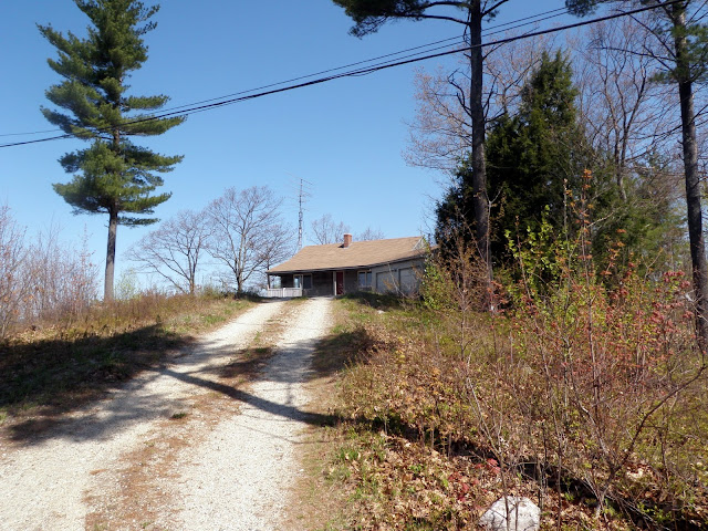
This vacant house is pretty much on the high point for Plausawa Hill (elevation: 1000 feet).
Just behind the house on the summit of Plausuwa Hill is this communications tower, which is visible from Concord and surrounding towns.
I made my way through a flagged ATV trail and across this swampy area in the saddle between Plausawa Hill and the un-named peak that denotes the Chichester town high point.
Along the way, I use several ATV/snowmobile trails as I made my way to the Chichester town high point.
The Chichester town high point (elevation: 1015 feet).
I made my way over to Garvin Hill, where the land owner was out doing some work so I didn't want to bother him and go to the high point which is roughly where the house is.
I followed the old roads back towards Plausawa Hill and came across this old stack of wood and bridge. Not sure why its out here in the middle of nowhere.
I also came across this hunting stand on the way back to the car, so it's a nice deer area.
A rather quick round trip hike with pleasant hiking weather and temperatures. There are views from Plausawa Hill and Garvin Hill, so besides doing the mediocre bushwhack to the Chichester town high point, it was a nice easy hike. I did manage to pull 5 ticks off of me during the hike and when I got back to the car, and the black fly swarm was out in full force. Not a bad bushwhack overall, even though I still had a headache from the night before.


No comments:
Post a Comment