Elevation gain: 2010 feet
Trails used: none. forest road, bushwhack.
Highlight(s): Moose Pond.
Joe and I planned a hike out for Saturday, although he kept telling me how slow he would be after his knee and ankle injuries but since I was in no hurry, we could go as slow as needed. It was a multi purpose hike/bushwhack as Joe wanted to try and find a waterfall off of the Kancamagus Highway, and I wanted to hit the two peaks to the northeast of Blue Mountain, which is a sub peak off of Mount Chocorua. Worst case is he would continue on looking for the falls and I would hit the two peaks, if time were a concern. The weather was not bad for a December day, with no snow forecasted and nice temperatures.
Moose Pond Mountain-East Peak and Moose Mountain-West Peak (unofficial names) are located in Albany, New Hampshire. There are no trails that go to the wooded, view-less summit areas of either Moose Pond Mountain peak so it requires a lengthy bushwhack plus forest road walk of various lengths.
The gated forest road 49 which is right off of the Kancamagus Highway. We would hike along the road and use it to try and find Ellen Falls first, then bushwhack to both summits of Moose Pond Mountain.

The forest road was a bit overgrown but easy to follow, until you come to the first water crossing. You would probably need a GPS to continue following it at this point.

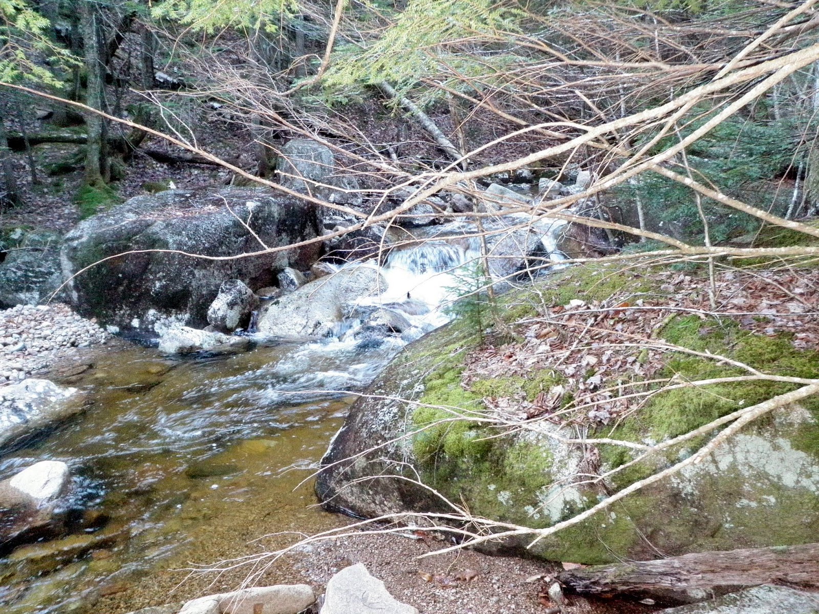
A section of Hobbs Brook as we crossed and bushwhacked along its banks looking for Ellen Falls (which we overshot by at least a mile).
Eventually we began the bushwhack through open woods as we headed at moderate grades to the eastern summit of Moose Pond Mountain.

No snow made for easy bushwhacking. Add to the fact that the woods were like this and it was an awesome late fall day to be out.

The views looking towards nearby White Ledge (and into Maine) from a ledge just below the eastern summit of Moose Pond Mountain.

A neon green rope or shoelace marks the high point for Moose Pond Mountain-East Peak (elevation: 2360 feet).

The views as we are heading down from Moose Pond Mountain-East Peak of Table Mountain and Bear Mountain, with the Moats to the left. Mount Washington is in the clouds in the background of the picture.

Moose Pond, a neat little pond in between the two summits of Moose Pond Mountain.

Some ledges leading up to the western summit area of Moose Pond Mountain.

I walked the entire summit ridge of Moose Pond Mountain-West Peak (elevation: 2360 feet) but did not find anything of significance. There were several areas I would consider a high point.

Joe bushwhacking down from the summit of Moose Pond Mountain-West Peak through open woods, of which there was quite a bit of hobblebush.

Joe trying to find one of the ledges he saw on Google Earth, which we did not manage to find on today's hike.

The steepest part of our descent as we headed down this gully or drainage. We had to sit down and scoot on our behind's since it was slippery and steep.

We worked our way down through woods like this, newer regrowth forest from logging done a few years ago.

We managed to make it to an old logging road and took it back to the original forest road we began the hike on. Joe and I decided to part ways at this point as Joe wanted to look for Ellen Falls (which he eventually found) and I was heading back into Lincoln to do some Christmas shopping. There was no snow whatsoever which is rare this time of year so it made for a nice walk in the woods. Finding Moose Mountain Pond in between both peaks was a nice little bonus find for the day.
No comments:
Post a Comment