Moody Mountain
Mileage: 2.25 miles
Elevation gain: 420 feet
Trails used: Moody Mountain Trail, bushwhack.
Highlight(s): new trail, slight views from a minor summit of Moody Mountain.
I found some interesting information on this hike several weeks ago, so this would be the perfect day to attempt it. Once I found where the hike started, it was a matter of finding a good place to park (which wasn't hard as I parked on the side of the road opposite where the gated woods road heads towards the summit of Moody Mountain).
Moody Mountain is located in Wolfeboro, New Hampshire and is the highest point in Wolfeboro. There is a somewhat new trail that looked like it was currently being worked on/improved upon but it was a pleasant hike to the summit nonetheless. There are slight views from the lower summit where the cabin is located but none from the wooded summit of Moody Mountain.
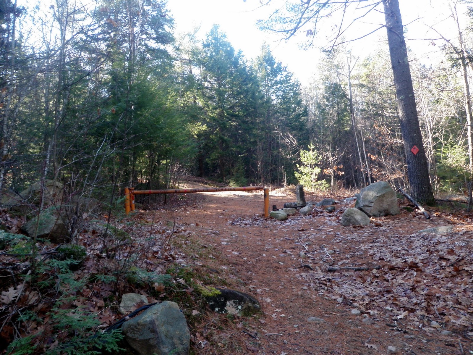
I started up this woods road off of Beach Pond Road. There is room for several cars just outside of the gate that blocks the road.

The woods road connects to the Moody Mountain Trail, which had recent trail work being done and new sections were probably made not too long ago.

Eventually, after a nice woods walk, you come to this rustic cabin on a lower summit of Moody Mountain. You can go inside the cabin; it has a register to sign in.

I took another flagged woods roads near the cabin to the highest point of Moody Mountain (elevation: 1420 feet), marked by this cairn. There is another bump nearby of almost equal elevation so I hit both.

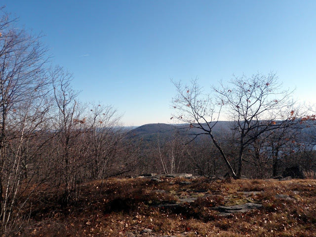
The views of Trask Hill with a house on its summit from clear cut area below the cabin on the minor summit of Moody Mountain. Green Mountain is to the left in the background.

Another view of the cabin from the clear cut below the minor summit of Moody Mountain.

The start of the Moody Mountain Forest area.

I tried another peak in the area but was turned back by private property issues so I looked for something else to do that was somewhat close to where I was. I found another peak that would fit the bill, and I wouldn't have to do a lengthy bushwhack to reach the summit. I would use ATV/snowmobile trails for most of the hike. Plus there were views from several ledges around the summit area, so it was a win win.
Caverly Mountain
Mileage: 4.85 miles
Elevation gain: 1020 feet
Trails used: Caverly Road, Caverly Mountain Loop (ATV/snowmobile), bushwhack.
Highlight(s): views from several ledges on different areas of the summit area of Caverly Mountain.
I walked this road briefly last weekend but due to hunter activity (and not having my hunter orange) I decided to hold off and do this hike at some other time.
Caverly Mountain is located in New Durham, New Hampshire. There are no trails that go to the summit of Caverly Mountain but there are snowmobile trails that you can use to get there. The actual highpoint of Caverly Mountain requires a short bushwhack through open woods and there is a view looking towards Moose Mountain from the summit. Also, there are several nice view point areas around the ledges of Caverly Mountain.


Two nice peaks on a nice crisp late fall day. I think at one point I was down to a t-shirt when I am usually wearing long sleeves, gloves and a hat at this point of the year. That is how nice it was outside. The first hike was a nice hike walking along a new trail that looks like it hasn't had time to set in but was easy to follow and led to a cabin. Just walk in and enjoy but please respect the property. Caverly Mountain was a nice hike along snowmobile trails with decent views. It was a bit confusing following the roads though so make sure you either look at a map or know how to navigate well.
I walked this road briefly last weekend but due to hunter activity (and not having my hunter orange) I decided to hold off and do this hike at some other time.
Caverly Mountain is located in New Durham, New Hampshire. There are no trails that go to the summit of Caverly Mountain but there are snowmobile trails that you can use to get there. The actual highpoint of Caverly Mountain requires a short bushwhack through open woods and there is a view looking towards Moose Mountain from the summit. Also, there are several nice view point areas around the ledges of Caverly Mountain.
I started the hike on Caverly Road, off of Kings Highway. The gate was open so one could drive in the road, although 4WD vehicles would be preferred.

I turned left off of and went around this gate and headed up the snowmobile trail towards the summit of Caverly Mountain.
The open woods and snowmobile trail with the summit of Caverly Mountain coming into view.

The Caverly Mountain Loop had some recent ATV use on it, and is still signed for snowmobile use in winter.

The views looking towards Mount Jesse from the southeastern ledges of Caverly Mountain. There is a house on the summit of Mount Jesse.

The views from the southeastern ledges of Caverly Mountain of nearby Moose Mountain, through the trees.

The high point of Caverly Mountain (elevation: 1439 feet), which is a short bushwhack from the southeastern ledges.

The views from the northwestern ledges of Caverly Mountain looking towards Belknap Mountain, Gunstock Mountain and a few other peaks in the Belknap Range. Mount Kearsarge is barely visible in the background.

The views from the northwestern ledges of Caverly Mountain looking towards Rattlesnake Island in Lake Winnipesaukee. Carr Mountain and Mount Moosilauke are in the background.

The open northwestern summit ledge area of Caverly Mountain.

As I headed down the Caverly Mountain Loop Trail, I came across this clear cut looking towards nearby Mount Long Stack with Mount Shaw in the Ossipee Range behind it.

The views from the clear cut looking towards Mount Chocorua and a frosty looking Mount Washington and Presidential Range.

As I walked down the ATV road/snowmobile trail, I glanced back at the summit area of Caverly Mountain from this logging area.

On the way back to the car, I came across numerous old cellar holes, this being the largest.

Walking back down Caverly Road and almost back to the car.

Two nice peaks on a nice crisp late fall day. I think at one point I was down to a t-shirt when I am usually wearing long sleeves, gloves and a hat at this point of the year. That is how nice it was outside. The first hike was a nice hike walking along a new trail that looks like it hasn't had time to set in but was easy to follow and led to a cabin. Just walk in and enjoy but please respect the property. Caverly Mountain was a nice hike along snowmobile trails with decent views. It was a bit confusing following the roads though so make sure you either look at a map or know how to navigate well.
No comments:
Post a Comment