Mann Hill
Mileage: 1.7 miles
Elevation gain: 590 feet
Trails used: access road, bushwhack.
Highlight(s): open woods bushwhack, register on the summit of Mann Hill.
I read a trip report recently on this one so I thought it would be short enough to fit in my time frame for the day and would be my first hike to begin the day. The snow was collecting pretty good as I drove through Franconia Notch and I even saw the DOT trucks out putting sand down. On the other side of Franconia Notch, the snow lessened but was still coming down lightly.
Mann Hill is located in Littleton, New Hampshire. There is an access road that goes to some communications towers for New Hampshire Public Television but not to the actual wooded, view-less summit.
Mann Hill is located in Littleton, New Hampshire. There is an access road that goes to some communications towers for New Hampshire Public Television but not to the actual wooded, view-less summit.
I parked just up the hill from the access road that leads to some communication towers off of Mann Hill Road, and walked the short distance to the gated road.

Still heading up the access road with the communications tower for New Hampshire Public TV (and a new one being built) just below the summit area of Mann Hill.

I went into the open woods just behind the communications tower as I made my way through the light snow covered ground towards the northern most summit of Mann Hill.

The highest point for Mann Hill. There was quite a few piles of moose poop here.

The pill bottle register on the summit of Mann Hill (elevation: 2152 feet).

On the way back down and to the car, I crossed this old logging area as the snow started coming down heavier.

A rather quick round trip, so I possibly had time for one more hike before I was to meet Kris for a hike in Weeks State Park. The next hike I would do was literally right around the corner, geographically. I had a nice half hour drive though over dirt roads to get to the point where I would start this hike. Seeing no signs prohibiting me from accessing the power line cut, I grabbed my rain coat, blaze orange vest and headed up.
Dalton Mountain
Mileage: 1.9 miles
Elevation gain: 955 feet
Trails used: none. bushwhack.
Highlight(s): power line cut hike with limited views.
This peak was hard to find access for as their are houses that pretty much surround the mountain, so noting nothing saying I couldn't go up the power line cut (sometimes they are posted no trespassing) I decided to suck it up and take the steep way up. The snow would be problematic for footing as I made my way up (and down to the car), but it made for a nice preview of what's to come with winter on the doorstep.
Dalton Mountain is located in Dalton, New Hampshire and is the highest point in Dalton. There are no trails that go to the wooded, view-less summit of Dalton Mountain so it requires a bushwhack to reach the summit.
I parked directly across from the power line cut off of Faraway Road and would use the cut to get to a comfortable point to take the ridge up to the summit of Dalton Mountain.

It was pretty steep and slick from the light snow as I used a mixture of foot trail and ATV tracks to reach the ridge line. The sun started peeking through at this point.

I noticed this nicely hunter tree stand as I was heading up the power line cut.

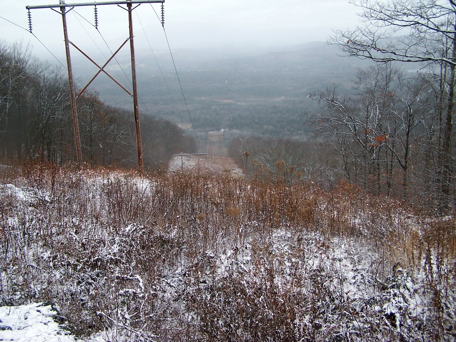
The views of the power line cut looking towards the snow line over Kimball Hill, Howland Hill and Russell Hill.

The snow started coming down again and it is starting to look like winter now.

Although not a relatively big summit area, it still was bumpy enough to have to try and figure out what bump was the highest.


I made my way across every bump on the summit of Dalton Mountain (elevation: 2146 feet). X marks the spot in my opinion.

Working my way back down the power line cut was fun as I slid my way back down to the car. The snow was coming down again pretty good at this point.
Cherry Mountain (Mount Martha) decided to make an appearance (almost) as I continue my way down the power line cut.

I got back in the car, messaged Kris that I would meet him around 11:15 am and headed towards my last peak of the day. I had time to eat some food while driving over to the parking area for Weeks State Park.
Prospect Mountain (Lancaster)
Mileage: 3.2 miles
Elevation gain: 815 feet
Trails used: none. road walk.
Highlight(s): fire tower on the summit of Prospect Mountain, limited views from several areas around the summit of Prospect Mountain and along the auto road.
I headed over towards the parking area off of Route 3 for Weeks State Park. The parking area wasn't there when Desi, Brian, Jim and I did this several years ago (via the ski trail, bushwhack and hiking trail) so it was nice to be able to park outside the now closed auto road, and make an easy walk up the road to the summit of Prospect Mountain.
Prospect Mountain is located in Lancaster, New Hampshire. It has several multi-use trails for hiking and skiing, an auto road that goes to the summit, a fire tower (open when a fire warden is on duty), and the John Wingate Weeks Historical site. We opted to take the auto road to the summit and then back down to the car.
Weeks State Park
Weeks State Park Map
Weeks State Park Map
The gate for the auto road that you can drive (in season) to a parking area just below the summit of Prospect Mountain.

One of the few views we got today based on the snow moving all around us. This was taking from one of the view point areas along the auto road.

Approaching the fire tower and summit house on the summit of Prospect Mountain (elevation: 2067 feet). The fire tower was closed today, big surprise.

A couple inches of snow collected on this bench. No clue how the cryptic writing got there.

A nice day for hiking despite the first snow of the season (hiking wise for me). The first hike up Mann Hill was an easy jog in the woods. Dalton Mountain, while steep hiking up the power line cut, was easy once I got on the summit ridge. Prospect Mountain was an easy road walk up and I enjoyed conversing with Kris, who I had not hiked with in some time. The snow made for a rough drive in spots but a light coating is a lot better than 6 feet of the horrible white stuff any day.
No comments:
Post a Comment