Gile Mountain
Mileage: 1.4
Elevation gain: 400'
Trails used: Gile Mountain Trail.
I had noticed Gile Mountain in a book we have lying around the house so I did my homework online and found out the information needed to find this hike. The weather was going to be nice for this hike with sunny skies and cooler temperatures but not the frigid days we've been having for the last few weeks.
Gile Mountain is located in Sharon and Norwich, Vermont and the summit is located in Norwich. This relatively easy and short hike is made all the better by the fire tower that resides on its summit, with 360 degree views available. This peak is a favorite hike for Dartmouth College hikers as it the college is somewhat nearby.
The Gile Mountain Trailhead kiosk off of Turnpike Road. The lot was not plowed out from the last snow but it was plowed somewhat recently so it was easy to get my Civic in.

The Gile Mountain Trail was recently tracked out by snowshoers so I wore snowshoes from the car to the summit. There was only about 2-3 inches of snow to walk in so it wasn't too bad.

The Gile Mountain Trail heads across this power line cut with views into New Hampshire. It is also, apparently, being used by snowmobiles.

The Shredd Shack, the former fire wardens cabin turned into a day shelter. It has some colorful graffiti and is pretty spacious. No camping is allowed here though.

The fire tower on the summit of Gile Mountain (elevation 1873'). The cab has been removed but you can still climb to the top for 360 degree views of Vermont and New Hampshire, and on a good day, one can probably see into New York.

Views looking into western New Hampshire from the fire tower on Gile Mountain. The Moose Mountain range is almost dead center, with Mount Cardigan just behind it sticking up. Smarts Mountain is to the left.

More views from the fire tower on Gile Mountain. Smarts Mountain and Mount Cube, Mount Moosilaukee, and the Franconia Ridge all in view. The ski trails on Mittersill Peak and nearby Cannon Mountain can be seen (to the left).

Looking west into Vermont towards the highest peak in Vermont, Mount Mansfield.

Possibly the Jay Peak ski area in Northern Vermont from the fire tower on Gile Mountain.

Views of Mount Ascutney in southern Vermont from the fire tower on Gile Mountain.

The views from the fire tower on Gile Mountain looking towards the Killington ski area and Mount Pico. Salt Ash Mountain and Bear Mountain are to the left.

The old fire wardens cabin from the top of the fire tower on Gile Mountain. This is one of the taller fire towers that I have found the courage to climb up for views.

After heading back down the fire tower, I decided to put my snowshoes on my backpack and bareboot my way back down to the car. So I retraced my steps coming up and made it this hike in about 45 minutes roundtrip. Very nice views from the fire tower so definitely worth it, even if it is a short hike with low elevation gain. Not satisfied with one hike, and with my knee feeling not too bad, I looked on the map for my second planned hike and headed out.
Wrights Mountain
Mileage: 1.9
Elevation gain: 525'
Trails used: Wright's Mountain Trail, Appreciation Way.
Wrights Mountain took some time to drive to and find as Wrights Mountain Road wasn't on my GPS so I drove down a different road and eventually found the trailhead, which was plowed out but still a bit rough to get into. While doing this hike in winter isn't so bad, I would probably save it for a nice summer or fall day to take advantage of the other trails and to visit Devil's Den.
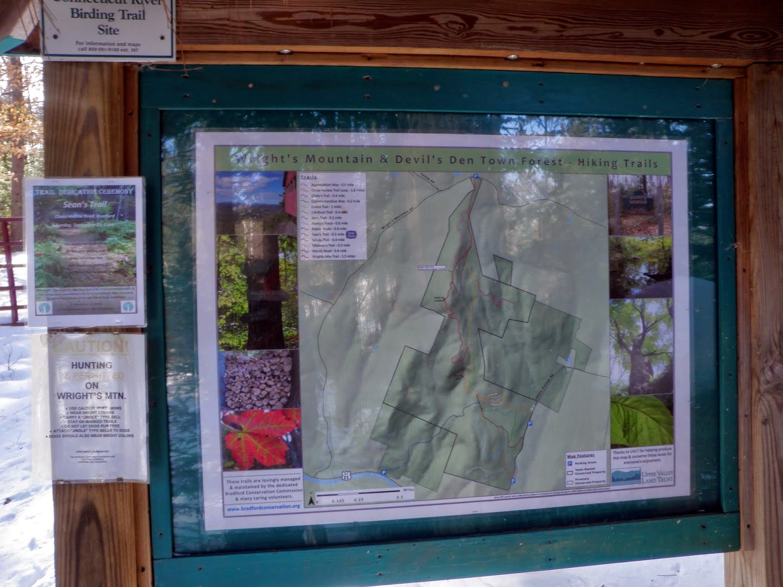
Wrights Mountain is located in Bradford, Vermont. It is also the highest point in Bradford. Hiking, snowshoeing and skiing are allowed on the roughly 3.5 mile of trails on this conservation land. For more information on this hike, go to the Upper Valley Land Trust website or to Upper Valley Trails Alliance for maps.
I start off on the Wright's Mountain Trail off of Wright's Mountain Road in Bradford, Vermont. There is also a bathroom a few feet up the trail.

The kiosk at the start of the Wright's Mountain Trail with a map. Maps are also available in a pamphlet you can get off the kiosk.
I wore snowshoes start to finish as the Wright's Mountain Trail was a mixture of XC ski tracks and snowshoe tracks.

I took the yellow blazed Appreciation Way trail to make this a small loop hike. On several maps, it is also referred to as the Commemorative Way trail.

While the scenery was nice, and it was a bit more varied trail in that it moves you up the ridge faster towards the peak, the only thing I "appreciated" about it was when I was back on the Wright's Mountain Trail towards the summit. The trail was heavily drifted-in in sections so it made the going tough on my knee.

A view point along the Appreciation Way Trail so why not. I only had to break trail through knee deep snow for some so-so views.

The small views from the view point looking into the Waits River Valley.

Back on the Wright's Mountain Trail, and heading to the summit area of Wrights Mountain.

There is a neat little shelter just below the summit area built onto a ledge area.

Looking into Caledonia and Orange Counties in Vermont. I think these mountains are the Knox Mountains, Butterfield Mountain and Signal Mountain. Taken from the ledge area right next to the shelter.

A barely visible Mount Ascutney (far left) from the ledge area.

The actual high point of Wrights Mountain (elevation 1822'). It was broken out by a XC skier so I went for it, the high pointer that I am.

I decided to just head back down the Wright's Mountain Trail as it had a better snowshoe track and was already broken out. I then came across this bench at another view point.

From the bench, you could clearly get views of snow covered Mount Moosilaukee.

Also from the bench area, you could get glimpes of Franconia Ridge and Cannon Mountain through the trees.

The trail system was easy to follow and the woods were wide open so it was a nice little hike.

Two really nice peaks and a nice day to hike. It was a bit cool as it never really made it out of the 20's but it was sunny so that is a plus. Gile Mountain is a quick little hike and a winner for views from the fire tower. Wrights Mountain would make a nice loop hike if you can hike further and even include Devils Den. Definitely do these family friendly hikes with no snow.
No comments:
Post a Comment