Bly Hill
Mileage: 0.50 miles
Elevation gain: 175 feet
Trails used: None. bushwhack, road walk.
Bly Hill has been tough to do since there are access issues to reach the high point. I drove up last year in early winter but noone was visible so I didn't intrude and left. This time, I would try a bushwhack around the backside as it looked like on Google Earth that it was a wooded summit but there is a house being renovated there. So I had to resort to asking one of the neighbors about the high point. It has camera surveillance and the owner is away so it wasn't wise to go over.
Bly Hill is located in Newbury, New Hampshire. There is a road that goes to the summit area but there are three houses that could possibly vie for the highest point, so please respect the property. There are really good views from just below the summit so you could always drive up for the views, too.
I parked at a pullout area and walked down this path and through the rock wall with views to Mount Kearsarge and Ragged Mountain.
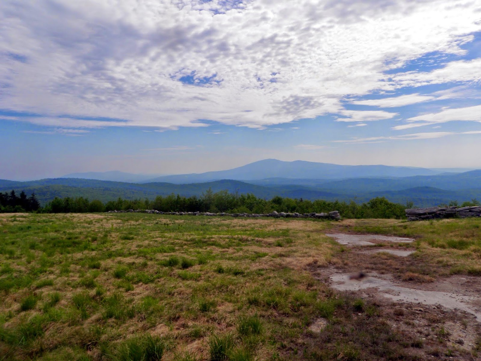
I bushwhacked below the rock wall through somewhat thick woods, and followed several herd paths towards the summit of Bly Hill.

Passing the last contour line, this was the closest I could get to the high point of Bly Hill (elevation 2024') without trespassing on this person's property.

Looking towards the Mink Hills and Stewarts Peak in Warner, New Hampshire from the grass area just below the summit of Bly Hill.

Looking back up to the high point area for Bly Hill.

I then drove around to the other side where I got views of nearby Mount Sunapee.

It was already hazy from the humidity but I got this view of Lake Sunapee and Croydon Peak and Grantham Mountain just barely visible.

A zoomed out picture of the Croydon/Grantham area and my car. Really nice views from here and on a less hazy day, you could probably see into Vermont.

Next hike would be a bit of a drive north so I turned on the air conditioner (as it was already very humid at 930 a.m) and started driving. I was familiar with the area as I had hiked here last year during a rainy day hike of Forbes Mountain.
Tinkham Hill
Mileage: 4.05 milesElevation gain: 1220 feet
Trails used: none. logging road, woods road, bushwhack.
Highlight(s):
I was going to do Tinkham Hill the same day I did nearby Forbes Mountain but it was a near downpour at the time so I didn't manage to make my way over that way. Today, I would start from the same place I did Forbes Mountain from and then make my way over to Tinkham Hill. The big difference this time around was the extended length meant more time in the woods with the heat and humidity of the day.
Tinkham Hill is located in Danbury, New Hampshire and is the highest point in Danbury. There are no trails that go to the open summit of Tinkham Hill so it requires a bushwhack to reach its high point. There are views along the bushwhack, depending on how you attempt this hike.
On the way up a clear cut road, I came across another black bear. This time I could not get a picture of it more because I think we scared each other. I followed him for a bit but I didn't take my chances in the chest high vegetation and not sure where exactly he was heading.
***DISCLAIMER. Access to this peak by this method is not permitted any further. There are signs posted against trespassing. DISCLAIMER***
I drove up to the end of Forbes Mountain Road and parked. This logging road is off limits to motorized vehicles but I was able to travel up on foot.

I started off taking old logging cuts that were overgrown with pricker bushes and welcomed it when I came across old woods roads like this.

I even managed to find a snowmobile trail in between Tinkham Hill and Forbes Mountain, but it ended up going in the wrong direction.

It was really steep and a bit scrappy as I made my way up to the summit of Tinkham Hill.

The clear cut summit area of Tinkham Hill. There is a possibility this summit will hold wind turbines in the future.

Another look at the summit area of Tinkham Hill (elevation 2320').

A nice wet area with recent moose tracks. I didn't stay long as the bugs were just as ferocious as the heat was.

The views as I was heading down from the summit of Tinkham Hill of Ragged Mountain and Mount Kearsarge behind it.

Two peaks to the day and lots of sweat lost on these hikes. Adding insult to the blood and sweat, I managed to have nine ticks attach themselves to me for a ride so I spent a good amount of time back at the car doing a tick check (I would later find three more in the car). Bly Hill was nice for the views and ease of reaching them; Tinkham Hill was worth it to visit just in case it does become a wind turbine peak and is off limits.
No comments:
Post a Comment