Elevation gain: 3015 feet
Trails used: Zealand Trail, Lend-a-Hand Trail, Hale Brook Trail, road walk.
Well, for one, we actually had a plan for today's hike. It would be one that I thought we could do easy enough and not have to use snowshoe's at all. Boy, was I wrong. The day was forecasted for frigid temperatures and it sure was; it was -13 on Brian's car thermometer. With the winds, it felt a heck of a lot colder.
Mount Hale is located in Bethlehem, New Hampshire and is part of the Twin Mountain Range. There are a few routes to take to reach its summit in winter: the road walk up Zealand Road to the Hale Brook Trailhead, the old fire warden's trail that still gets regular use, and by people staying at the Zealand Falls Hut and walking up the Lend-a-Hand Trail to the summit.
Mount Hale is on the New Hampshire 100 Highest and 200 Highest List and also on the New Hampshire Fire Tower List.
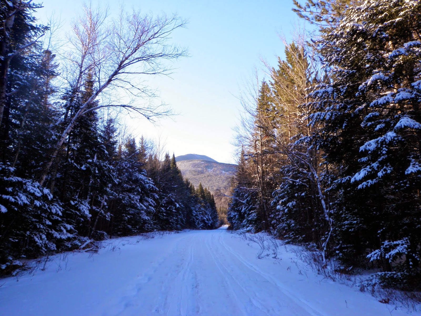
We parked at the hiker parking area off of Route 302 in Twin Mountain and then started the long road walk up Zealand Road, with its now broken gate.

Portions of Zealand Road are used by snowmobiles. It also gets a lot of XC ski traffic. This is walking up the road with views to Mount Hale.
No Brian, it's not Spring yet. He's sitting at a picnic bench by the Hale Brook Trail area.

Brian beginning the long trek down the Zealand Trail as we are passing by the Zealand Road summer parking lot.

Winter snow along the Zealand Trail.

There was a mixture of old XC ski tracks and snowshoe, plus people (like us) barebooting along the 2.8 mile stretch of the Zealand Trail to the Zealand Falls Hut.

Along the Zealand Trail and right around the beginning of the beaver pond area, we get views of Zeacliff and Zealand Mountain.

Not really sure if Brian is trying to pole dance or he's frozen to it. You need to cross this bridge to get to the Zealand Falls Hut.

The views from outside the Zealand Falls Hut. Whitewall Mountain (left) and Zeacliff (on the right, through the trees). Straight ahead is Mount Carrigan, Vose Spur and Mount Anderson.

We started heading up the Lend-a-Hand Trail. We were going to do South Hale but once we got to the col between it and Mount Hale, the buchwhack attempt through waist to almost chest deep snow (in spots) was more than I wanted to try. We went about .02 miles in about 10 minutes; at this rate we would be heading out in the dark.

The Presidential Range from the Lend-a-Hand Trail.

Zeacliff and Zealand Mountain from the Lend-a-Hand Trail.

We are getting closer to the summit of Mount Hale. The trail was pretty easy to follow with the only bad snow off the trails.

The rime iced trees on the Lend-a-Hand Trail just below the summit of Mount Hale.

Brian admiring the awesome views on Mount Hale (elevation 4054'). Either that or he is wondering why in the hell he is on this peak yet again in winter.

Me on the summit of Mount Hale. Did I mention it was cold outside.

Mount Washington was in the clear the entire day. It would have been nice to get up there for views but it definitely would have been an extremely cold day.

We headed back down the Hale Brook Trail, which hasn't seen any recent activity (at least when we did it). It was soft snow on an old hard pack snow base so it felt like we were skiing on the way down and we both slipped a few times. We only saw five people on the summit of Mount Hale, and 3 people cross country skiing (and a few snowmobilers).
A very cold day to be out. I went through three pairs of gloves and a few buffs to cover my face. If only we were getting these miles for last year, there was really no reason to do this hike other than the fact we got to GRID this peak for January *wink*.
No comments:
Post a Comment