Mount Cushman
Mileage: 3.2
Elevation gain: 990'
Trails used: None. Old logging roads, bushwhack.
This was going to be my second time here but first in winter. The original route had us going through the Hubbard Brook Experimental Forest, but with Hubbard Brook Road closed for the season, I had to resort to a different route. I had good information from a friend that from the height-of-land off of Route 118 was easy going. So I made good time and parked and proceeded to get ready. I would try the snowshoes out for this trip, as I have yet to use them thus far.
Mount Cushman is located in the Hubbard Brook Experimental Forest in Woodstock, New Hampshire. The actual forest also extends into Ellsworth and Thornton, New Hampshire and is managed by the USDA Forest Service Northern Research Station. For more information on what the Forest is for, go here. Mount Cushman is a trail-less hike and requires a bushwhack to reach its summit.
Mount Cushman is on the New Hampshire 200 Highest List and New Hampshire 3k List.
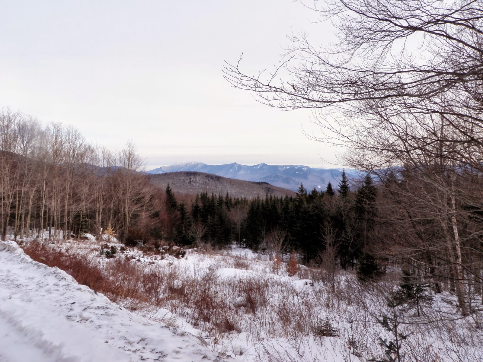
I decided to start the bushwhack at this road side pull out off of Route 118 (just below the height-of land) with views of Franconia Ridge.
From the car, I noticed and followed some old snowshoe and XC ski tracks that lead to this frozen over pond area.

The woods down low were nice and open but I did cross a lot of drainages and old logging/skidder roads on my way up.

Occasionally I would come across some thicker woods. Here the tree in the center had very recent evidence of moose gnawing on the bark as there were wood chips below it.

While this is generally easy to walk through, in winter it is a bit tough with snowshoes on.

The summit canister for Mount Cushman (elevation 3321). I remember the last time we were up here, we had to rehang the canister since the tree it was on fell over. It was re-hung this last time very haphazardly and it was tightened too much/frozen so I could not open it.

On the descent, I decided it was best to avoid my tracks heading up and took a more north to northwest bearing back towards the car. I did get a view through the trees of Mount Liberty and Franconia Ridge.

With the going much easier on this route, I hit one of the old skidder/logging roads and took it almost back out to the car.

I made it back to the frozen pond area, where I got views to Blue Ridge area of Mount Moosilaukee which borders it on the eastern side.

Looking back to Mount Cushman, from where I just hiked down from.

Once back down to the car, I was going to head over to try Mount Kineo and East Kineo while I was in the area. Problem was, the road leading to the Hubbard Brook Trail was very icy and I didn't feel like getting the Civic stuck so I looked for another target.
Cobble Hill
Mileage: 5.35
Elevation gain: 1430'
Trails used: Cobble Hill Trail, old logging roads, bushwhack.
What a difference a few months make. The last time Brian and I was in this area and on this particular trail, it was hot, buggy and miserable. Now with the "lack" of snow, I figured it would be a better time to hike on this trail when its not a mosquito hell.
Cobble Hill is located in Landaff, New Hampshire. The trail starts at the Cobble Hill Trailhead off of NH Route 112. Cobble Hill is a trail-less hike and requires a bushwhack to reach its summit.
The start of the Cobble Hill Trail, once past the gate. It was very light snow on top of ice and various foot traffic recently. It looked like someone had driven an ATV through.

As I made the long 2.5 miles hike on the Cobble Hill Trail, the snow never increased but the ice and animal prints sure did.

Eventually I would need to start my bushwhack so I started it on this old logging road.

I lucked out as the logging road took me right up the ridge towards the summit.

The Kinsmans and the Mount Wolf ridge.

Looking back across the ridge to the summit of Cobble Hill (elevation 2306').

As I descended, I got this view (through the trees) of Moody Ledge. The Cobble Hill Trail goes right between these two peaks.

Looking south to Mount Moosilaukee (left) and Mount Clough coming down the southern ridge off of Cobble Hill.

While the cold weather is always a minus on these types of hikes, I couldn't complain about the conditions on the ground. I wore snowshoes for the first bushwhack but they really were more of an inconvenience as the snow was hard packed and firm enough to walk on. So, the second hike I just wore Microspikes and was fine. I still managed to slip around a lot on the exposed leaves due to the lack of snow at lower elevations.
No comments:
Post a Comment