Cone Mountain
Mileage: 2 miles
Elevation gain: 845 feet
Trails used: none. bushwhack.
Highlight(s): register on the summit of Cone Mountain, slight views from ledges around the summit of Cone Mountain.
I had read of a recent trip report on this peak so I thought with the good snow conditions I would give it a go finally. I tried this peak several years ago but was turned around by private property issues and I didn't ask for permission at the time. I tried coming from the south again but again, private property and no trespassing signs dominated the route that I wanted to use to reach the summit of Cone Mountain. I had to move around the boundary area enough so that I wasn't trespassing which made this hike longer than it needed to be.
Cone Mountain is located in Thornton, New Hampshire. There are no trails that go to the wooded,view-less summit of Cone Mountain so it requires a bushwhack to reach its high point. There are several ledges around the summit area of Cone Mountain that offer views to nearby peaks.
Cone Mountain is located in Thornton, New Hampshire. There are no trails that go to the wooded,view-less summit of Cone Mountain so it requires a bushwhack to reach its high point. There are several ledges around the summit area of Cone Mountain that offer views to nearby peaks.
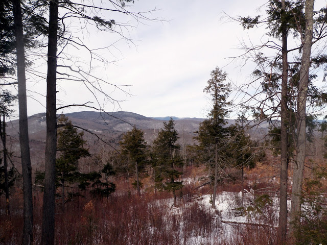
The views from ledges below the summit of Cone Mountain looking towards Jennings Peak, Sandwich Dome and Acteon Ridge with its numerous ledgy bumps.

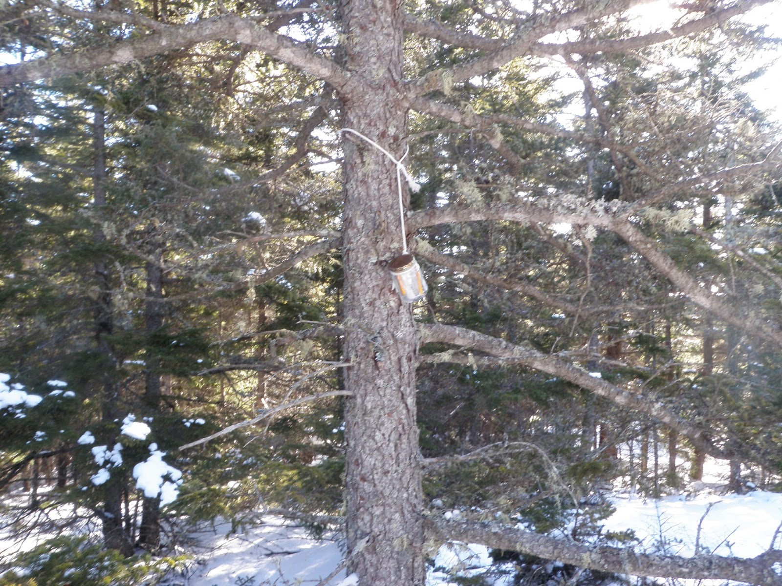
The jar register on the summit of Cone Mountain (elevation: 2132 feet).
The views from ledges below the summit of Cone Mountain looking towards Peaked Hill, Plymouth Mountain and Mount Kearsarge (in between).

The views from ledges below the summit of Cone Mountain looking towards Mount Dickey and Mount Welch, a popular hike at any time of year.

On the bushwhack back down to the car, I came across this little shelter overlooking Cone Pond. It even has a small bench inside.

The views from the ledge above Cone Pond looking towards Jennings Peak, Sandwich Mountain and Acteon Ridge.

A quick round trip hike and I was back at the car. The approach from the north is the preferred method of doing this hike as hiking from the south is posted No Trespassing and would require permission to do (if permission can be obtained). I had enough energy for a second hike, which I didn't think would take that much time to do so after throwing my gear in the car, I headed out for the next objective.
Blake Mountain
Mileage: 3.15 miles
Elevation gain: 830 feet
Trails used: none. bushwhack.
Highlight(s): views from the logging cuts below the summit of Blake Mountain.
This would be another hike that I had read about recently so I decided to give it a go as it was somewhat nearby to where I hiked my first hike. My only issue was where to find the trailhead parking area where I would begin my hike and not necessarily take to my end destination.
Blake Mountain is located in Thornton, New Hampshire. There are no trails that go to the wooded,view-less summit of Blake Mountain so it requires a bushwhack to reach its high point. There are several logging cuts leading up to the summit of Blake Mountain that offer views to nearby peaks.
I parked at the end of the Peaked Hill Pond Trail and walked a short distance to a logging cut, where I would begin the bushwhack to the summit of Blake Mountain.

The snow was hard packed and the woods were open to start the bushwhack.

Eventually, I hit this forest boundary line and followed it awhile through open woods. Eventually I would start the climb to the summit of Blake Mountain.

The boundary line started heading in a different direction than the summit of Blake Mountain so I started heading up through these old logging cuts.I looked back and got this view of Peaked Hill, the Mount Kineo-East Peak ridge, and Mount Moosilauke.

The views from a logging cut looking north towards Franconia Notch, Franconia Ridge, and Cannon Mountain.

The views (through the trees) from the summit area of Blake Mountain of Campton, New Hampshire, Mount Weetamoo, Campton Mountain, Mount Percival, Mount Morgan and Mount Prospect.

The high point of Blake Mountain (elevation: 1561 feet). You can get views from just below the summit and through the trees (in winter when the leaves are down).

Heading back down through the logging area looking north towards Franconia Notch, Franconia Ridge, Scar Ridge, Cannon Mountain, the Cannonballs, North Kinsman, South Kinsman, and Mount Wolf.

Heading down one last logging cut with views looking towards Mount Tecumseh.

While hiking in logging cuts can be slow going (and painful) due to the pricker bushes, sometimes you have no choice eventually but go up towards the summit. It was definitely weird hiking through them with the low snow winter we have had so far as they are usually buried under snow. On the plus side, it was a bonus to get views from Blake Mountain, as well as Cone Mountain, and have decent weather as well.
No comments:
Post a Comment