Black Mountain (VT)
Mileage: 3.45
Elevation gain: 710'
Trails used: unnamed trail.
Brian had a copy of his Vermont Dayhikers Guide so we found another hike to do near Brattelboro, Vermont which would leave us close to New Hampshire for our return home. The fun part was actually trying to find the trailhead to do this hike as the book and gazetteer did not match where the roads should be.
Black Mountain is located in Dummerston, Vermont and also in the Black Mountain Conservation Area. It has a horseshoe ridge with several different summits, with the eastern summit being the best of the views. The area has mountain laurel, pitch pine, scrub oak and red pines in various locations along the hike. We came across a lot of deer tracks so wildlife is in abundance as well.
The main trailhead parking is off of Rice Farm Road.
We found a trailhead for Black Mountain but it was not the main one off of Rice Farm Road, but the one off of Black Mountain Road.

Please respect the property as landowners let people use their lands for recreational uses.

There were several people hiking ahead of us so there was a good base for us to snowshoe our way up to the eastern summit of Black Mountain.

Along the trail, there are vast amounts of mountain laurel. This trail is a gentle graded hike compared to the main trail off of Rice Farm Road.

Views looking into southern Vermont from a lower summit of Black Mountain.

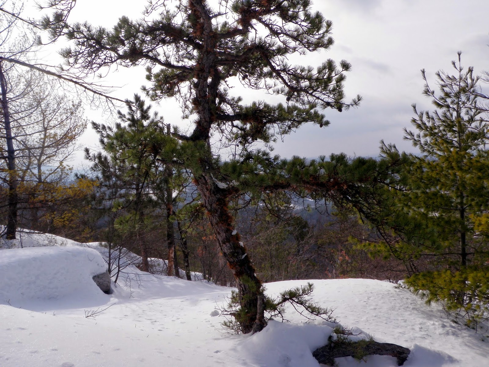
A rock wall of some sort on this lower summit with a pitch pine tree.

Another pitch pine on the ledges off the lower summit.
More views looking southwest into Vermont.

We made the roughly 1 mile hike to the actual summit of Black Mountain. We overtook a group of cross country skiers to break out the old snowshoe track to the summit.

The actual summit of Black Mountain (elevation 1289').

We decided to head back into New Hampshire to find something else to hike. I think we spent more time in the car today than we did actually hiking, which sometimes is the norm for the day.
Little Monadnock Mountain
Mileage: 3.2
Elevation gain: 805'
Trails used: Little Monadnock Mountain Trail.
I had always wanted to hike Little Monadnock for some reason so it seemed a good time to hike this mountain. We figured there would be at least someone who had hiked here recently and we were encouraged when we pulled up to the park entrance and saw two trucks there. We saw a fresh snowshoe track heading in so we geared up, put the snowshoes on again and began the hike.
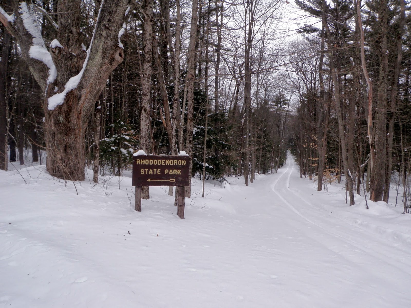
Little Monadnock Mountain is located in Troy and Fitzwilliam, New Hampshire and also in the Rhododendron State Park. You can hike to the summit of this mountain via the State Park entrance or from the Metacomet-Monandock Trail which crosses over the mountain.
The road heading into the Rhododendron State Park where the Old Patch Place is located.
Brian walking through a rhododendron tunnel. The best time to see the rhododendron bloom is in mid-July. The snowshoe track ended right around the junction for the Little Monadnock Mountain Trail and the Laurel Trail.

We crossed through a recent (within the last few years) logging cut. At this point, we were breaking trail through shin to knee deep snow until we got to the junction of the Little Monadnock Mountain Trail and the Metacomet-Monadnock Trail.

The Little Monadnock Mountain Trail is blazed in yellow rectangles so its easy to follow.

The only views one could get are from this ledge area just below the summit of Little Monadnock Mountain. This is looking towards Mount Monadnock, which is clouded over.

The junction of the Little Monadnock Mountain Trail and the Metacomet-Monadnock Trail which runs over the summit of Little Monadnock. From here to the summit, it was knee to hip deep snow for the "longer-than-.1-mile" hike.

Another look back towards Mount Monadnock and Gap Mountain (dead center).

A tired Brian on the summit of Little Monadnock Mountain (elevation 1899'. There are different ranges for this mountain such as the 1883' on the summit sign).

We turned around and made the quick hike back to the car. We lucked out with this hike as there was no snow to worry about, other than the horrible stuff we had to hike in. Both hikes were fairly quick and would be even more so in the spring/summer/fall months when there is no snow.
No comments:
Post a Comment