Elevation gain: 1395'
Trails used: North Meadow Trail, Chapman Trail, Dickins Trail, Harrington Trail, Link Trail, Mountain House Trail, Windmill Farm Trail, Midstate Trail.
Desi and I had planned this hike for sometime now since we had a wedding to go to in nearby Westminster on Saturday evening. We couldn't ask for a more perfect day either (well, maybe a little less heat and more of a breeze) but for being fall, you can't really complain.
We started this hike at a parking area for the Wachusett Meadow Wildlife Sanctuary, a 1,200 acre sanctuary with about 12 miles of trails and plenty of wildlife viewing opportunities as well as old growth forests. Information can be found here. Make sure to grab a map before you head out. They are located outside of the restrooms for the visitor center.
The Midstate Trail runs through the sanctuary on its way towards Wachusett Mountain. The Midstate Trail is a 92 mile hiking trail that runs from the border of Rhode Island, through Worcester County in Massachusetts and continues to the Massachusetts/New Hampshire border (just over the summit of Mount Watatic. It then continues on as the Wapack Trail in New Hampshire.
The route we took is a longer route but it is less than 1000 feet of elevation gain throughout probably 3/4th of the hike and the last push to Wachusett being the most elevation gain. There are a bunch of trails that you can take from all 4 directions to get to the summit.
Looking into South Meadow from the parking area at the visitor center for the Wachussett Meadow Wildlife Sanctuary.

The North Meadow Trail. It's basically a large mowed field with a path around the perimeter, that links up with various other trails on the wildlife sanctuary.

The trail was typically this nice through the whole first part of the trail, up to the start of the climb for the Harrington Trail.

There are a lot of trail options in the Wachusett Meadow Wildlife Sanctuary like this two trails: the West-Border Trail and Glacial Boulder Trail. We would continue straight on the Chapman Trail until the sanctuary boundary.

The trails were pretty easy to follow, and blazing is spacious. At this point, you are hiking on the Midstate Trail.

The edge of the sanctuary. From here it turns into the Dickens Trail and is roughly 5 miles to the summit of Wachusett Mountain. It didn't feel like 5 miles though.

The trail goes over Westminster Road and goes back into the woods. Still easy hiking to here.

It starts getting rocky and a bit steep once you cross over West Road.

We saw snakes galore today. I think we counted at least 7 on the way up and back down. One I almost stepped on and it went automatically into coiled up defense mode.

The junction of the Mountain House Trail and the Link Trail (which connects to the Harrington Trail). Turn left to head to the summit.

Approaching the summit of Wachusett Mountain, which you can either hike or drive to the summit. A lot of people drove today. There is a fire tower located behind the communications array but the stairs were retracted so you couldn't go up for views.

The view of hazy Mount Monadnock in New Hampshire from the summit of Wachusett Mountain (elevation 2006').

Views to the south from the summit observation tower on Wachusett Mountain.

More views back towards the southwest and the way we came. Yes, those are wind turbines and we did pass them on the way up.

Desi heading back down the Harrington Trail, which is pretty steep from here back down to the Link Trail which connects to the Mountain House Trail.

The Summit Access Road that heads up to the summit of Wachusett Mountain. It is only open during certain seasons and is about 2.35 miles long.

More trail goodness. I wish all trails could be this wide and easy to move along.

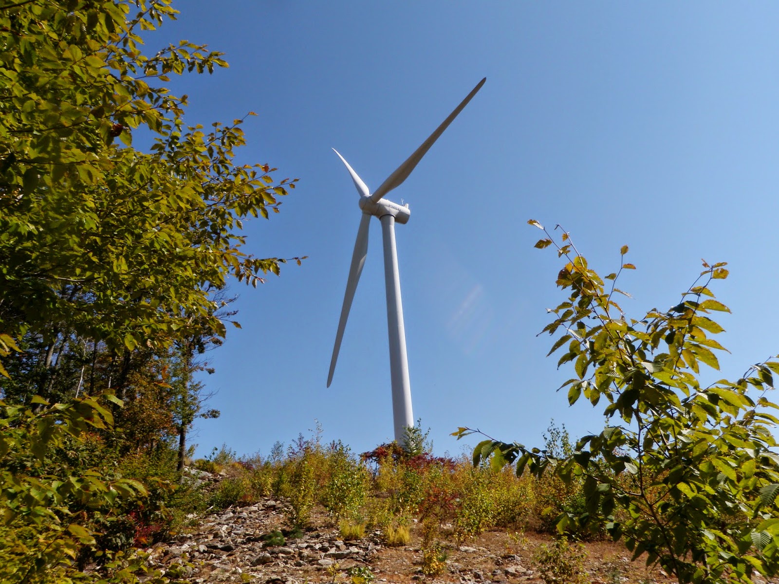
One of the two wind turbines that you can climb up to via the Windmill Farm Trail. The only restrictions are to access the area at your own risk.
The view from the old logging area where the wind turbines now reside.

The only water crossing (that was dry) along the route that runs along a nice marsh area.

A nice hike with some easy miles. The views from Wachusett were really nice and we were even treated to some migrating hawks or falcons (couldn't tell exactly what they were since they were a good ways up). A definite popular mountain on a nice day as evidenced by the split majority of hikers we passed going up and down as well as the people who drove to the summit.
Please, as I said, pick up a map or research the route ahead of time. With the vast amount of trails available, it could be really easy for someone to lose their way.
No comments:
Post a Comment