Elevation gain: 4285'
Trails Used: Grays Peak Trail.
This would be my first hike of my vacation/family reunion in Colorado. I had planned to do a few hikes and this was going to be the first one I would attempt, doing it is a combination hike (Torreys first, then head over to Grays).
So I got up early (traffic sucks in Colorado due to all the construction going on all the time) and headed out I70 to get to the trail head in Bakerville, Colorado. The road to the trail head is what we would consider a class 4/5+ road here in New Hampshire.
Grays Peak is the 9th highest peak in Colorado and Torreys Peak is the 11th. Grays Peak is the highest peak in both Clear Creek and Summit counties. Grays and Torreys are the only Colorado Fourteener's on the Continental Divide and both are located in the Front Range.
Looking up the road I would walk to get to the Grays Peak Trail head located in Stevens Gulch. The actual trail head was about a little more than a mile up.

Looking back to where I parked the car. I made it up a little further but this road is not maintained any longer, making it a rather "rocky" ascent. There were two areas in the road where the rut was pretty good sized so I did not want to damage the rental.

Walking along the road, I got this view of the eastern ridge of Kelso Mountain, a thirteener.

With scenery like this, who wouldn't mind a road walk every once in awhile.

I am certainly not a flower person but I think these could be some sort of Columbine.

I walked along this river the whole way to the trail head. There were quite a few camping spots people could use right next to it; it would make for a nice camping trip some time.

Looking into the Stevens Gulch area from a bridge that crosses over this creek to the take the trail up to both Grays and Torreys.

This is the start of the Grays Peak Trail which is a Class 1 trail. The trail would be pretty much like this for the first half of the hike, until you start climbing to the summit area's.


McClellan Mountain (right) and Ganley Mountain (left).

Once again, Ill hazard a guess and say this is Orange Paintbrush.

Possibly some sort of Columbine again (and someone's shadow).

The only water crossing, other than over the bridge at the beginning of the trail.

I kept looking back to the views of Kelso Mountain. I skipped this peak on the return trip as it meant about another 2 miles round trip and 1000 feet of elevation gain.

On the way up to Torreys, I glanced back for this views towards the way I came with Kelso Mountain and the Stevens Gulch area.

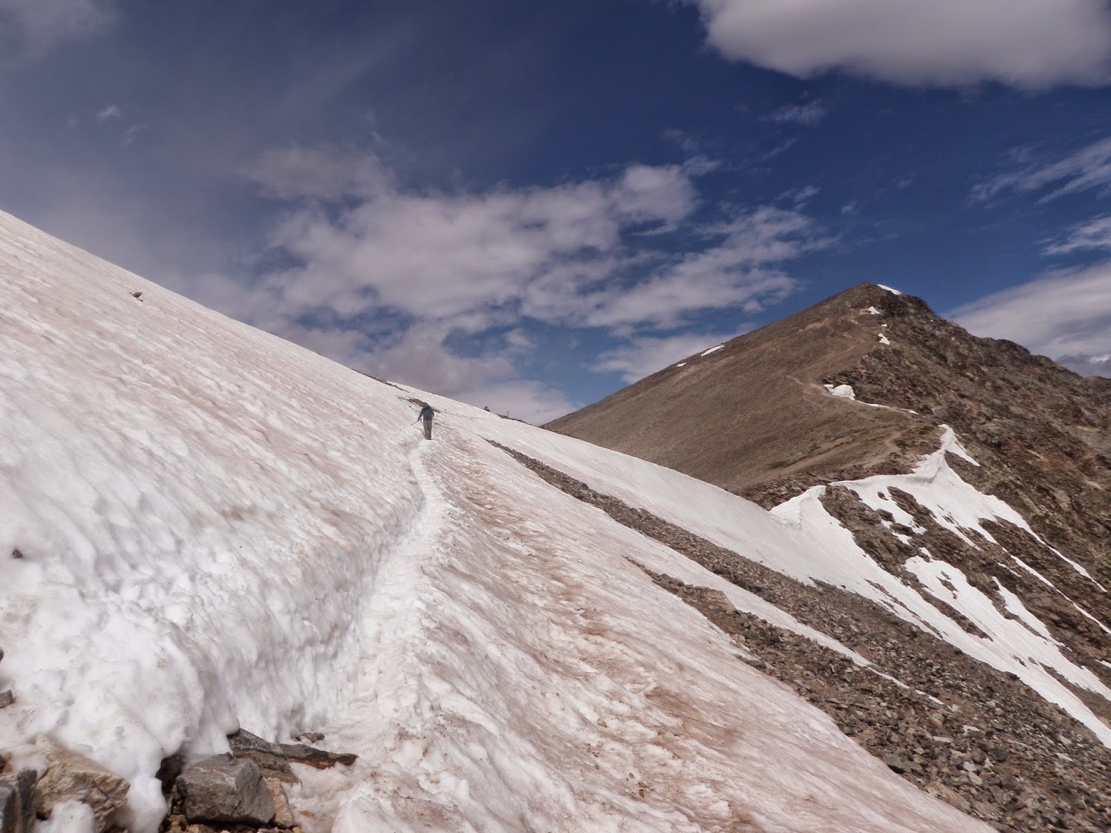
A snowfield that I had to cross to get to Torreys Peak. It amused me to see how many people were skittish about crossing the snow. These was coming up the South Slopes route.
The views looking west from the col between Grays and Torreys Peak's.

Heading up to Torrey's Peak first. The snow field here was still about 3 to 4 feet deep but it was well off trail. It was fun watching people/dogs running through it as many people have not encountered snow before from different southern states.

Looking towards Grays Peak from the summit of Torreys Peak (elevation 14267').

Panorama from the summit of Torreys Peak.

The next few grainy pictures were taken from my smart phone, with various shots being taken from the summit of Torreys Peak.


Looking over to Grays Peak (right), Ruby Mountain (center) and Mount Edwards (left). The Continental Divide runs along the ridge between Grays Peak and mount Edwards.


Look, their high peaks have canister's! They're even out in the open, not hidden like on some of our peaks/mountains. This is just below the summit of Torrey's Peak.

I could just sit up here all day and look at the views like this. The snow was still out in good amounts in spots and will probably remain until it starts snowing again soon. You can clearly see the trail in the gulch below.

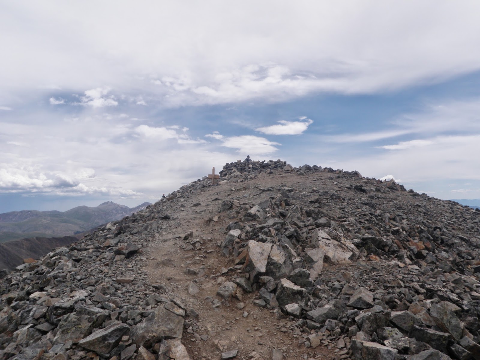
Heading up the talus slope to the summit of Grays Peak. There are even rock steps built into the side of the mountain up this high.

Looking into the Chihuahua Gulch area. A nice little glacial tarn sits below Grizzly Peak.

Approaching Grays Peak summit. A lot of the summits have some sort of rock walls to keep away the wind and a good place to camp in winter.
Headed straight over Grays Peak (elevation 14270') to get this shot back towards the summit and the summit of Torreys Peak.

Views into Horseshoe Basin from the summit of Grays Peak.

Heading back down towards the Steven Gulch area and back on the Grays Peak Trail.

Part of the Lost Rat Colouir, a steep route up to Grays Peak (easier with snow for the ascent).

I believe this is Mount Edwards, which is on the Continental Divide.

It's amazing how different it is 2000+ feet lower; green and lush with nice streams and lakes.

Trails in Colorado tend to be on the easier side. The trail crews do an amazing job on maintaining the trails for future generations.

Old mines, such as this one (Stevens Mine, I think), are littered throughout the mountains in Colorado.

The mine area on the lower slopes of McClellan Mountain.

Heading back down and nearing the trail head.

Looking towards Kelso Mountain for the last time. This would be an interesting approach to reach the summit of this mountain.

A small modest mining/hunting shack (I believe this was for sale) that I passed on the way to the trail head and back to the car.

I passed an old deteriorating building on the way up and back down, possibly some sort of old house or inn. It had two stories but the floorboards were rotted and in poor shape so I didn't go inside. Possibly some sort of relic from the mining days.

A beautiful first hike in Colorado. The trails were not too crowded, the weather was nice and comfortable and the best part? NO BUGS. The only downer is I only get to hike these mountains every two years (when we have family reunions. I realize I can come out for vacation any time). A relatively easy 11.5 miles with beautiful views all around.
No comments:
Post a Comment