I was back from Texas so after a shortened week of work, Saturday rolled around and it was time to start up some southern New Hampshire hiking once again as the snow in the north was still lingering around. We had a few peaks planned earlier in the week so Friday night we just went with what we had said we would do. So Saturday I meet Brian at the Hillsborough Park N Ride and off we went.
The day started off cloudy but would clear out quite nicely with a moderate breeze throughout the day.
Bacon Pond Hill - Jones Hill - Ames Hill
Mileage: 4.15
Elevation gain: 1010'
Trails used: Mad Road Trail, bushwhack.
Brian wanted to do this peak as lately several people have done it and found the remains of what appears to be an old fire tower on its summit. The old thought was that the fire tower was on several of the bumps for Goves Mountain in Pillsbury State Park, but no remains were found on any of them.
Bacon Pond Hill, Jones Hill and Ames Hill are located in Washington, New Hampshire and are also in Pillsbury State Park. The Mad Road Trail continues on towards Bacon Pond and towards the May Pond and Mill Pond part of the park near the campground area. There are no trails to these peaks so it requires a short bushwhack to Bacon Pond Hill, and a moderately long round trip hike to Jones Hill and Ames Hill (if you do all three together).
The start of the Mad Road Trail which is located off of Route 31. Fletcher Pond is nearby.
An old woods road we used to make our way to the summit of Bacon Pond Hill.
The remains of a fire place near the summit of Bacon Pond Hill.
The remains of one of the old cement guylines for the possible fire tower that once stood on the summit of Bacon Pond Hill.
The new register on the summit of Bacon Pond Hill (elevation 2028'), placed about a week ago.
Once we got back down to the Mad Road Trail, we headed towards Jones Hill first and then would make our way across the ridge to Ames Hill.
We took an old logging cut along the ridge on the way to Jones Hill. The views from here weren't so bad and recent evidence of deer and moose was visible.
From the summit of Jones Hill (2028'), the surrounding peaks of the Pillsbury Park area were visible, but in the clouds. The Lovewell Mountain ridge is straight ahead.
From another clear cut in the col between Jones Hill and Ames Hill, we got some more views looking towards Silver Mountain and Huntley Mountain. This could be a good place to spot wildlife at certain times of the year.
Brian signing into the register on Ames Hill (elevation 2106').
I figured it would be easy going coming off of Ames Hill and heading towards Route 31, and then doing a road walk back to the car but the terrain was steep and we were slowed a bit. Luckily the woods were mostly open like this.
Once back down to the road, we had less than a mile to walk back to my car so it was quick. Since it was still early in the morning, we decided to try Bean Mountain. Unfortunately, we were blocked by No Trespassing signs so we had to decide on doing something else. I remembered Brian had mentioned about doing Silver Mountain a few weeks ago, and since I was denied views back in September, it was to be next on the docket.
Silver Mountain
Mileage: 1.2
Elevation gain: 475'
Trails used: Silver Mountain Trail.
I remembered the drive down South Road being brutal on my car and it was no different on the drive to Silver Mountain today. Higher clearance vehicles would make it to the trailhead most effortlessly as I did bottom out quite a few times. Plus, since I knew there was a trailhead it wasn't as bad as my last time here in September, where i ended up bushwhacking to the summit only to find the trail.
Silver Mountain is located in Lempster, New Hampshire and is a part of the Ashuelot River Headwaters Forest, which is managed by the Society for the Protection of New Hampshire Forests. A trail goes from the trailhead off of South Road to the summit of Silver Mountain; it is moderately steep towards the summit but the rewards are quite nice.
Where we parked the car off of South Road for the Silver Mountain Trail and looking towards Sand Pond and Huntley Mountain.
I missed this old cellar hole my last time here. This is along the Silver Mountain Trail.
After a very brief steep stretch, we are nearing the summit of Silver Mountain.
Brian on the summit of Silver Mountain (elevation 2190'). Mount Ascutney is dead center. Most of the views into Vermont was very hazy today.
Looking south towards Mount Monadnock from the summit of Silver Mountain.
We didn't stay long on the summit of Silver Mountain. The views were a lot better than when I had done Silver Mountain in September, though. So after a quick descent to the car, we looked at the gazetteer for something else to do in the area. Brian remembered something about Wilson Hill and having views so after a quick check online (from my phone), we were off to find the trailhead.
Wilson Hill
Mileage: .075
Elevation gain: 135'
Trails used: Woods road.
Finding the trailhead for the High Five Reservation was fun but once we did, the black flies assaulted us (which they would do for the rest of the hikes). Thankfully, this is a very short hike with good views as a payoff.
Wilson Hill is located in Deering, New Hampshire and is in the High Five Reservation, which is managed by the Society for the Protection of New Hampshire Forests. There is an old road that makes its way to the summit and the views of the surrounding area are quite nice for the little effort needed to hike here.
The trailhead for the High Five Reservation off of Sky Farms Road in Deering.
Almost on the summit of Wilson Hill, you get views of nearby Crotched Mountain and its ski slopes that still had snow on them.
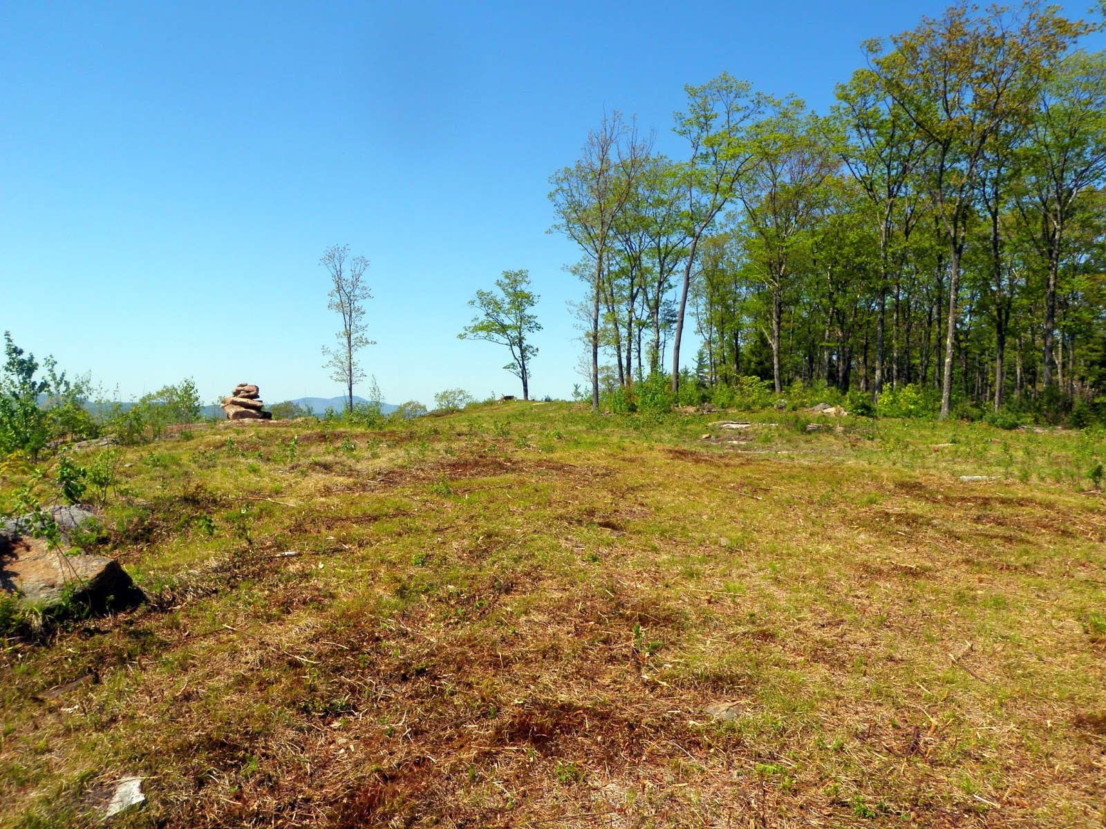
A big rock pile on the summit of Wilson Hill (elevation 1414'). From various points on the summit, you could get views to many points in New Hampshire and Vermont.
The views looking north to Clark Summit and towards the Pillsbury State Park area.
I noticed this rock cairn area just off to the side of the summit. Pretty cool to see but kind of weird to see a large pile or rocks other than the one on the summit.
A nice short, quick hike with good views as a payoff. The bugs were quite fierce but not biting but they were kept at bay a few times by a nice breeze that blew up every so often. This would be a really nice place to bring a chair and sit on a nice day as the summit is almost lawn-like and the views are good.
Since we noticed Clark Summit just to the north, we decided we would find a place to hike up to its summit. Once again, after a quick search online, I found some directions to get to the trail that goes all the way to the summit.
Clark Summit
Mileage: 1.7
Elevation gain: 540'
Trails used: road walk, Clark Summit Trail.
I read somewhere that this peak could be difficult to hike, even though there is a trail that goes to the summit of Clark Summit. To reach the trail, it lies on the property for His Mansion Ministries in Deering, New Hampshire. It is a Christian-based rehabilitation center and you should check in at the office about the ability to use their trail.
Clark Summit is located in Deering, New Hampshire and is also the highest point in Deering. There is a trail that goes all the way to the summit where there are limited views in all directions.
A cell tower on a sub peak for Clark Summit. At the top, to the left of the cell tower the trail heads over to Clark Summit.
Between the sub-peak and Clark Summit, it gets pretty steep but its easy to follow this white blazed trail all the way to the summit.
A plaque on the summit of Clark Summit (elevation 1570') explaining the meaning behind the name for this peak. Pretty somber.
View of Mount Monadnock from the summit of Clark Summit.
View of Lovewell Mountain from the summit of Clark Summit.
There were these 3 (2 pictured) crosses on the ledges on the sub-peak just below the cell tower. Nice views like the one above of Lovewell Mountain.
The gate for the cell tower access road where we parked the car. Foot traffic is welcome.
The black flies were getting worse as the day wore on so we didn't stay too long on the summit so we headed back to the car. We still had time in the day to do one or two more hikes and then call it a day. We spent a good while driving around to different areas to see if we could do a few peaks in Hillsborough but we couldn't find good access points to use. We noticed Stowe Hill nearby, which was not too far from the road so we went to check it out.
Stowe Hill
Mileage: 1.85
Elevation gain: 640'
Trails used: none. woods road.
This hike would be the last one of the day and the one we had the least information available for. I checked online and found nothing so we did what we do best; we improvised. On the map, it looked like a road went right by the peak so we would pull off on the road somewhere and then bushwhack to the summit.
Stowe Hill is located in Hillsborough, New Hampshire. We lucked out on this one big time as we took several woods roads up to the summit area. On Google Earth, you can clearly see the roads. We noticed roads coming up from the north side as well, and possibly from the west so there are quite a few options on getting here.
We took Stowe Mountain Road as far as you can drive and parked. We then walked up the road and took a few old woods road up towards the summit of Stowe Hill.
This is pretty much the only real view (without poking around in the area) from the summit of Stowe Hill. Yes, those are black flies that hounded us the whole hike.
The summit area of Stowe Hill (elevation 1624'). It looked like it was freshly cut at some point recently and we also found a destroyed picnic table up here.
Headed back down to the car via one of the old woods roads. We were glad to call it an end to the day as the bugs were out in force.
Since we were already in Hillsborough, it was a quick drive over to the Park N Ride and we were both on the way home not too long after that. Overall, it was a fruitful day. The weather was nice as it wasn't too hot nor was there any rain. The bugs are already out in force but luckily they weren't biting. I did manage to find three ticks on me though so they are definitely out as well.