My Pages

Saturday, November 7, 2015

Unity Mountain * Green Mountain (Claremont): 11/7/2015

Originally I was going to head into Vermont to hike Saturday, but I woke up and didn't feel like driving as far as I had planned. So, I looked for a few hikes to do in New Hampshire and headed out. It was going to be a cool day, and pretty breezy. It even rained slightly on my first hike.


Unity Mountain

Mileage: 1.05 
Elevation gain: 175 feet
Trails used: none. road walk, bushwhack.
Highlight(s): woods walk.


I had two hikes planned around the same area but I drove past the first hike I wanted to do, so I settled on Unity Mountain. I saw a road on some topographic maps that looked like I could make this an easy hike, and I was not disappointed when I found it. Although it is a class V un-maintained road, when its dry out you could probably drive in further than I did.

Unity Mountain is located in Unity, New Hampshire. I walked the road to the access road for some communications towers on a lower ridge of Unity Mountain, and then bushwhacked through open woods towards the wooded, view-less summit. 


I parked my car just after the house on Mica Mine Road, which turns into a class V road. I could have driven further in if not for that big puddle.


No Hunting signs along Mica Mine Road so, while i brought my hunter orange, I didn't wear it.


The wooded high point of Unity Mountain (elevation: 1873 feet). It was moose heaven up here as almost everywhere I stepped there were piles of moose poop. 


The hike to the summit of Unity Mountain (and back to the car) was a mixture of open woods and old logging cuts.


A quick mile round trip and I was back at the car. For my next hike, I had planned on doing a peak that was literally almost around the corner from where I was (Wilcox Hill) but upon arriving to where I wanted to start the hike, there were three trucks there and an ATV. I parked but immediately heard some gunshots, so that was that. I had my hunter orange on, but I didn't want to chance it. I still had another peak in mind for another hike.


Green Mountain (Claremont)

Mileage: 3.70
Elevation gain: 915 feet
Trails used: none. access road, atv trail.
Highlight(s): views from the access road, slight views from the summit of Green Mountain.


This hike I was going to attempt a few years ago in late winter/early spring but when I saw a truck sitting outside of the gate and two guys un-hitching a snowmobile, I figured they were heading up to the summit. I wasn't sure if they worked on the communications towers on the summit or not. While there are noted prohibitions on doing this hike, they do ask that no ORHV vehicles go up. 

Green Mountain is located in Claremont, New Hampshire and is the highest point in Claremont. There are three communications towers along the ridge of Green Mountain, accessed by an old logging road/atv road. There are views along the access road, and minor views from the first tower area, and on the summit of Green Mountain (if you hop on the rocks).


I started off parking off of Cat Hole Road, which is an ATV trail. I then headed up the access road towards the summit area of Green Mountain.


The Green Mountain access road was easy to follow as it switchbacked its way towards the summit of Green Mountain.


This is the third set of communication towers as I am nearing the summit of Green Mountain.


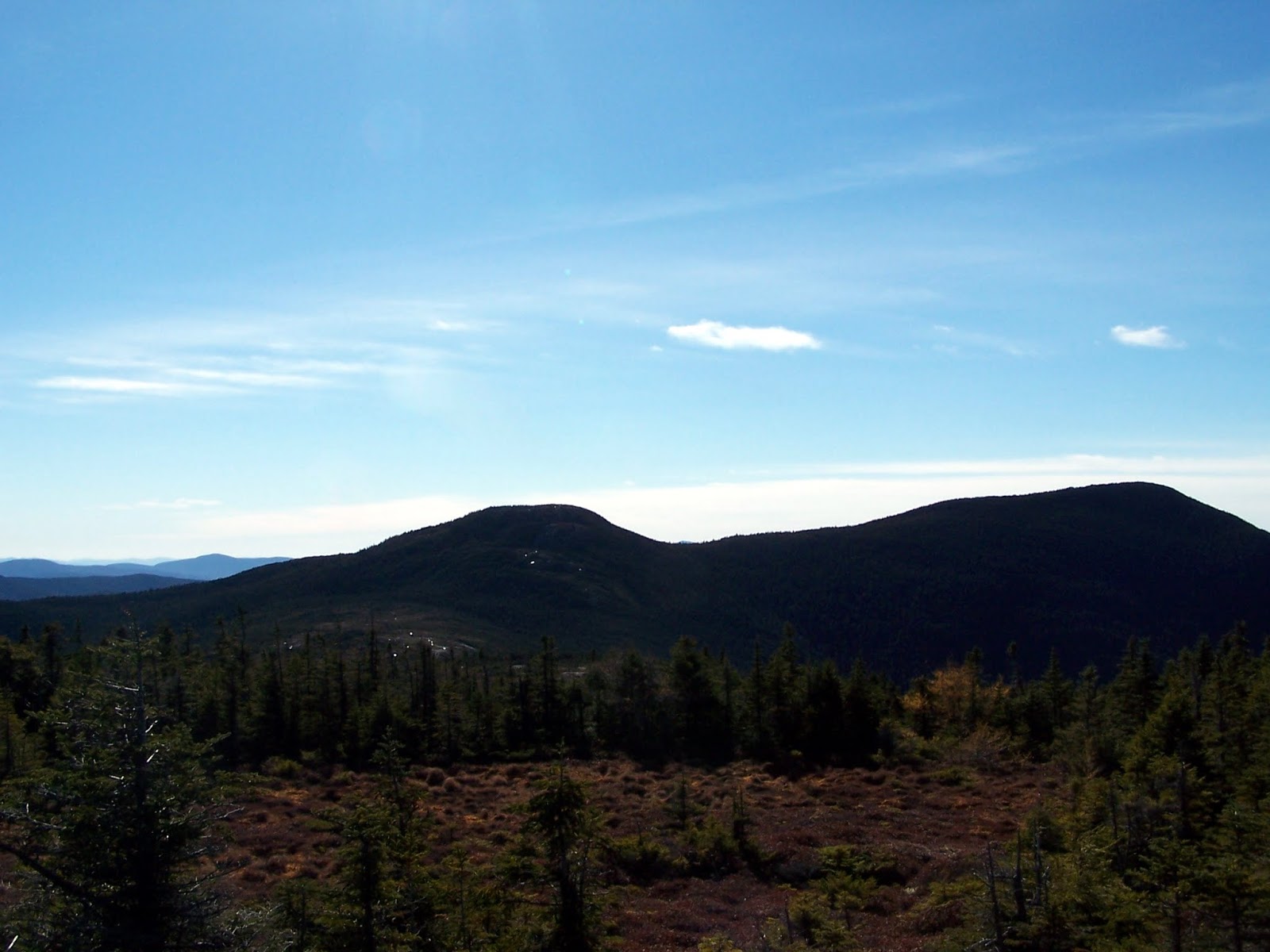
One of the three communications towers on Green Mountain, this one being on the summit. Mount Ascutney is in the background, with the Killington ski area behind it.


The summit area of Green Mountain (elevation: 2018 feet). The ledge behind this one is slightly higher so we will say that one is the high point.


The views of Mount Ascutney from a logging cut along the access road for Green Mountain. 


I wasn't feeling like doing any more hikes so I headed home early, which is somewhat rare for a hiking day. The foliage is long gone, and the impending winter weather will make itself known soon so I got in a few hikes that would be made a little more difficult with snow. There was no reason to do either of these hikes other than I felt like doing them.

Saturday, October 31, 2015

Fulling Mill Mountain * Goose Eye Mountain-North Peak * Goose Eye Mountain: 10/31/2015

Mileage: 9.4 miles
Elevation gain: 3250 feet
Trails used: Notch Trail, Mahoosuc Trail, Appalachian Trail, Goose Eye Trail.
Highlight(s): Appalachian Trail, register on the summit of Fulling Mill Mountain, 360 degree views from the summit of Goose Eye Mountain.


After our two day outing in Vermont last week, Brian actually came up with this suggestion for this weekend's hike. We had eyed this stretch of trail from up high when we did Goose Eye Mountain with Desi last year. It was supposed to be a nice day out, cool in the morning windy, but sunny with no chance of any kind of precipitation. This would be the perfect time to do a car spot and do a loop hike on an almost perfect day. The fun to start the day would be driving down Success Pond Road to leave one car at a trailhead and drive down to another trailhead to leave the other car.

Fulling Mill Mountain, Goose Eye Mountain-North Peak and Goose Eye Mountain are located in Riley, Maine. They are also a part of the Mahoosuc Range and is traversed by both the Mahoosuc Trail and Appalachian Trail. There are no trails that go to the wooded, view-less summit of Fulling Mill Mountain so it requires a short bushwhack. The Mahoosuc Trail/Appalachian Trail goes over the summit of Goose Eye Mountain-North Peak and Goose Eye Mountain where there are views from both summits.

Goose Eye Mountain is on the New England One Hundred Highest List, the Maine One Hundred Highest List, the Maine Two Hundred Highest List and Maine 3K List. Goose Eye Mountain-North Peak and Fulling Mill Mountain are located on the Maine One Hundred Highest List, the Maine Two Hundred Highest List, and the Maine 3K List.


We spotted a car at the Goose Eye parking area and drove down Success Pond Road to Shelter Brook Road. After 0.3 miles we came to a parking area and the start of the Notch Trail.


The Notch Trail follows old logging roads and you cross Shelter Brook several times.


Here Brian is preparing to cross Shelter Brook, which wasn't hard to do even after all the rain we received recently.


A cool cascade area of Shelter Brook right around where we crossed in the above picture.


The Notch Trail was probably the easiest part of the hike today, as the trail is easy to follow with a moderate amount of elevation gain. Plus, it was a nice walk in the woods.


The junction of the Mahoosuc Trail/Appalachian Trail and Notch Trail. Turn left here and you head into Mahoosuc Notch. We would turn right and head towards Goose Eye.


The Mahoosuc Trail/Appalachian Trail was very steep and rocky as we climb up towards Fulling Mill Mountain. We also started encountering ice around this point.


You know its steep when on certain sections of the Mahoosuc Notch Trail/Appalachian Trail has ladders to help you make the ascent.


We started the short bushwhack to Fulling Mill Mountain. Initially our approach up was through semi thick woods, and we even marsh area, but we managed a better route on the way back to the Mahoosuc Trail/Appalachian Trail.


Me rocking it out on the summit of Fulling Mill Mountain (elevation: 3440 feet).


Once back on the Mahoosuc Trail/Appalachian Trail, we headed towards the southern summit of Fulling Mill Mountain through these bog areas on numerous bog bridges.


Looking back towards Fulling Mill Mountain, Mahoosuc Arm, Old Speck and the Baldpate Mountains from Fulling Mill Mountain-South Peak.


The views looking towards Mount Washington, Mount Madison and the ridge heading up to Goose Eye Mountain from Fulling Mill Mountain-South Peak.


The shelter at the Full Goose campsite area along the Mahoosuc Trail/Appalachian Trail.


The Full Goose Campsite is set into a notch area along the Mahoosuc Trail/Appalachian Trail and you had to climb these stairs (on both sides) to continue along the trails.


Another steep section of the Mahoosuc Trail/Appalachian Trail this time with iron rungs set into the granite. There were several sections like this, but the second set was worse due to the ice we were encountering along the way.


Every so often, we would get glimpses through the trees of the Mahoosuc Trail/Appalachian Trail as it snaked its way towards Goose Eye Mountain.


As we continued on the Mahoosuc Trail/Appalachian Trail, we got views looking back towards Mahoosuc Arm, Old Speck, and the Baldpate Mountains. In the background, Sugarloaf Mountain, Spaulding Mountain and Mount Abraham can be seen.


The views from Goose Eye Mountain-North Peak of the peaks that are part of the Sunday River Ski Area in Maine.


The views from Goose Eye Mountain-North Peak of Goose Eye Mountain-East Peak and Goose Eye Mountain. The Mahoosuc Trail/Appalachian Trail can be seen snaking up towards Goose Eye Mountain-East Peak.


The Mahoosuc Trail/Appalachian Trail runs through this nice alpine area, our reason for doing this hike today as we get closer to Goose Eye Mountain-East Peak.


The views along the Mahoosuc Trail/Appalachian Trail looking into New Hampshire at North Percy Peak, South Percy Peak, the Long Mountain range, Sugarloaf Mountain, Gore Mountain and Whitcomb Mountain.


Even more wooden steps and ice as we work our way along the Mahoosuc Trail/Appalachian Trail as we get closer to Goose Eye Mountain.


A break in the trees along the Mahoosuc Trail/Appalachian Trail looking back towards Fulling Mill Mountain and Old Speck Mountain.


There were several sections of ice covered bridges to help as you climb towards the summit of Goose Eye-North Peak.


The views of Goose Eye Mountain from Goose Eye-North Peak. You can almost see someone standing on the summit of Goose Eye Mountain.


The views from the summit of Goose Eye-North Peak looking towards Mount Madison, Mount Washington, Mount Success, The Carter-Moriah Range and Mount Carlo.


The junction of the Goose Eye Trail/Mahoosuc Trail/Appalachian Trail just below the summit of Goose Eye Mountain. We hit the summit of Goose Eye Mountain and then headed down the Goose Eye Trail.


Looking back towards Goose Eye-North Peak from the summit of Goose Eye Mountain (elevation: 3860 feet). You can get 360 degree views from here.


After a short road walk, we hit this Goose Eye Trail sign for the last section back to the car.


I didn't take many pictures from the summit of Goose Eye Mountain, nor the trip down and back to my car so that's the reason there aren't many pictures after we hit Goose Eye Mountain. We did this hike up to Goose Eye Mountain and Goose Eye Mountain-North Peak last year with Desi so this was a perfect day to complete this small section of the Mahoosuc Trail/Appalachian Trail.

Sunday, October 25, 2015

Long Trail Hike (Hazens Notch to Jay Pass) * Sugarloaf Mountain * Buchanan Mountain * Domeys Dome: 10/25/2015

Mileage: 7.05 miles
Elevation gain: 2880 feet
Trails used: Long Trail, bushwhack to Sugarloaf Mountain.
Highlight(s): Long Trail, register on the summit of Sugarloaf Mountain.


After our overnight at Jay Pass Camp, where we were the only people staying, we packed up our gear and headed back to the cars to begin the drive over to the start of the Long Trail in Hazens Notch. First, we got our gear ready and had some quick breakfast which was tough since the wind was howling through Jay Pass and trying to get the camp stove to stay lit was a chore. We then left my car in Jay Pass, and drove around to Hazens Notch where we would do this traverse from south to north.

Sugarloaf Mountain, Buchanan Mountain and Domeys Dome are located in Westfield, Vermont. The wooded, view-less summit of Sugarloaf Mountain can be reached by a combination of trails and bushwhack. The Long Trail runs over the summit of  wooded, view-less Buchanan Mountain,  Domeys Dome and Gilpin Mountain (the northern bump is the higher summit, thus reached by bushwhack). There would be views all along the Long Trail but with todays weather, they were all but non-existent. 


We started the day at the parking area in Jay Pass at 730 in the morning and right after a night of almost constant rain. We then drove Brian's car to Hazens Notch so we would do the Long Trail from south to north this time.


The start of the Long Trail off of Hazens Notch Road. There's a spot just down the road for two to three cars, and then walk to the start of the trail.


We climbed along the Long Trail on the west shoulder of Sugarloaf Mountain, at first not gaining much elevation but actually losing it. The Long Trail then decided it wanted to go up, which it did until we began the bushwhack to the summit of Sugarloaf Mountain.


Despite the overnight rain, the few stream crossings were still pretty low along this section of the Long Trail.


Wide open woods on the bushwhack up to the summit of Sugarloaf Mountain. We followed a flagged route that went directly to the summit area.


The jar register on the summit of Sugarloaf Mountain (elevation: 2421 feet).


Brian working his way back down to the Long Trail, where we continued our hike on the way to Bruce Peak and Buchanan Mountain.


The junction of the Long Trail and short spur path to Hazens Notch Camp. We liked the mileage marker that tells you how close to Canada you are, or how far away from Massachusetts you are.


The Long Trail was a mixture of ups and downs and slight straight sections of trail on our way over to Bruce Peak and Buchanan Mountain.


In between Hazens Camp and the hike up towards Buchanan Mountain, the rain and winds hit us and the low clouds moved in which made the last three miles dismal.


The summit area for Buchanan Mountain (elevation: 2940 feet), which is right along the Long Trail. There were no views today, even if we looked around the summit for them.


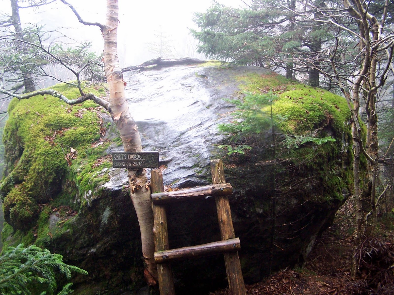
Chet's Lookout, which consisted of this ladder and boulder. Unfortunately, we would get no views from it today so we didn't bother climbing up.


The summit of Domeys Dome (elevation: 2880 feet). It was a bit confusing on this summit to figure out where the Long Trail continued north.


It was rainy and overcast, which is why this picture of the summit area of Domeys Dome managed to come out blurry.


Brian walking along the Long Trail as we near the southern spur for Gilpin Mountain. We were both pretty much soaked and muddy from the rain.


The summit area for Gilpin Mountain-South Peak (elevation: 2920 feet). It was less of a summit and more of a southern spur of the south peak of Gilpin Mountain.


Heading down off of Gilpin Mountain we came across our nemesis for the past two days. Brian is showing his appreciation for all the mud.


Finally we make it back to Jay Pass and the finish of our two day trek along these two sections of the Long Trail.


We were glad to be at the cars so we could get some dry clothes on and warm up after the last few miles walking in the rain. This was an okay section to hike but not as nice as the first days ramblings in the woods. The weather also did not play a good role but we were well aware of how the two days would turn out. Two sections are complete but this ends our Long Trail jaunts for 2015. We will continue where we left off in May of 2016.